Sells West Topo Map Arizona
To zoom in, hover over the map of Sells West
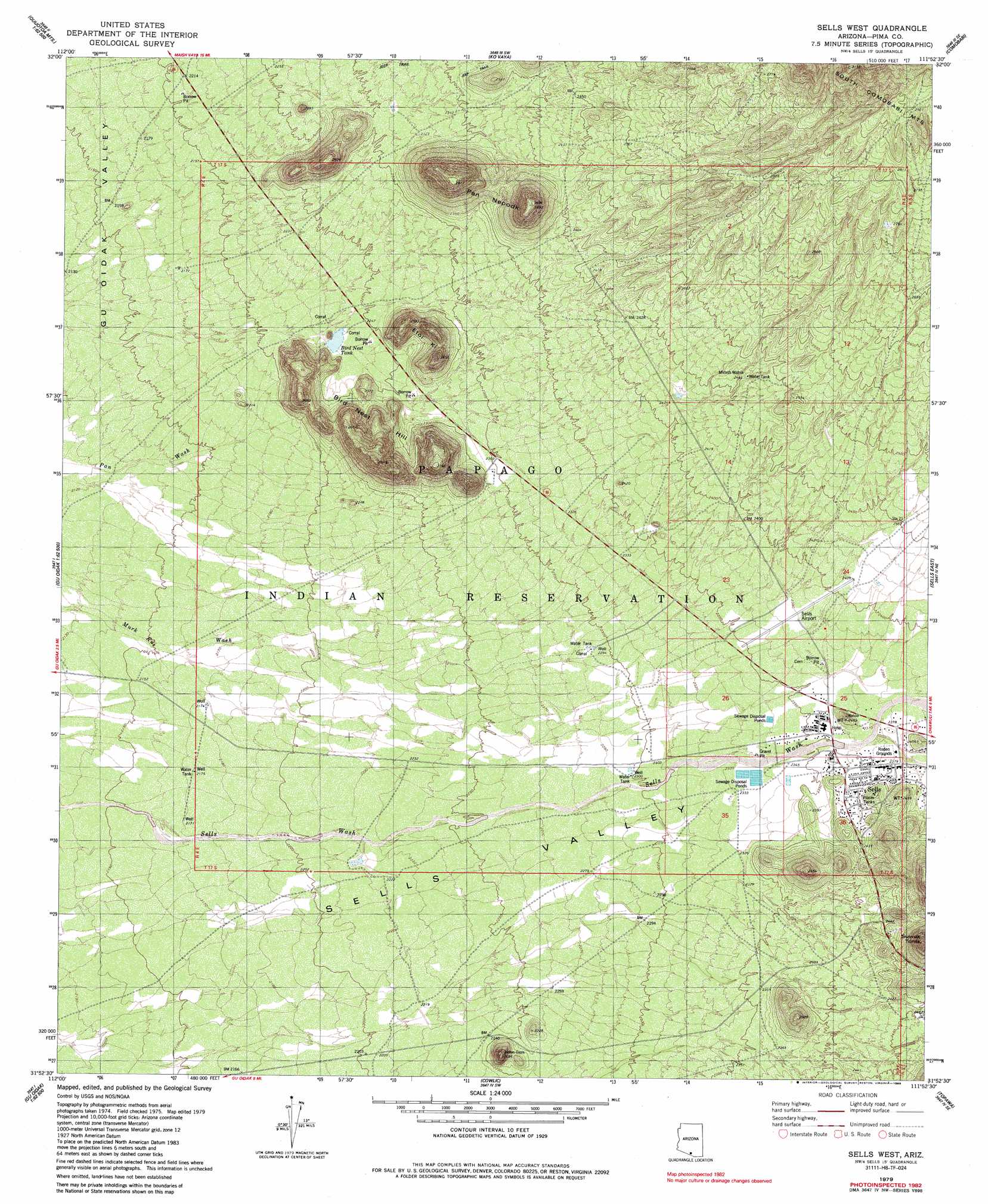
USGS Topo Quad 31111h8 - 1:24,000 scale
| Topo Map Name: | Sells West |
| USGS Topo Quad ID: | 31111h8 |
| Print Size: | ca. 21 1/4" wide x 27" high |
| Southeast Coordinates: | 31.875° N latitude / 111.875° W longitude |
| Map Center Coordinates: | 31.9375° N latitude / 111.9375° W longitude |
| U.S. State: | AZ |
| Filename: | o31111h8.jpg |
| Download Map JPG Image: | Sells West topo map 1:24,000 scale |
| Map Type: | Topographic |
| Topo Series: | 7.5´ |
| Map Scale: | 1:24,000 |
| Source of Map Images: | United States Geological Survey (USGS) |
| Alternate Map Versions: |
Sells West AZ 1979, updated 1979 Download PDF Buy paper map Sells West AZ 1979, updated 1985 Download PDF Buy paper map Sells West AZ 1996, updated 2002 Download PDF Buy paper map Sells West AZ 2011 Download PDF Buy paper map Sells West AZ 2014 Download PDF Buy paper map |
1:24,000 Topo Quads surrounding Sells West
Maish Vaya |
Gurli Put Vo |
Sand Wells |
Sil Nakya |
Black Hills |
Ben Nevis Mountain |
Vainom Kug |
Ko Vaya |
Comobabi |
Haivana Nakya |
Kupk |
Gu Oidak |
Sells West |
Sells East |
San Juan Spring |
Kots Kug Ranch |
Chukut Kuk |
Cowlic |
Topawa |
Chiuli Shaik |
La Lesna Mountains |
Tecolote Ranch |
Vamori |
South Komelik |
Aguirre Peak |
> Back to 31111e1 at 1:100,000 scale
> Back to 31110a1 at 1:250,000 scale
> Back to U.S. Topo Maps home
Sells West topo map: Gazetteer
Sells West: Airports
Sells Airport elevation 726m 2381′Sells West: Populated Places
Sells elevation 0m 0′Sells West: Reservoirs
Bird Nest Tank elevation 681m 2234′Sells West: Springs
Mimsh Wahia elevation 750m 2460′Sells West: Summits
Bird Nest Hill elevation 857m 2811′Etoi Ki elevation 780m 2559′
Pan Nepodk elevation 883m 2896′
Sells West digital topo map on disk
Buy this Sells West topo map showing relief, roads, GPS coordinates and other geographical features, as a high-resolution digital map file on DVD: