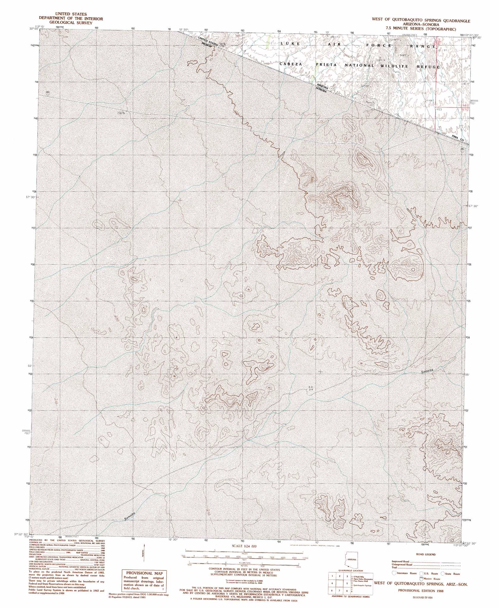
West Of Quitobaquito Springs Topo Map Arizona
To zoom in, hover over the map of West Of Quitobaquito Springs
USGS Topo Quad 31113h2 - 1:24,000 scale
| Topo Map Name: | West Of Quitobaquito Springs |
| USGS Topo Quad ID: | 31113h2 |
| Print Size: | ca. 21 1/4" wide x 27" high |
| Southeast Coordinates: | 31.875° N latitude / 113.125° W longitude |
| Map Center Coordinates: | 31.9375° N latitude / 113.1875° W longitude |
| U.S. State: | AZ |
| Filename: | o31113h2.jpg |
| Download Map JPG Image: | West Of Quitobaquito Springs topo map 1:24,000 scale |
| Map Type: | Topographic |
| Topo Series: | 7.5´ |
| Map Scale: | 1:24,000 |
| Source of Map Images: | United States Geological Survey (USGS) |
| Alternate Map Versions: |
West of Quitobaquito Springs AZ 1988, updated 1988 Download PDF Buy paper map West of Quitobaquito Springs AZ 1996, updated 2000 Download PDF Buy paper map West of Quitobaquito Springs AZ 2011 Download PDF Buy paper map West of Quitobaquito Springs AZ 2014 Download PDF Buy paper map |
1:24,000 Topo Quads surrounding West Of Quitobaquito Springs
Pinta Playa |
Antelope Hills |
North Of Agua Dulce Mountains |
Palo Verde Camp |
Bates Well |
Las Playas |
O'Neill Hills |
Agua Dulce Mountains |
Pozo Nuevo Well |
Kino Peak |
West Of Quitobaquito Springs |
Quitobaquito Springs |
West Of Lukeville |
||
> Back to 31113e1 at 1:100,000 scale
> Back to 31112a1 at 1:250,000 scale
> Back to U.S. Topo Maps home
No gazetteer data is available for the West Of Quitobaquito Springs topo map sheet.
West Of Quitobaquito Springs digital topo map on disk
Buy this West Of Quitobaquito Springs topo map showing relief, roads, GPS coordinates and other geographical features, as a high-resolution digital map file on DVD: