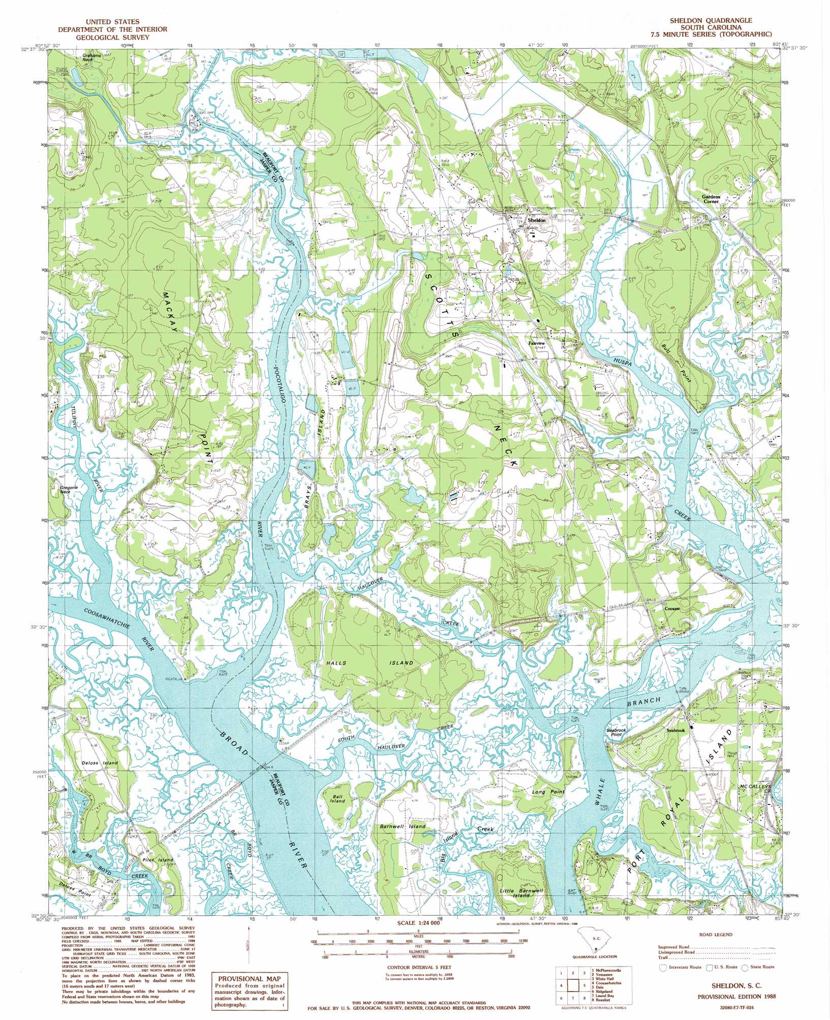
Sheldon Topo Map South Carolina
To zoom in, hover over the map of Sheldon
USGS Topo Quad 32080e7 - 1:24,000 scale
| Topo Map Name: | Sheldon |
| USGS Topo Quad ID: | 32080e7 |
| Print Size: | ca. 21 1/4" wide x 27" high |
| Southeast Coordinates: | 32.5° N latitude / 80.75° W longitude |
| Map Center Coordinates: | 32.5625° N latitude / 80.8125° W longitude |
| U.S. State: | SC |
| Filename: | o32080e7.jpg |
| Download Map JPG Image: | Sheldon topo map 1:24,000 scale |
| Map Type: | Topographic |
| Topo Series: | 7.5´ |
| Map Scale: | 1:24,000 |
| Source of Map Images: | United States Geological Survey (USGS) |
| Alternate Map Versions: |
Sheldon SC 1988, updated 1988 Download PDF Buy paper map Sheldon SC 2011 Download PDF Buy paper map Sheldon SC 2014 Download PDF Buy paper map |
1:24,000 Topo Quads surrounding Sheldon
Hampton |
Cummings |
Black Creek |
Hendersonville |
Neyles |
Grays |
Mcphersonville |
Yemassee |
Whitehall |
Green Pond |
Calfpen Bay |
Coosawhatchie |
Sheldon |
Dale |
Wiggins |
Tillman |
Ridgeland |
Laurel Bay |
Beaufort |
Frogmore |
Hardeeville |
Jasper |
Spring Island |
Parris Island |
Saint Phillips Island |
> Back to 32080e1 at 1:100,000 scale
> Back to 32080a1 at 1:250,000 scale
> Back to U.S. Topo Maps home
Sheldon topo map: Gazetteer
Sheldon: Capes
Bull Point elevation 7m 22′Gregorie Neck elevation 1m 3′
Long Point elevation 3m 9′
Mackay Point elevation 8m 26′
Pages Point elevation 0m 0′
Scotts Neck elevation 7m 22′
Seabrook Point elevation 1m 3′
Sheldon: Islands
Ball Island elevation 1m 3′Barnwell Island elevation 4m 13′
Brays Island elevation 4m 13′
Deloss Island elevation 5m 16′
Halls Island elevation 4m 13′
Little Barnwell Island elevation 7m 22′
Long Island elevation 3m 9′
Pilot Island elevation 5m 16′
Sheldon: Populated Places
Coosaw elevation 4m 13′Fairview elevation 9m 29′
Gardens Corner elevation 1m 3′
Knowles elevation 5m 16′
Seabrook elevation 5m 16′
Sheldon elevation 7m 22′
Sheldon: Post Offices
Seabrook Post Office elevation 4m 13′Sheldon: Streams
Coosawhatchie River elevation 0m 0′Field Creek elevation 0m 0′
Haulover Creek elevation 0m 0′
Huspa Creek elevation 0m 0′
Pocotaligo River elevation 0m 0′
South Haulover Creek elevation 0m 0′
Tulifiny River elevation 0m 0′
Sheldon digital topo map on disk
Buy this Sheldon topo map showing relief, roads, GPS coordinates and other geographical features, as a high-resolution digital map file on DVD:
South Carolina, Western North Carolina & Northeastern Georgia
Buy digital topo maps: South Carolina, Western North Carolina & Northeastern Georgia