Meldrim Se Topo Map Georgia
To zoom in, hover over the map of Meldrim Se
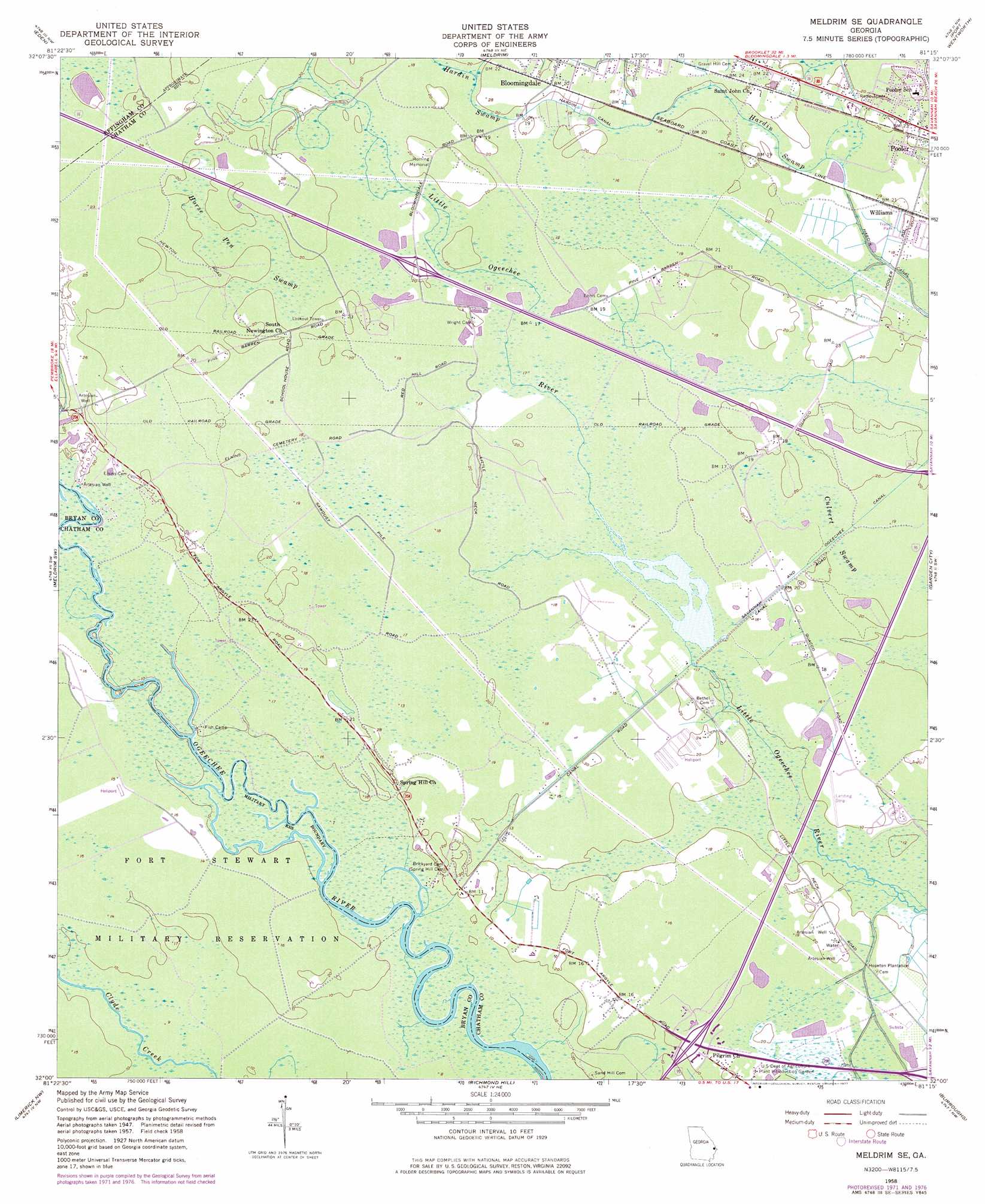
USGS Topo Quad 32081a3 - 1:24,000 scale
| Topo Map Name: | Meldrim Se |
| USGS Topo Quad ID: | 32081a3 |
| Print Size: | ca. 21 1/4" wide x 27" high |
| Southeast Coordinates: | 32° N latitude / 81.25° W longitude |
| Map Center Coordinates: | 32.0625° N latitude / 81.3125° W longitude |
| U.S. State: | GA |
| Filename: | o32081a3.jpg |
| Download Map JPG Image: | Meldrim Se topo map 1:24,000 scale |
| Map Type: | Topographic |
| Topo Series: | 7.5´ |
| Map Scale: | 1:24,000 |
| Source of Map Images: | United States Geological Survey (USGS) |
| Alternate Map Versions: |
Meldrim SE GA 1958, updated 1961 Download PDF Buy paper map Meldrim SE GA 1958, updated 1968 Download PDF Buy paper map Meldrim SE GA 1958, updated 1972 Download PDF Buy paper map Meldrim SE GA 1958, updated 1977 Download PDF Buy paper map Meldrim SE GA 2012 Download PDF Buy paper map Meldrim SE GA 2014 Download PDF Buy paper map |
1:24,000 Topo Quads surrounding Meldrim Se
Stilson |
Guyton |
Springfield South |
Rincon |
Hardeeville |
Lanier |
Eden |
Meldrim |
Port Wentworth |
Limehouse |
Letford |
Meldrim Sw |
Meldrim Se |
Garden City |
Savannah |
Trinity |
Limerick Nw |
Richmond Hill |
Burroughs |
Isle Of Hope |
Hinesville |
Dorchester |
Limerick Se |
Oak Level |
Raccoon Key |
> Back to 32081a1 at 1:100,000 scale
> Back to 32080a1 at 1:250,000 scale
> Back to U.S. Topo Maps home
Meldrim Se topo map: Gazetteer
Meldrim Se: Airports
Hopeton Plantation Field elevation 3m 9′Meldrim Se: Canals
Hardin Canal elevation 3m 9′Meldrim Se: Crossings
Exit 16 elevation 3m 9′Exit 31 elevation 6m 19′
Meldrim Se: Populated Places
Garden Acres Estates elevation 5m 16′Highland Woods Mobile Home Park elevation 4m 13′
Morgans Trailer Park Eastside elevation 5m 16′
Regency Mobile Home Park elevation 3m 9′
Tutens elevation 5m 16′
Williams elevation 6m 19′
Meldrim Se: Post Offices
Pooler Post Office elevation 6m 19′Meldrim Se: Reservoirs
Little Ogeechee Pond elevation 3m 9′Meldrim Se: Swamps
Horse Pen Swamp elevation 6m 19′Meldrim Se digital topo map on disk
Buy this Meldrim Se topo map showing relief, roads, GPS coordinates and other geographical features, as a high-resolution digital map file on DVD:
South Carolina, Western North Carolina & Northeastern Georgia
Buy digital topo maps: South Carolina, Western North Carolina & Northeastern Georgia