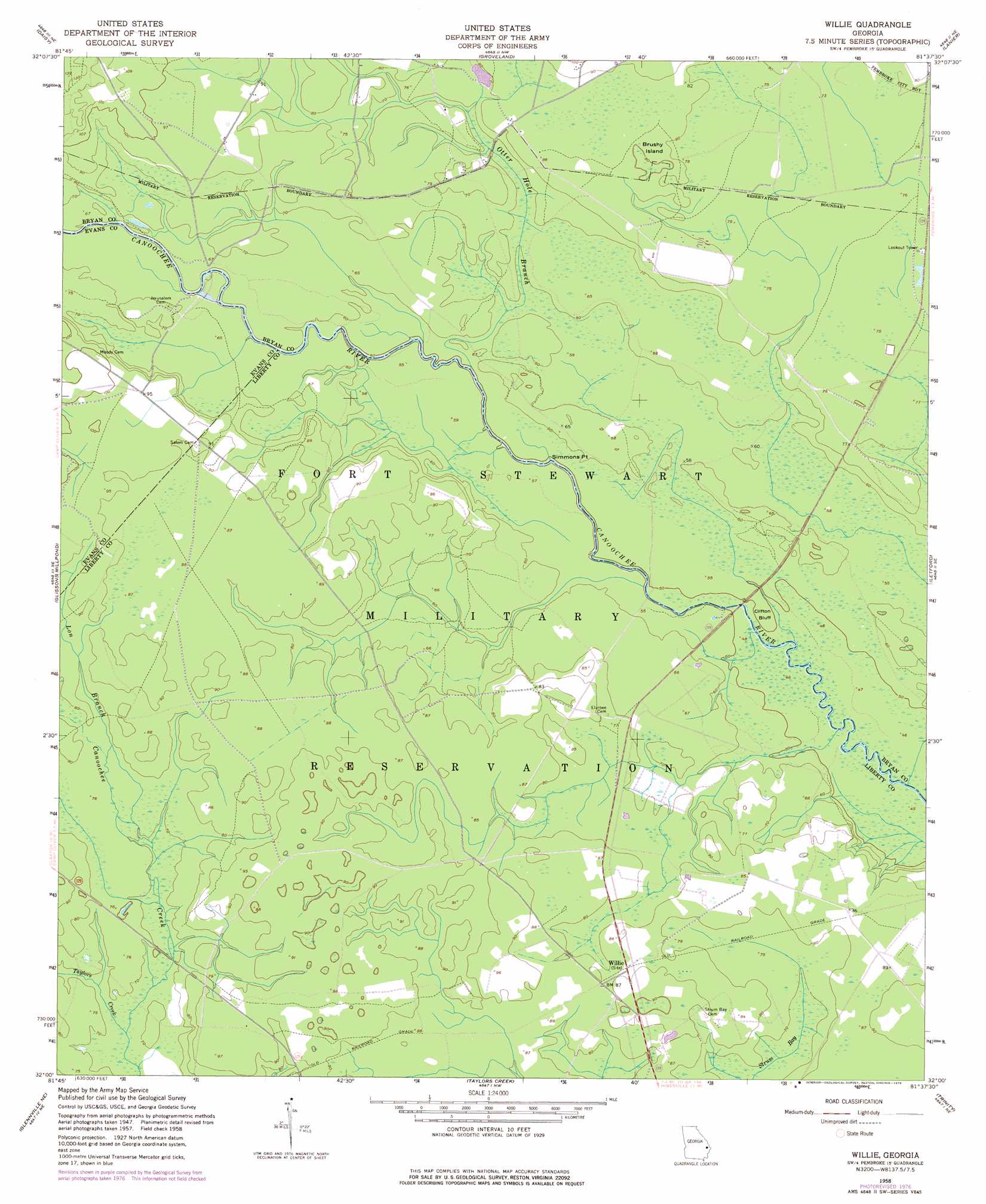
Willie Topo Map Georgia
To zoom in, hover over the map of Willie
USGS Topo Quad 32081a6 - 1:24,000 scale
| Topo Map Name: | Willie |
| USGS Topo Quad ID: | 32081a6 |
| Print Size: | ca. 21 1/4" wide x 27" high |
| Southeast Coordinates: | 32° N latitude / 81.625° W longitude |
| Map Center Coordinates: | 32.0625° N latitude / 81.6875° W longitude |
| U.S. State: | GA |
| Filename: | o32081a6.jpg |
| Download Map JPG Image: | Willie topo map 1:24,000 scale |
| Map Type: | Topographic |
| Topo Series: | 7.5´ |
| Map Scale: | 1:24,000 |
| Source of Map Images: | United States Geological Survey (USGS) |
| Alternate Map Versions: |
Willie GA 1958, updated 1961 Download PDF Buy paper map Willie GA 1958, updated 1976 Download PDF Buy paper map Willie GA 1958, updated 1978 Download PDF Buy paper map Willie GA 2011 Download PDF Buy paper map Willie GA 2014 Download PDF Buy paper map |
1:24,000 Topo Quads surrounding Willie
Register |
Nevils |
Denmark |
Stilson |
Guyton |
Claxton |
Daisy |
Groveland |
Lanier |
Eden |
Deans Crossing |
Glissons Millpond |
Willie |
Letford |
Meldrim Sw |
Glennville |
Glennville Ne |
Taylors Creek |
Trinity |
Limerick Nw |
Glennville Sw |
Glennville Se |
Walthourville |
Hinesville |
Dorchester |
> Back to 32081a1 at 1:100,000 scale
> Back to 32080a1 at 1:250,000 scale
> Back to U.S. Topo Maps home
Willie topo map: Gazetteer
Willie: Bars
Edwards Rocks elevation 15m 49′Willie: Bridges
Moodys Bridge elevation 18m 59′Willie: Cliffs
Clifton Bluff elevation 16m 52′Simmons Point elevation 15m 49′
Willie: Islands
Brushy Island elevation 25m 82′Willie: Populated Places
Dukes (historical) elevation 27m 88′Strum Bay (historical) elevation 25m 82′
Willie elevation 27m 88′
Willie: Streams
Long Branch elevation 21m 68′Otter Hole Branch elevation 16m 52′
Taylors Creek elevation 21m 68′
Willie digital topo map on disk
Buy this Willie topo map showing relief, roads, GPS coordinates and other geographical features, as a high-resolution digital map file on DVD:
South Carolina, Western North Carolina & Northeastern Georgia
Buy digital topo maps: South Carolina, Western North Carolina & Northeastern Georgia