Limehouse Topo Map South Carolina
To zoom in, hover over the map of Limehouse
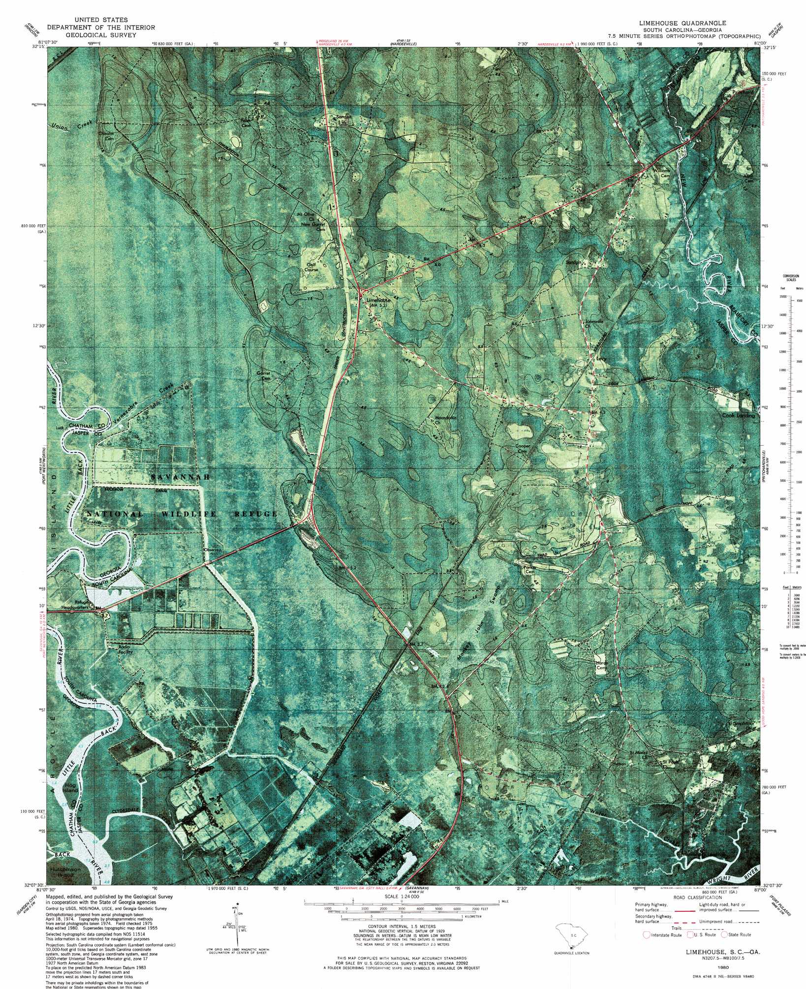
USGS Topo Quad 32081b1 - 1:24,000 scale
| Topo Map Name: | Limehouse |
| USGS Topo Quad ID: | 32081b1 |
| Print Size: | ca. 21 1/4" wide x 27" high |
| Southeast Coordinates: | 32.125° N latitude / 81° W longitude |
| Map Center Coordinates: | 32.1875° N latitude / 81.0625° W longitude |
| U.S. States: | SC, GA |
| Filename: | p32081b1.jpg |
| Download Map JPG Image: | Limehouse topo map 1:24,000 scale |
| Map Type: | Orthophoto |
| Topo Series: | 7.5´ |
| Map Scale: | 1:24,000 |
| Source of Map Images: | United States Geological Survey (USGS) |
| Alternate Map Versions: |
Limehouse SC 1955, updated 1957 Download PDF Buy paper map Limehouse SC 1955, updated 1973 Download PDF Buy paper map Limehouse SC 1980, updated 1980 Download PDF Buy paper map Limehouse SC 1980, updated 1987 Download PDF Buy paper map Limehouse SC 2011 Download PDF Buy paper map Limehouse SC 2014 Download PDF Buy paper map |
1:24,000 Topo Quads surrounding Limehouse
Springfield North |
Hardeeville Nw |
Tillman |
Ridgeland |
Laurel Bay |
Springfield South |
Rincon |
Hardeeville |
Jasper |
Spring Island |
Meldrim |
Port Wentworth |
Limehouse |
Pritchardville |
Bluffton |
Meldrim Se |
Garden City |
Savannah |
Fort Pulaski |
Tybee Island North |
Richmond Hill |
Burroughs |
Isle Of Hope |
Wassaw Sound |
Tybee Island South |
> Back to 32081a1 at 1:100,000 scale
> Back to 32080a1 at 1:250,000 scale
> Back to U.S. Topo Maps home
Limehouse topo map: Gazetteer
Limehouse: Bridges
New River Bridge elevation 3m 9′Limehouse: Canals
Lucknow Canal elevation 0m 0′Murray Hill Canal elevation 0m 0′
Taylor Canal elevation 0m 0′
Limehouse: Capes
Tunbridge Neck elevation 5m 16′Limehouse: Channels
Cross Tides elevation 1m 3′Limehouse: Islands
Hog Island elevation 0m 0′Limehouse: Parks
Savannah National Wildlife Refuge elevation 0m 0′Limehouse: Populated Places
Cook Landing elevation 3m 9′Levy elevation 4m 13′
Limehouse elevation 6m 19′
Pritchard elevation 6m 19′
Turnbridge Landing elevation 1m 3′
Limehouse: Streams
Clydesdale Creek elevation 1m 3′Little Back River elevation 0m 0′
Little Back River elevation 0m 0′
Salt Water Creek elevation 0m 0′
Vernezobre Creek elevation 0m 0′
Limehouse: Swamps
Monkey John Swamp elevation 1m 3′Limehouse digital topo map on disk
Buy this Limehouse topo map showing relief, roads, GPS coordinates and other geographical features, as a high-resolution digital map file on DVD:
South Carolina, Western North Carolina & Northeastern Georgia
Buy digital topo maps: South Carolina, Western North Carolina & Northeastern Georgia