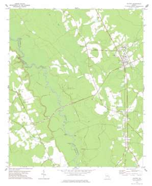
Guyton Topo Map Georgia
To zoom in, hover over the map of Guyton
USGS Topo Quad 32081c4 - 1:24,000 scale
| Topo Map Name: | Guyton |
| USGS Topo Quad ID: | 32081c4 |
| Print Size: | ca. 21 1/4" wide x 27" high |
| Southeast Coordinates: | 32.25° N latitude / 81.375° W longitude |
| Map Center Coordinates: | 32.3125° N latitude / 81.4375° W longitude |
| U.S. State: | GA |
| Filename: | o32081c4.jpg |
| Download Map JPG Image: | Guyton topo map 1:24,000 scale |
| Map Type: | Topographic |
| Topo Series: | 7.5´ |
| Map Scale: | 1:24,000 |
| Source of Map Images: | United States Geological Survey (USGS) |
| Alternate Map Versions: |
Guyton GA 1978, updated 1978 Download PDF Buy paper map Guyton GA 2011 Download PDF Buy paper map Guyton GA 2014 Download PDF Buy paper map |
1:24,000 Topo Quads surrounding Guyton
> Back to 32081a1 at 1:100,000 scale
> Back to 32080a1 at 1:250,000 scale
> Back to U.S. Topo Maps home
Guyton topo map: Gazetteer
Guyton: Bends
Horseshoe Bend elevation 10m 32′Guyton: Bridges
Captain William Cone Bridge elevation 12m 39′Doctor Floyd Bridge elevation 13m 42′
Guyton: Cliffs
Saint Peters Bluff elevation 16m 52′Guyton: Islands
Raccoon Keys elevation 15m 49′Guyton: Parks
Guyton Historic District elevation 29m 95′Guyton: Populated Places
Guyton elevation 29m 95′Hubert elevation 30m 98′
Ivanhoe elevation 28m 91′
Marlow elevation 21m 68′
Olney elevation 21m 68′
Pineora elevation 23m 75′
Guyton: Post Offices
Guyton Post Office elevation 29m 95′Guyton: Streams
Mill Creek elevation 12m 39′Shrimp Creek elevation 12m 39′
Sweeten Water Branch elevation 11m 36′
Guyton: Swamps
Big Bay elevation 18m 59′Blue Lake elevation 10m 32′
Duck Lake elevation 12m 39′
Guyton digital topo map on disk
Buy this Guyton topo map showing relief, roads, GPS coordinates and other geographical features, as a high-resolution digital map file on DVD:
South Carolina, Western North Carolina & Northeastern Georgia
Buy digital topo maps: South Carolina, Western North Carolina & Northeastern Georgia


