Denmark Topo Map Georgia
To zoom in, hover over the map of Denmark
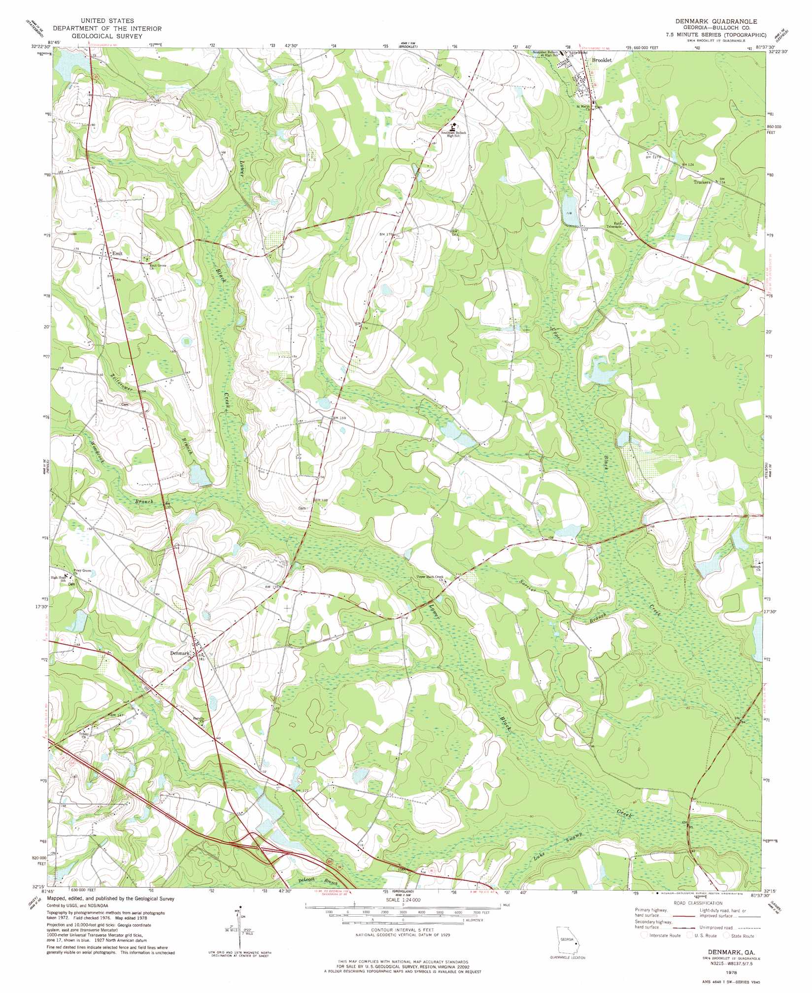
USGS Topo Quad 32081c6 - 1:24,000 scale
| Topo Map Name: | Denmark |
| USGS Topo Quad ID: | 32081c6 |
| Print Size: | ca. 21 1/4" wide x 27" high |
| Southeast Coordinates: | 32.25° N latitude / 81.625° W longitude |
| Map Center Coordinates: | 32.3125° N latitude / 81.6875° W longitude |
| U.S. State: | GA |
| Filename: | o32081c6.jpg |
| Download Map JPG Image: | Denmark topo map 1:24,000 scale |
| Map Type: | Topographic |
| Topo Series: | 7.5´ |
| Map Scale: | 1:24,000 |
| Source of Map Images: | United States Geological Survey (USGS) |
| Alternate Map Versions: |
Denmark GA 1978, updated 1978 Download PDF Buy paper map Denmark GA 2011 Download PDF Buy paper map Denmark GA 2014 Download PDF Buy paper map |
1:24,000 Topo Quads surrounding Denmark
Portal |
Hopeulikit |
Dover |
Oliver |
Kildare |
Pulaski |
Statesboro |
Brooklet |
Leefield |
Egypt |
Register |
Nevils |
Denmark |
Stilson |
Guyton |
Claxton |
Daisy |
Groveland |
Lanier |
Eden |
Deans Crossing |
Glissons Millpond |
Willie |
Letford |
Meldrim Sw |
> Back to 32081a1 at 1:100,000 scale
> Back to 32080a1 at 1:250,000 scale
> Back to U.S. Topo Maps home
Denmark topo map: Gazetteer
Denmark: Bridges
Birds Bridge elevation 22m 72′Denmark: Crossings
Eb Lee Ford elevation 23m 75′Exit 26 elevation 37m 121′
Denmark: Dams
Crombley Pond Dam elevation 36m 118′McDonald Pond Dam elevation 34m 111′
Quattebaum Pond Dam elevation 51m 167′
Trapnell Pond Dam elevation 30m 98′
Whitaker Pond Dam elevation 27m 88′
Denmark: Populated Places
Denmark elevation 55m 180′Emit elevation 52m 170′
Truckers elevation 37m 121′
Denmark: Reservoirs
Crombley Pond elevation 36m 118′McDonald Pond elevation 34m 111′
Quattlebaum Pond elevation 51m 167′
Trapnell Pond elevation 30m 98′
Whitaker Pond elevation 27m 88′
Denmark: Streams
Luke Swamp elevation 24m 78′Reed Branch elevation 25m 82′
Sorrier Branch elevation 25m 82′
Woodcock Branch elevation 35m 114′
Zeiterower Branch elevation 36m 118′
Denmark digital topo map on disk
Buy this Denmark topo map showing relief, roads, GPS coordinates and other geographical features, as a high-resolution digital map file on DVD:
South Carolina, Western North Carolina & Northeastern Georgia
Buy digital topo maps: South Carolina, Western North Carolina & Northeastern Georgia