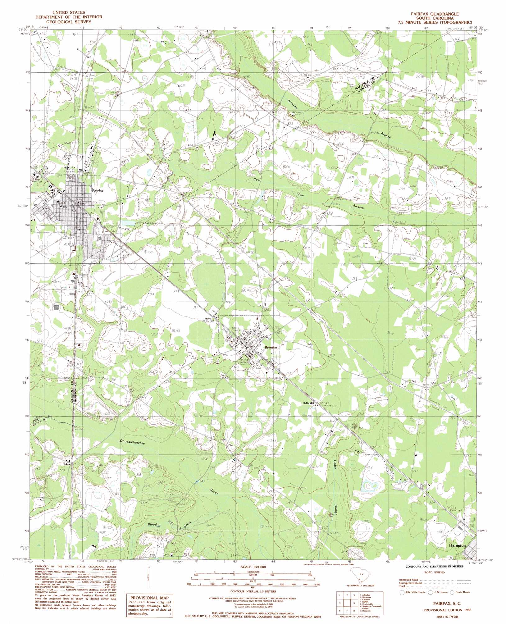
Fairfax Topo Map South Carolina
To zoom in, hover over the map of Fairfax
USGS Topo Quad 32081h2 - 1:24,000 scale
| Topo Map Name: | Fairfax |
| USGS Topo Quad ID: | 32081h2 |
| Print Size: | ca. 21 1/4" wide x 27" high |
| Southeast Coordinates: | 32.875° N latitude / 81.125° W longitude |
| Map Center Coordinates: | 32.9375° N latitude / 81.1875° W longitude |
| U.S. State: | SC |
| Filename: | o32081h2.jpg |
| Download Map JPG Image: | Fairfax topo map 1:24,000 scale |
| Map Type: | Topographic |
| Topo Series: | 7.5´ |
| Map Scale: | 1:24,000 |
| Source of Map Images: | United States Geological Survey (USGS) |
| Alternate Map Versions: |
Fairfax SC 1988, updated 1988 Download PDF Buy paper map Fairfax SC 2011 Download PDF Buy paper map Fairfax SC 2014 Download PDF Buy paper map |
1:24,000 Topo Quads surrounding Fairfax
Snelling |
Barnwell |
Olar |
Clear Pond |
Tony Hill Bay |
Martin |
Allendale |
Sycamore |
Ehrhardt |
Lodge |
Bull Pond |
Barton |
Fairfax |
Crocketville |
Islandton |
Brier Creek Landing |
Solomons Crossroads |
Gifford |
Hampton |
Cummings |
Blue Springs Landing |
Shirley |
Furman |
Grays |
Mcphersonville |
> Back to 32081e1 at 1:100,000 scale
> Back to 32080a1 at 1:250,000 scale
> Back to U.S. Topo Maps home
Fairfax topo map: Gazetteer
Fairfax: Bridges
Brandon Crossing elevation 23m 75′Lovetts Crossing elevation 26m 85′
Fairfax: Dams
Rentz Fish Pond D-2600 Dam elevation 32m 104′Fairfax: Populated Places
Brunson elevation 41m 134′Dukes elevation 31m 101′
Fairfax elevation 42m 137′
Halls Mill elevation 34m 111′
Hampton elevation 33m 108′
Pond Town elevation 35m 114′
Richardson Crossroads elevation 31m 101′
Fairfax: Post Offices
Brunson Post Office elevation 41m 134′Fairfax Post Office elevation 42m 137′
Fairfax: Streams
Beech Branch elevation 27m 88′Blood Hill Creek elevation 22m 72′
Fairfax digital topo map on disk
Buy this Fairfax topo map showing relief, roads, GPS coordinates and other geographical features, as a high-resolution digital map file on DVD:
South Carolina, Western North Carolina & Northeastern Georgia
Buy digital topo maps: South Carolina, Western North Carolina & Northeastern Georgia