Reidsville East Topo Map Georgia
To zoom in, hover over the map of Reidsville East
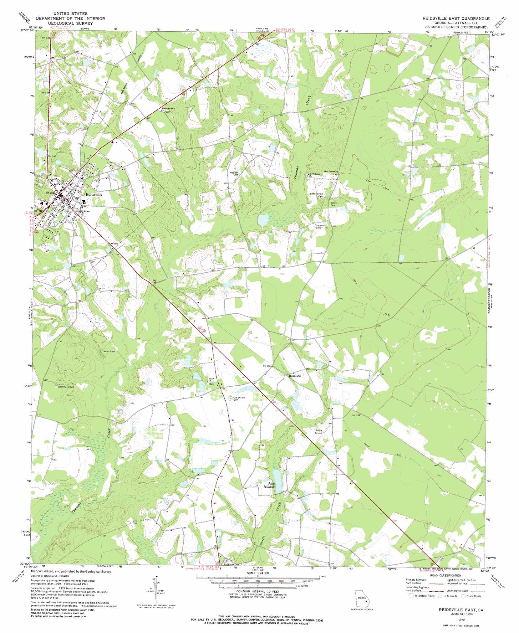
USGS Topo Quad 32082a1 - 1:24,000 scale
| Topo Map Name: | Reidsville East |
| USGS Topo Quad ID: | 32082a1 |
| Print Size: | ca. 21 1/4" wide x 27" high |
| Southeast Coordinates: | 32° N latitude / 82° W longitude |
| Map Center Coordinates: | 32.0625° N latitude / 82.0625° W longitude |
| U.S. State: | GA |
| Filename: | o32082a1.jpg |
| Download Map JPG Image: | Reidsville East topo map 1:24,000 scale |
| Map Type: | Topographic |
| Topo Series: | 7.5´ |
| Map Scale: | 1:24,000 |
| Source of Map Images: | United States Geological Survey (USGS) |
| Alternate Map Versions: |
Reidsville East GA 1970, updated 1973 Download PDF Buy paper map Reidsville East GA 1970, updated 1987 Download PDF Buy paper map Reidsville East GA 2011 Download PDF Buy paper map Reidsville East GA 2014 Download PDF Buy paper map |
1:24,000 Topo Quads surrounding Reidsville East
Oak Park |
Cobbtown |
Metter Se |
Register |
Nevils |
Lyons |
Ohoopee |
Collins |
Claxton |
Daisy |
Johnson Corner |
Reidsville West |
Reidsville East |
Deans Crossing |
Glissons Millpond |
Baxley Ne |
Altamaha |
Tison |
Glennville |
Glennville Ne |
Baxley |
Altamaha Sw |
Altamaha Se |
Glennville Sw |
Glennville Se |
> Back to 32082a1 at 1:100,000 scale
> Back to 32082a1 at 1:250,000 scale
> Back to U.S. Topo Maps home
Reidsville East topo map: Gazetteer
Reidsville East: Airports
Tootle Airport elevation 56m 183′Reidsville East: Dams
D L Lake Dam elevation 47m 154′Durrence Lake Dam elevation 49m 160′
Hodges Pond Dam elevation 48m 157′
Jones Millpond Dam elevation 42m 137′
Segull Lake Dam elevation 54m 177′
Reidsville East: Populated Places
Bradleys (historical) elevation 56m 183′Hughland elevation 55m 180′
Reidsville elevation 62m 203′
Reidsville East: Reservoirs
D L Lake elevation 47m 154′Durrence Lake elevation 49m 160′
Hodges Pond elevation 48m 157′
Jones Millpond elevation 42m 137′
Segull Lake elevation 54m 177′
Reidsville East: Streams
Douglas Branch elevation 43m 141′Reidsville East digital topo map on disk
Buy this Reidsville East topo map showing relief, roads, GPS coordinates and other geographical features, as a high-resolution digital map file on DVD:
South Carolina, Western North Carolina & Northeastern Georgia
Buy digital topo maps: South Carolina, Western North Carolina & Northeastern Georgia