Lowery Topo Map Georgia
To zoom in, hover over the map of Lowery
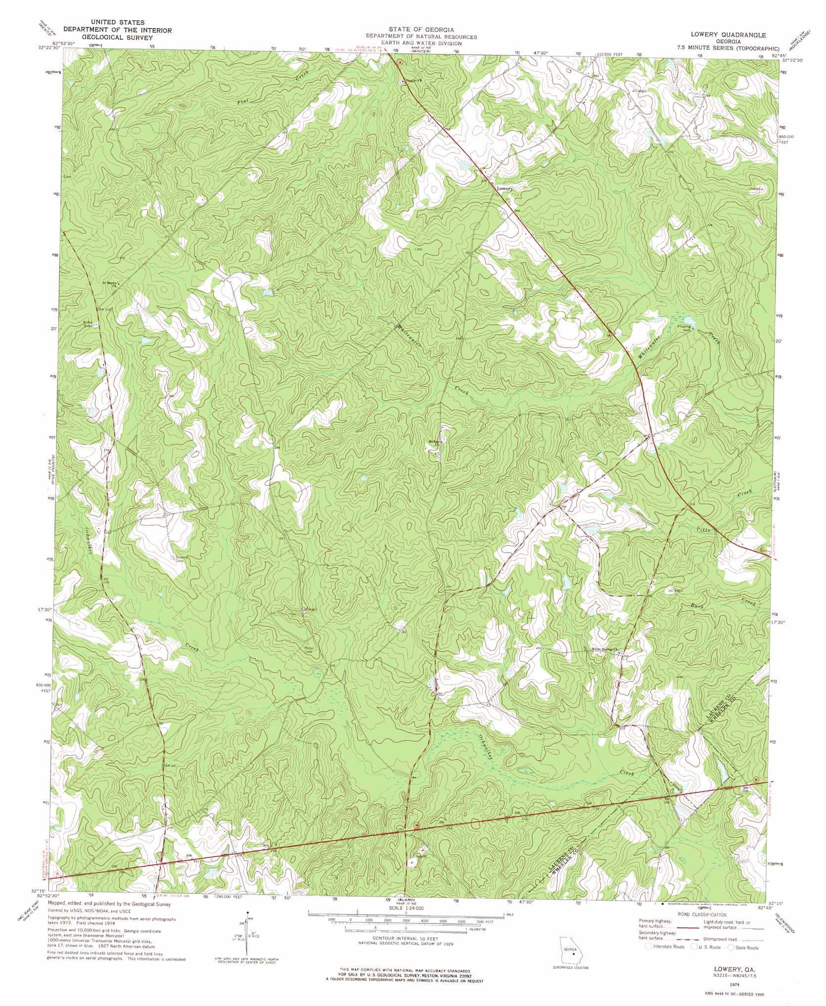
USGS Topo Quad 32082c7 - 1:24,000 scale
| Topo Map Name: | Lowery |
| USGS Topo Quad ID: | 32082c7 |
| Print Size: | ca. 21 1/4" wide x 27" high |
| Southeast Coordinates: | 32.25° N latitude / 82.75° W longitude |
| Map Center Coordinates: | 32.3125° N latitude / 82.8125° W longitude |
| U.S. State: | GA |
| Filename: | o32082c7.jpg |
| Download Map JPG Image: | Lowery topo map 1:24,000 scale |
| Map Type: | Topographic |
| Topo Series: | 7.5´ |
| Map Scale: | 1:24,000 |
| Source of Map Images: | United States Geological Survey (USGS) |
| Alternate Map Versions: |
Lowery GA 1974, updated 1976 Download PDF Buy paper map Lowery GA 2011 Download PDF Buy paper map Lowery GA 2014 Download PDF Buy paper map |
1:24,000 Topo Quads surrounding Lowery
Dudley |
Dublin |
East Dublin |
Scott |
Adrian |
Dexter |
Rentz |
Minter |
Rockledge |
Soperton North |
Cadwell |
Five Points |
Lowery |
Lothair |
Soperton South |
Jay Bird Springs |
Mcrae Nw |
Alamo |
Glenwood |
Mount Vernon |
Milan |
Mcrae |
Scotland |
Jordan |
Uvalda |
> Back to 32082a1 at 1:100,000 scale
> Back to 32082a1 at 1:250,000 scale
> Back to U.S. Topo Maps home
Lowery topo map: Gazetteer
Lowery: Dams
Swinson Lake Dam elevation 64m 209′Lowery: Populated Places
Hatoff (historical) elevation 83m 272′Lowery elevation 68m 223′
Walkee (historical) elevation 69m 226′
Lowery: Reservoirs
Swinson Lake elevation 64m 209′Lowery: Streams
Ochwalkee Creek elevation 68m 223′Lowery digital topo map on disk
Buy this Lowery topo map showing relief, roads, GPS coordinates and other geographical features, as a high-resolution digital map file on DVD:
South Carolina, Western North Carolina & Northeastern Georgia
Buy digital topo maps: South Carolina, Western North Carolina & Northeastern Georgia