Stillmore Topo Map Georgia
To zoom in, hover over the map of Stillmore
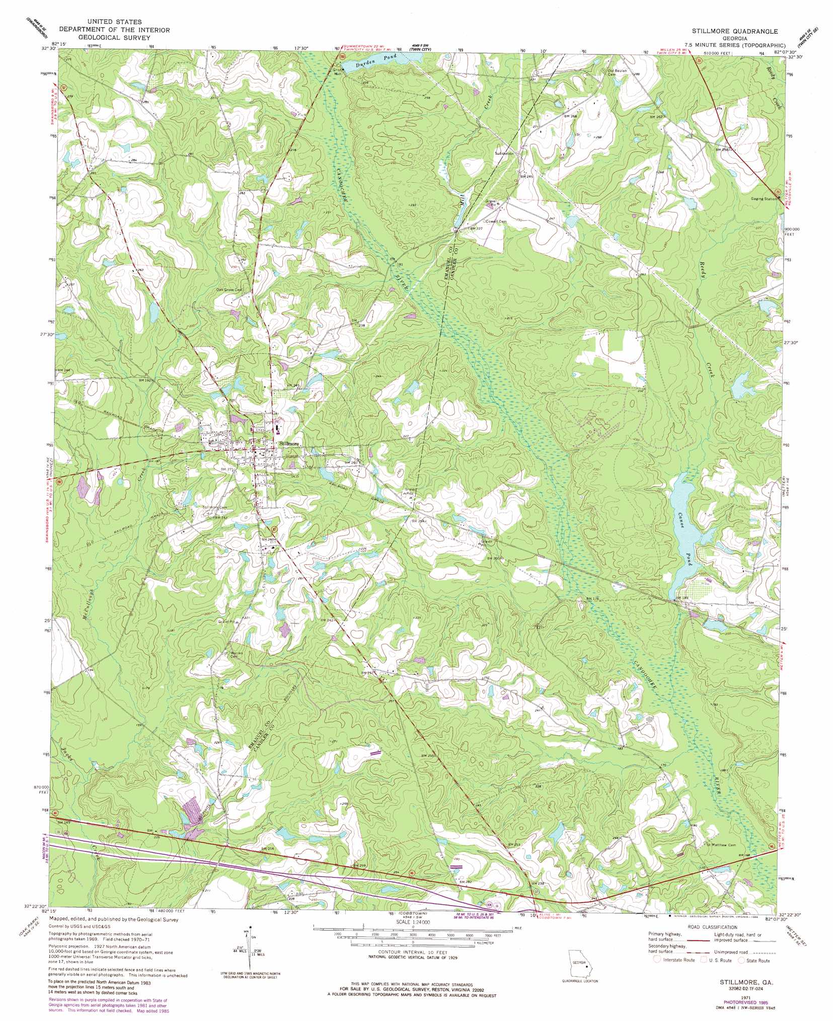
USGS Topo Quad 32082d2 - 1:24,000 scale
| Topo Map Name: | Stillmore |
| USGS Topo Quad ID: | 32082d2 |
| Print Size: | ca. 21 1/4" wide x 27" high |
| Southeast Coordinates: | 32.375° N latitude / 82.125° W longitude |
| Map Center Coordinates: | 32.4375° N latitude / 82.1875° W longitude |
| U.S. State: | GA |
| Filename: | o32082d2.jpg |
| Download Map JPG Image: | Stillmore topo map 1:24,000 scale |
| Map Type: | Topographic |
| Topo Series: | 7.5´ |
| Map Scale: | 1:24,000 |
| Source of Map Images: | United States Geological Survey (USGS) |
| Alternate Map Versions: |
Stillmore GA 1971, updated 1973 Download PDF Buy paper map Stillmore GA 1971, updated 1986 Download PDF Buy paper map Stillmore GA 2011 Download PDF Buy paper map Stillmore GA 2014 Download PDF Buy paper map |
1:24,000 Topo Quads surrounding Stillmore
Dellwood |
Summertown |
Canoochee |
Garfield |
Four Points |
Norristown |
Swainsboro |
Twin City |
Twin City Se |
Portal |
Covena |
Nunez |
Stillmore |
Metter |
Pulaski |
Oak Park Sw |
Oak Park |
Cobbtown |
Metter Se |
Register |
Vidalia |
Lyons |
Ohoopee |
Collins |
Claxton |
> Back to 32082a1 at 1:100,000 scale
> Back to 32082a1 at 1:250,000 scale
> Back to U.S. Topo Maps home
Stillmore topo map: Gazetteer
Stillmore: Bridges
Emmit Bridge (historical) elevation 51m 167′Strawfield Bridge elevation 48m 157′
Stillmore: Dams
Brantley Trapnell Lake Dam elevation 63m 206′Canoe Pond Dam elevation 54m 177′
Cooper Lake Dam elevation 61m 200′
Durdens Pond Dam elevation 62m 203′
Lewis Lake Dam elevation 67m 219′
Stillmore: Populated Places
Canoe elevation 57m 187′Stillmore elevation 81m 265′
Stillmore: Reservoirs
Brantley Trapnell Lake elevation 63m 206′Canoe Pond elevation 54m 177′
Cooper Lake elevation 61m 200′
Cowarts Mill Pond elevation 59m 193′
Durden Pond elevation 62m 203′
Lewis Lake elevation 67m 219′
Stillmore: Streams
McCullough Creek elevation 45m 147′Mill Creek elevation 53m 173′
Reedy Creek elevation 50m 164′
Stillmore digital topo map on disk
Buy this Stillmore topo map showing relief, roads, GPS coordinates and other geographical features, as a high-resolution digital map file on DVD:
South Carolina, Western North Carolina & Northeastern Georgia
Buy digital topo maps: South Carolina, Western North Carolina & Northeastern Georgia