Rentz Topo Map Georgia
To zoom in, hover over the map of Rentz
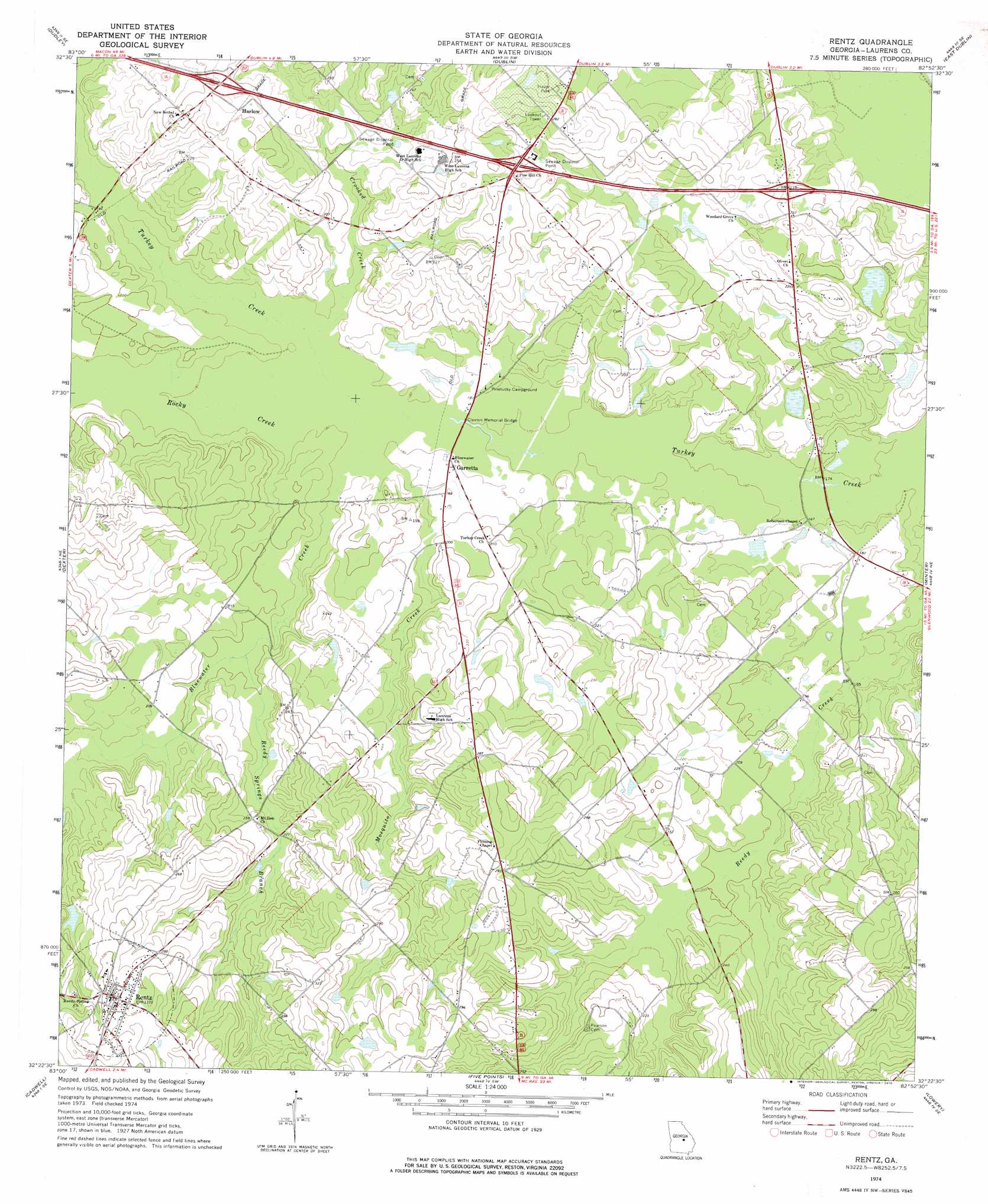
USGS Topo Quad 32082d8 - 1:24,000 scale
| Topo Map Name: | Rentz |
| USGS Topo Quad ID: | 32082d8 |
| Print Size: | ca. 21 1/4" wide x 27" high |
| Southeast Coordinates: | 32.375° N latitude / 82.875° W longitude |
| Map Center Coordinates: | 32.4375° N latitude / 82.9375° W longitude |
| U.S. State: | GA |
| Filename: | o32082d8.jpg |
| Download Map JPG Image: | Rentz topo map 1:24,000 scale |
| Map Type: | Topographic |
| Topo Series: | 7.5´ |
| Map Scale: | 1:24,000 |
| Source of Map Images: | United States Geological Survey (USGS) |
| Alternate Map Versions: |
Rentz GA 1974, updated 1976 Download PDF Buy paper map Rentz GA 2011 Download PDF Buy paper map Rentz GA 2014 Download PDF Buy paper map |
1:24,000 Topo Quads surrounding Rentz
Stuckey Boone Lake |
Nicklesville |
Cow Hell Swamp |
Lovett |
Wrightsville |
Danville East |
Dudley |
Dublin |
East Dublin |
Scott |
Chester |
Dexter |
Rentz |
Minter |
Rockledge |
Yonkers |
Cadwell |
Five Points |
Lowery |
Lothair |
Eastman |
Jay Bird Springs |
Mcrae Nw |
Alamo |
Glenwood |
> Back to 32082a1 at 1:100,000 scale
> Back to 32082a1 at 1:250,000 scale
> Back to U.S. Topo Maps home
Rentz topo map: Gazetteer
Rentz: Bridges
Claxton Memorial Bridge elevation 52m 170′Rentz: Crossings
Exit 13 elevation 79m 259′Exit 14 elevation 84m 275′
Exit 15 elevation 69m 226′
Rentz: Dams
Bailey Lake Dam elevation 55m 180′Colter Lake Dam elevation 76m 249′
Freeman Lake Dam elevation 58m 190′
Greene Lake Dam elevation 52m 170′
Hardin Lake Dam elevation 64m 209′
Lamar Smith Lake Dam elevation 74m 242′
Rentz: Populated Places
Garretta elevation 55m 180′Harlow elevation 79m 259′
Mayberry (historical) elevation 72m 236′
Rentz elevation 93m 305′
Rentz: Reservoirs
Bailey Lake elevation 55m 180′Colter Lake elevation 76m 249′
Freeman Lake elevation 58m 190′
Greene Lake elevation 52m 170′
Hardin Lake elevation 64m 209′
Lamar Smith Lake elevation 74m 242′
Rentz: Streams
Bluewater Creek elevation 54m 177′Crooked Creek elevation 54m 177′
Mosquito Creek elevation 54m 177′
Reedy Springs Branch elevation 59m 193′
Rocky Creek elevation 54m 177′
Rentz digital topo map on disk
Buy this Rentz topo map showing relief, roads, GPS coordinates and other geographical features, as a high-resolution digital map file on DVD:
South Carolina, Western North Carolina & Northeastern Georgia
Buy digital topo maps: South Carolina, Western North Carolina & Northeastern Georgia