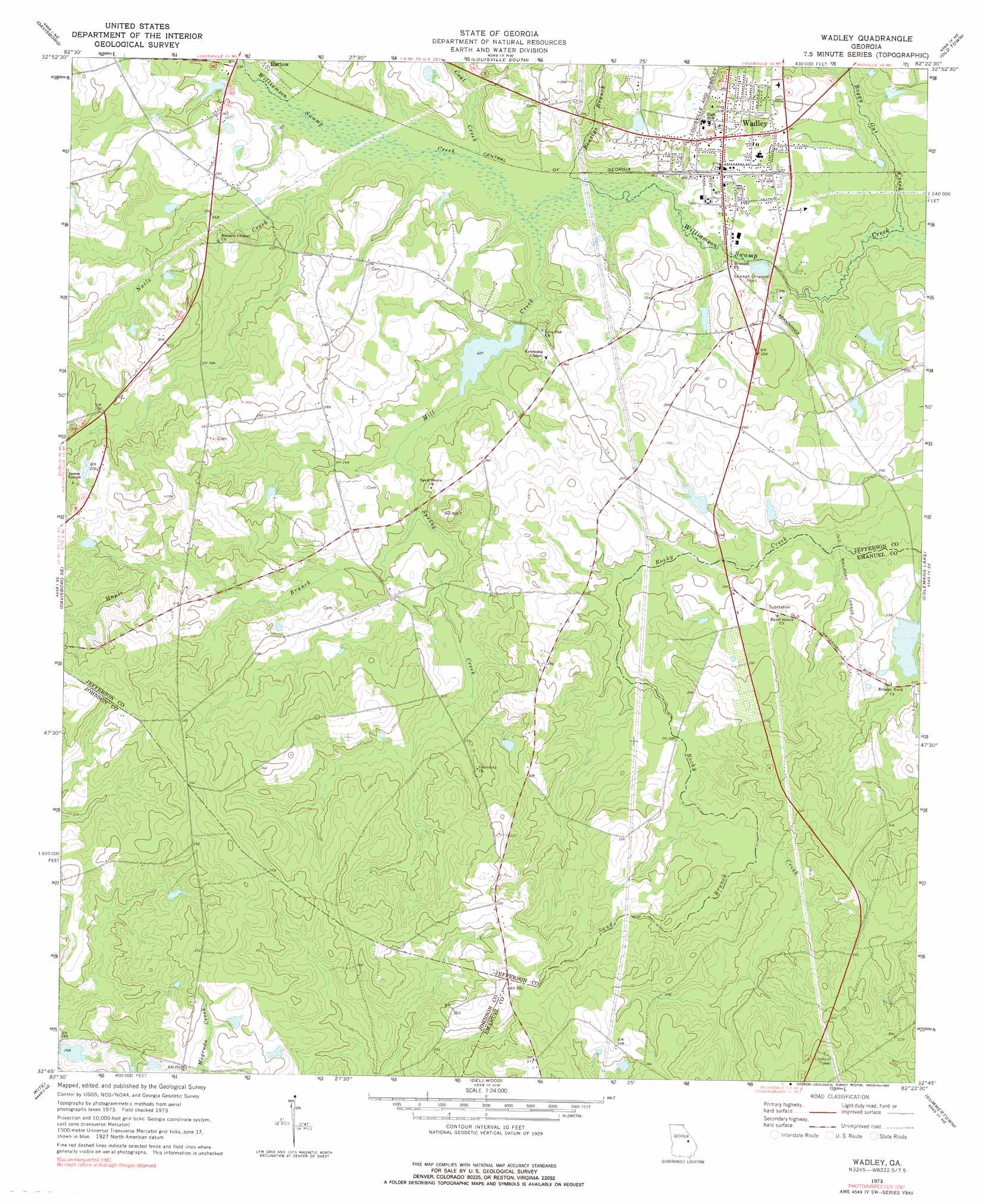
Wadley Topo Map Georgia
To zoom in, hover over the map of Wadley
USGS Topo Quad 32082g4 - 1:24,000 scale
| Topo Map Name: | Wadley |
| USGS Topo Quad ID: | 32082g4 |
| Print Size: | ca. 21 1/4" wide x 27" high |
| Southeast Coordinates: | 32.75° N latitude / 82.375° W longitude |
| Map Center Coordinates: | 32.8125° N latitude / 82.4375° W longitude |
| U.S. State: | GA |
| Filename: | o32082g4.jpg |
| Download Map JPG Image: | Wadley topo map 1:24,000 scale |
| Map Type: | Topographic |
| Topo Series: | 7.5´ |
| Map Scale: | 1:24,000 |
| Source of Map Images: | United States Geological Survey (USGS) |
| Alternate Map Versions: |
Wadley GA 1973, updated 1976 Download PDF Buy paper map Wadley GA 2011 Download PDF Buy paper map Wadley GA 2014 Download PDF Buy paper map |
1:24,000 Topo Quads surrounding Wadley
Downs |
Grange |
Louisville |
Kellys Pond |
Gough |
Riddleville |
Davisboro |
Louisville South |
Old Town |
Scotts Corner |
Harrison |
Davisboro Se |
Wadley |
Colemans Lake |
Midville |
Wrightsville |
Kite |
Dellwood |
Summertown |
Canoochee |
Scott |
Adrian |
Norristown |
Swainsboro |
Twin City |
> Back to 32082e1 at 1:100,000 scale
> Back to 32082a1 at 1:250,000 scale
> Back to U.S. Topo Maps home
Wadley topo map: Gazetteer
Wadley: Dams
Beegles Farm Pond Dam elevation 69m 226′Easterlin Lake Dam elevation 71m 232′
Evans Lake Dam elevation 78m 255′
Harrison Pond Dam elevation 80m 262′
Rachels Pond Dam elevation 70m 229′
Wadley: Populated Places
Pinetucky (historical) elevation 83m 272′Wadley elevation 76m 249′
Wadley: Reservoirs
Beegles Farm Pond elevation 69m 226′Easterlin Lake elevation 71m 232′
Evans Lake elevation 78m 255′
Harrison Pond elevation 80m 262′
Rachels Pond elevation 70m 229′
Wadley: Streams
Beaslys Branch elevation 64m 209′Boggy Gut Creek elevation 60m 196′
Coat Creek elevation 65m 213′
Maple Branch elevation 72m 236′
Mill Creek elevation 64m 209′
Nails Creek elevation 66m 216′
Sand Branch elevation 82m 269′
Spring Creek elevation 71m 232′
Wadley digital topo map on disk
Buy this Wadley topo map showing relief, roads, GPS coordinates and other geographical features, as a high-resolution digital map file on DVD:
South Carolina, Western North Carolina & Northeastern Georgia
Buy digital topo maps: South Carolina, Western North Carolina & Northeastern Georgia