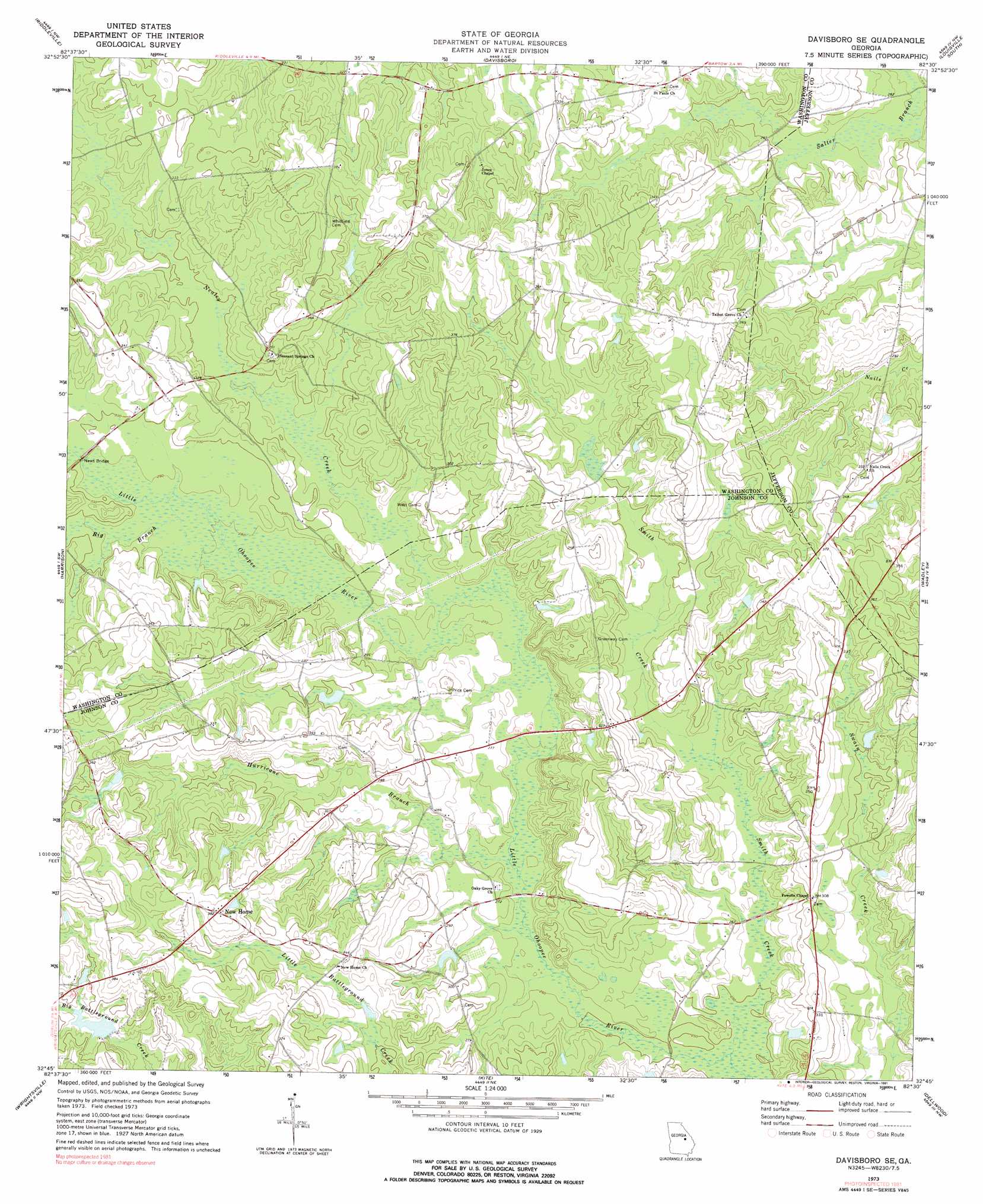
Davisboro Se Topo Map Georgia
To zoom in, hover over the map of Davisboro Se
USGS Topo Quad 32082g5 - 1:24,000 scale
| Topo Map Name: | Davisboro Se |
| USGS Topo Quad ID: | 32082g5 |
| Print Size: | ca. 21 1/4" wide x 27" high |
| Southeast Coordinates: | 32.75° N latitude / 82.5° W longitude |
| Map Center Coordinates: | 32.8125° N latitude / 82.5625° W longitude |
| U.S. State: | GA |
| Filename: | o32082g5.jpg |
| Download Map JPG Image: | Davisboro Se topo map 1:24,000 scale |
| Map Type: | Topographic |
| Topo Series: | 7.5´ |
| Map Scale: | 1:24,000 |
| Source of Map Images: | United States Geological Survey (USGS) |
| Alternate Map Versions: |
Davisboro SE GA 1973, updated 1976 Download PDF Buy paper map Davisboro SE GA 1973, updated 1991 Download PDF Buy paper map Davisboro SE GA 2011 Download PDF Buy paper map Davisboro SE GA 2014 Download PDF Buy paper map |
1:24,000 Topo Quads surrounding Davisboro Se
Warthen |
Downs |
Grange |
Louisville |
Kellys Pond |
Sandersville |
Riddleville |
Davisboro |
Louisville South |
Old Town |
Irwins Crossroads |
Harrison |
Davisboro Se |
Wadley |
Colemans Lake |
Lovett |
Wrightsville |
Kite |
Dellwood |
Summertown |
East Dublin |
Scott |
Adrian |
Norristown |
Swainsboro |
> Back to 32082e1 at 1:100,000 scale
> Back to 32082a1 at 1:250,000 scale
> Back to U.S. Topo Maps home
Davisboro Se topo map: Gazetteer
Davisboro Se: Bridges
News Bridge elevation 89m 291′Davisboro Se: Dams
Lewis Lake Dam elevation 95m 311′Whittmer Pond Dam elevation 100m 328′
Davisboro Se: Reservoirs
Dukes Lake elevation 97m 318′Lewis Lake elevation 95m 311′
Whittmer Pond elevation 100m 328′
Davisboro Se: Streams
Big Branch elevation 86m 282′Hurricane Branch elevation 78m 255′
Nealey Creek elevation 82m 269′
Smith Creek elevation 75m 246′
Davisboro Se digital topo map on disk
Buy this Davisboro Se topo map showing relief, roads, GPS coordinates and other geographical features, as a high-resolution digital map file on DVD:
South Carolina, Western North Carolina & Northeastern Georgia
Buy digital topo maps: South Carolina, Western North Carolina & Northeastern Georgia