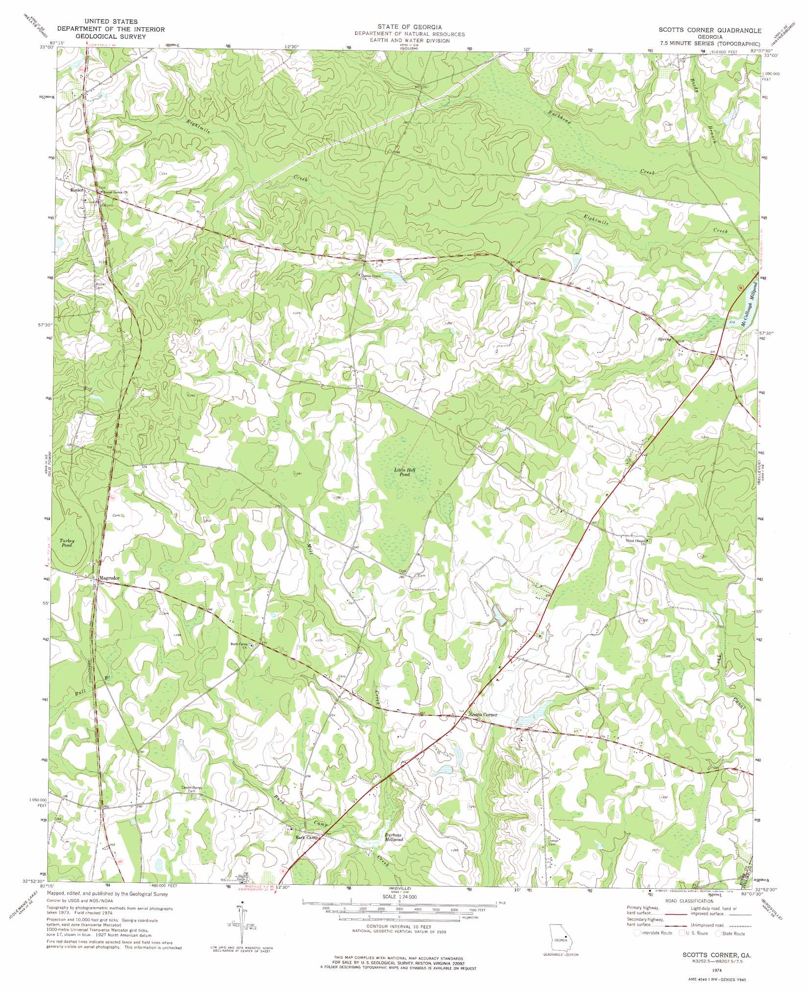
Scotts Corner Topo Map Georgia
To zoom in, hover over the map of Scotts Corner
USGS Topo Quad 32082h2 - 1:24,000 scale
| Topo Map Name: | Scotts Corner |
| USGS Topo Quad ID: | 32082h2 |
| Print Size: | ca. 21 1/4" wide x 27" high |
| Southeast Coordinates: | 32.875° N latitude / 82.125° W longitude |
| Map Center Coordinates: | 32.9375° N latitude / 82.1875° W longitude |
| U.S. State: | GA |
| Filename: | o32082h2.jpg |
| Download Map JPG Image: | Scotts Corner topo map 1:24,000 scale |
| Map Type: | Topographic |
| Topo Series: | 7.5´ |
| Map Scale: | 1:24,000 |
| Source of Map Images: | United States Geological Survey (USGS) |
| Alternate Map Versions: |
Scotts Corner GA 1974, updated 1976 Download PDF Buy paper map Scotts Corner GA 2011 Download PDF Buy paper map Scotts Corner GA 2014 Download PDF Buy paper map |
1:24,000 Topo Quads surrounding Scotts Corner
Wrens |
Matthews |
Keysville |
Storys Millpond |
Mcbean |
Louisville |
Kellys Pond |
Gough |
Waynesboro |
Idlewood |
Louisville South |
Old Town |
Scotts Corner |
Bellevue |
Perkins |
Wadley |
Colemans Lake |
Midville |
Birdsville |
Millen |
Dellwood |
Summertown |
Canoochee |
Garfield |
Four Points |
> Back to 32082e1 at 1:100,000 scale
> Back to 32082a1 at 1:250,000 scale
> Back to U.S. Topo Maps home
Scotts Corner topo map: Gazetteer
Scotts Corner: Lakes
Little Hell Pond elevation 84m 275′Turkey Pond elevation 89m 291′
Scotts Corner: Populated Places
Magruder elevation 88m 288′Rosier elevation 104m 341′
Scotts Corner elevation 76m 249′
Scotts Corner: Reservoirs
Burtons Millpond elevation 65m 213′Scotts Corner: Streams
Beedy Branch elevation 63m 206′Mill Creek elevation 65m 213′
Scotts Corner digital topo map on disk
Buy this Scotts Corner topo map showing relief, roads, GPS coordinates and other geographical features, as a high-resolution digital map file on DVD:
South Carolina, Western North Carolina & Northeastern Georgia
Buy digital topo maps: South Carolina, Western North Carolina & Northeastern Georgia