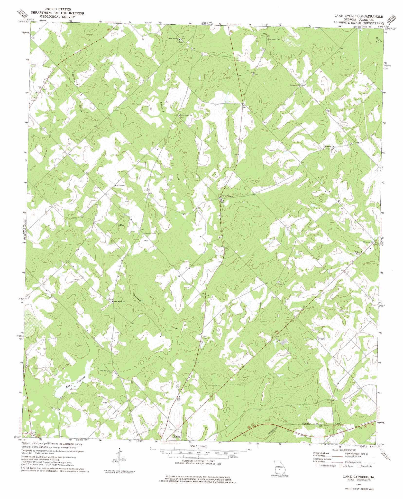
Lake Cypress Topo Map Georgia
To zoom in, hover over the map of Lake Cypress
USGS Topo Quad 32083a2 - 1:24,000 scale
| Topo Map Name: | Lake Cypress |
| USGS Topo Quad ID: | 32083a2 |
| Print Size: | ca. 21 1/4" wide x 27" high |
| Southeast Coordinates: | 32° N latitude / 83.125° W longitude |
| Map Center Coordinates: | 32.0625° N latitude / 83.1875° W longitude |
| U.S. State: | GA |
| Filename: | o32083a2.jpg |
| Download Map JPG Image: | Lake Cypress topo map 1:24,000 scale |
| Map Type: | Topographic |
| Topo Series: | 7.5´ |
| Map Scale: | 1:24,000 |
| Source of Map Images: | United States Geological Survey (USGS) |
| Alternate Map Versions: |
Lake Cypress GA 1972, updated 1975 Download PDF Buy paper map Lake Cypress GA 2011 Download PDF Buy paper map Lake Cypress GA 2014 Download PDF Buy paper map |
1:24,000 Topo Quads surrounding Lake Cypress
Hawkinsville |
Empire |
Yonkers |
Cadwell |
Five Points |
Finleyson East |
West Of Eastman |
Eastman |
Jay Bird Springs |
Mcrae Nw |
Pineview East |
Abbeville North |
Lake Cypress |
Milan |
Mcrae |
Rochelle |
Abbeville South |
Rhine |
Cooks Still |
Workmore |
Rebecca |
Sibbie |
Queensland |
China Hill |
Jacksonville |
> Back to 32083a1 at 1:100,000 scale
> Back to 32082a1 at 1:250,000 scale
> Back to U.S. Topo Maps home
Lake Cypress topo map: Gazetteer
Lake Cypress: Dams
Jamieson Pond Dam elevation 93m 305′Lake Cypress Dam elevation 57m 187′
Peterson Pond Dam elevation 98m 321′
Lake Cypress: Populated Places
Ararat elevation 91m 298′Calvin elevation 99m 324′
Five Points elevation 81m 265′
Lake Cypress: Reservoirs
Jamieson Pond elevation 93m 305′Lake Cypress elevation 57m 187′
Peterson Pond elevation 98m 321′
Lake Cypress: Streams
Cypress River elevation 67m 219′Lake Cypress digital topo map on disk
Buy this Lake Cypress topo map showing relief, roads, GPS coordinates and other geographical features, as a high-resolution digital map file on DVD:
South Carolina, Western North Carolina & Northeastern Georgia
Buy digital topo maps: South Carolina, Western North Carolina & Northeastern Georgia