Eastman Topo Map Georgia
To zoom in, hover over the map of Eastman
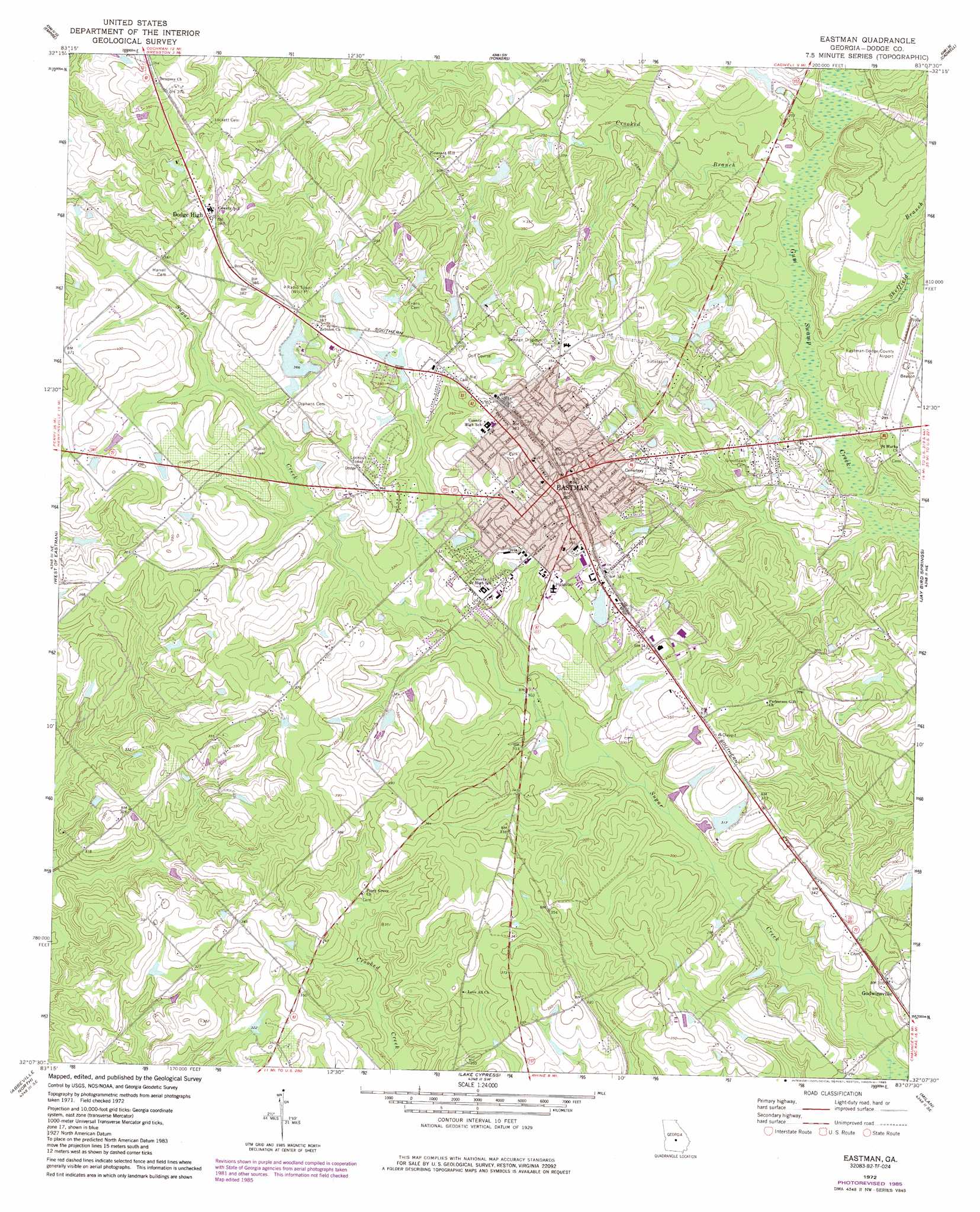
USGS Topo Quad 32083b2 - 1:24,000 scale
| Topo Map Name: | Eastman |
| USGS Topo Quad ID: | 32083b2 |
| Print Size: | ca. 21 1/4" wide x 27" high |
| Southeast Coordinates: | 32.125° N latitude / 83.125° W longitude |
| Map Center Coordinates: | 32.1875° N latitude / 83.1875° W longitude |
| U.S. State: | GA |
| Filename: | o32083b2.jpg |
| Download Map JPG Image: | Eastman topo map 1:24,000 scale |
| Map Type: | Topographic |
| Topo Series: | 7.5´ |
| Map Scale: | 1:24,000 |
| Source of Map Images: | United States Geological Survey (USGS) |
| Alternate Map Versions: |
Eastman GA 1972, updated 1975 Download PDF Buy paper map Eastman GA 1972, updated 1985 Download PDF Buy paper map Eastman GA 2011 Download PDF Buy paper map Eastman GA 2014 Download PDF Buy paper map |
1:24,000 Topo Quads surrounding Eastman
Westlake |
Cochran |
Chester |
Dexter |
Rentz |
Hawkinsville |
Empire |
Yonkers |
Cadwell |
Five Points |
Finleyson East |
West Of Eastman |
Eastman |
Jay Bird Springs |
Mcrae Nw |
Pineview East |
Abbeville North |
Lake Cypress |
Milan |
Mcrae |
Rochelle |
Abbeville South |
Rhine |
Cooks Still |
Workmore |
> Back to 32083a1 at 1:100,000 scale
> Back to 32082a1 at 1:250,000 scale
> Back to U.S. Topo Maps home
Eastman topo map: Gazetteer
Eastman: Airports
Eastman-Dodge County Airport elevation 91m 298′Eastman: Dams
Harrell Pond Dam elevation 103m 337′Jamieson Pond Dam elevation 96m 314′
Tripps Lake Dam elevation 109m 357′
Eastman: Populated Places
Amoskeag (historical) elevation 101m 331′Dempsey elevation 115m 377′
Dodge High elevation 119m 390′
Eastman elevation 106m 347′
Godwinsville elevation 94m 308′
Lowery elevation 87m 285′
Eastman: Reservoirs
Harrell Pond elevation 103m 337′Jamieson Pond elevation 96m 314′
Tripps Lake elevation 109m 357′
Eastman: Streams
Crooked Branch elevation 72m 236′Sheffield Branch elevation 70m 229′
Eastman digital topo map on disk
Buy this Eastman topo map showing relief, roads, GPS coordinates and other geographical features, as a high-resolution digital map file on DVD:
South Carolina, Western North Carolina & Northeastern Georgia
Buy digital topo maps: South Carolina, Western North Carolina & Northeastern Georgia