Byromville Topo Map Georgia
To zoom in, hover over the map of Byromville
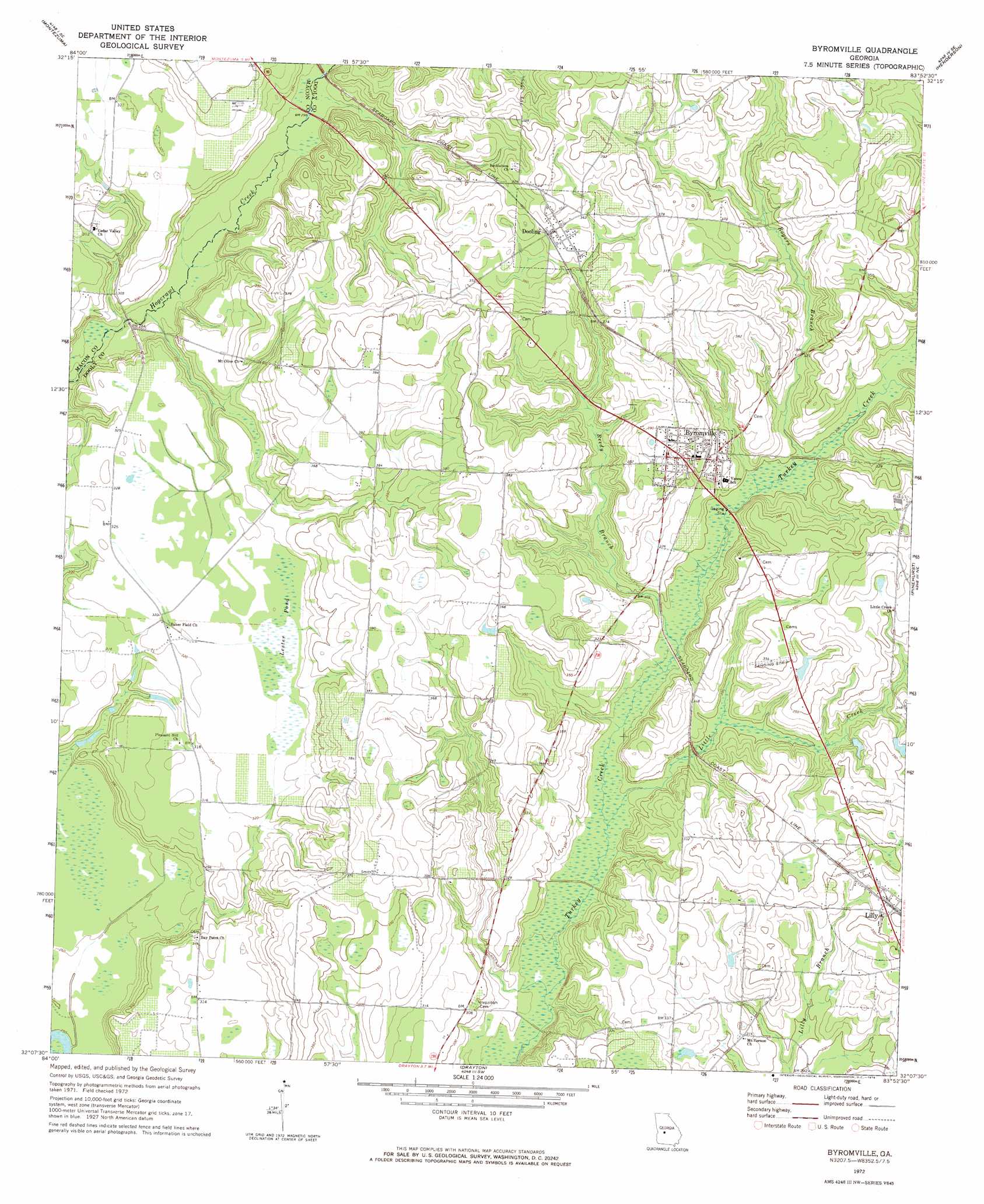
USGS Topo Quad 32083b8 - 1:24,000 scale
| Topo Map Name: | Byromville |
| USGS Topo Quad ID: | 32083b8 |
| Print Size: | ca. 21 1/4" wide x 27" high |
| Southeast Coordinates: | 32.125° N latitude / 83.875° W longitude |
| Map Center Coordinates: | 32.1875° N latitude / 83.9375° W longitude |
| U.S. State: | GA |
| Filename: | o32083b8.jpg |
| Download Map JPG Image: | Byromville topo map 1:24,000 scale |
| Map Type: | Topographic |
| Topo Series: | 7.5´ |
| Map Scale: | 1:24,000 |
| Source of Map Images: | United States Geological Survey (USGS) |
| Alternate Map Versions: |
Byromville GA 1972, updated 1974 Download PDF Buy paper map Byromville GA 2011 Download PDF Buy paper map Byromville GA 2014 Download PDF Buy paper map |
1:24,000 Topo Quads surrounding Byromville
Ideal North |
Garden Valley |
Marshallville |
Perry West |
Perry East |
Ideal South |
Montezuma |
Marshallville Sw |
Henderson |
Unadilla |
Andersonville |
Pennington |
Byromville |
Pinehurst |
Pineview Nw |
Americus |
Methvins |
Drayton |
Vienna |
Pineview Sw |
Smithville East |
Leslie |
Cobb |
Cordele |
Penia |
> Back to 32083a1 at 1:100,000 scale
> Back to 32082a1 at 1:250,000 scale
> Back to U.S. Topo Maps home
Byromville topo map: Gazetteer
Byromville: Airports
Byromville Aerodrome elevation 94m 308′Flint River Nursery Airport elevation 98m 321′
Byromville: Bridges
Quinn Bridge elevation 86m 282′Byromville: Populated Places
Bakerfield (historical) elevation 98m 321′Byromville elevation 106m 347′
Dooling elevation 113m 370′
Lilly elevation 106m 347′
Byromville: Post Offices
Lilly Post Office elevation 107m 351′Byromville: Streams
Little Creek elevation 84m 275′Reedy Branch elevation 86m 282′
Rogers Branch elevation 91m 298′
Byromville: Swamps
Bass Pond elevation 95m 311′Lester Pond elevation 100m 328′
Byromville digital topo map on disk
Buy this Byromville topo map showing relief, roads, GPS coordinates and other geographical features, as a high-resolution digital map file on DVD:
South Carolina, Western North Carolina & Northeastern Georgia
Buy digital topo maps: South Carolina, Western North Carolina & Northeastern Georgia