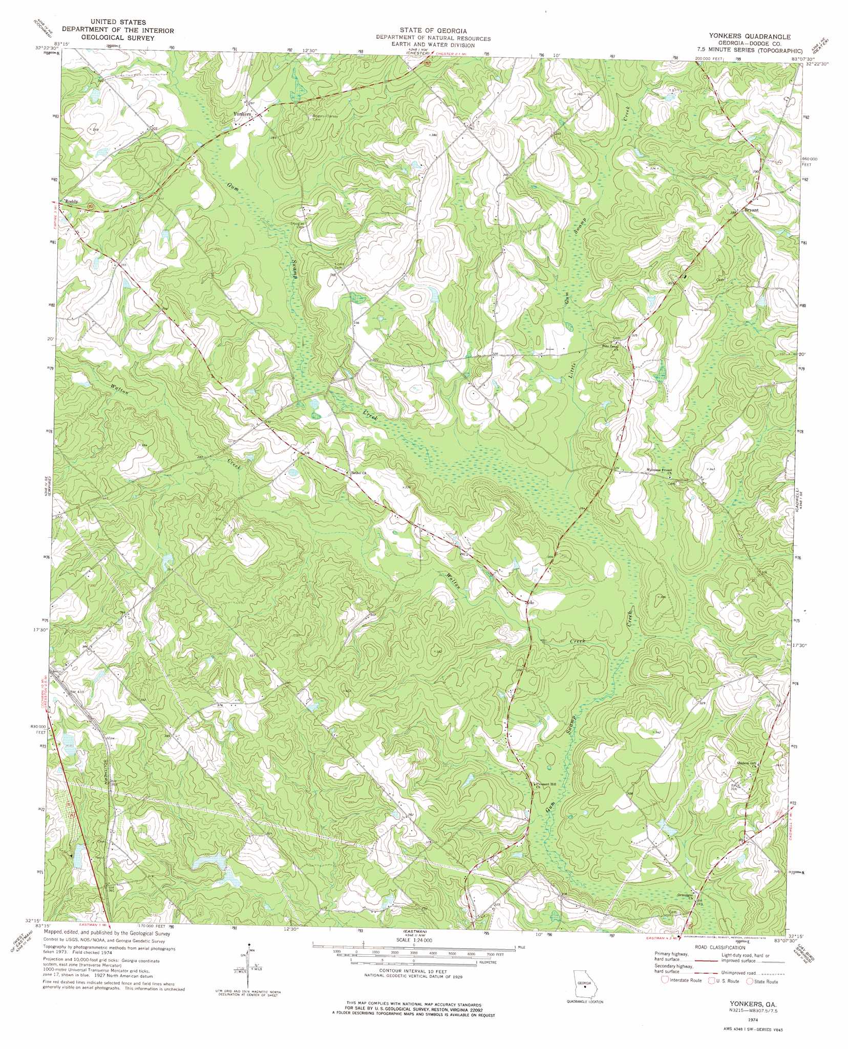
Yonkers Topo Map Georgia
To zoom in, hover over the map of Yonkers
USGS Topo Quad 32083c2 - 1:24,000 scale
| Topo Map Name: | Yonkers |
| USGS Topo Quad ID: | 32083c2 |
| Print Size: | ca. 21 1/4" wide x 27" high |
| Southeast Coordinates: | 32.25° N latitude / 83.125° W longitude |
| Map Center Coordinates: | 32.3125° N latitude / 83.1875° W longitude |
| U.S. State: | GA |
| Filename: | o32083c2.jpg |
| Download Map JPG Image: | Yonkers topo map 1:24,000 scale |
| Map Type: | Topographic |
| Topo Series: | 7.5´ |
| Map Scale: | 1:24,000 |
| Source of Map Images: | United States Geological Survey (USGS) |
| Alternate Map Versions: |
Yonkers GA 1974, updated 1976 Download PDF Buy paper map Yonkers GA 2011 Download PDF Buy paper map Yonkers GA 2014 Download PDF Buy paper map |
1:24,000 Topo Quads surrounding Yonkers
Tarversville |
Danville West |
Danville East |
Dudley |
Dublin |
Westlake |
Cochran |
Chester |
Dexter |
Rentz |
Hawkinsville |
Empire |
Yonkers |
Cadwell |
Five Points |
Finleyson East |
West Of Eastman |
Eastman |
Jay Bird Springs |
Mcrae Nw |
Pineview East |
Abbeville North |
Lake Cypress |
Milan |
Mcrae |
> Back to 32083a1 at 1:100,000 scale
> Back to 32082a1 at 1:250,000 scale
> Back to U.S. Topo Maps home
Yonkers topo map: Gazetteer
Yonkers: Dams
Long Pond Dam elevation 82m 269′Tripp Dam East elevation 87m 285′
Tripp Pond West Dam elevation 96m 314′
Wilton Tripp Dam elevation 109m 357′
Yonkers: Populated Places
Bryant elevation 118m 387′Yonkers elevation 87m 285′
Yonkers: Reservoirs
Long Pond elevation 82m 269′Milton Tripp Lake elevation 109m 357′
Tripp Pond East elevation 87m 285′
Tripp Pond West elevation 96m 314′
Yonkers: Streams
Little Gum Swamp Creek elevation 78m 255′Walton Creek elevation 75m 246′
Yonkers digital topo map on disk
Buy this Yonkers topo map showing relief, roads, GPS coordinates and other geographical features, as a high-resolution digital map file on DVD:
South Carolina, Western North Carolina & Northeastern Georgia
Buy digital topo maps: South Carolina, Western North Carolina & Northeastern Georgia