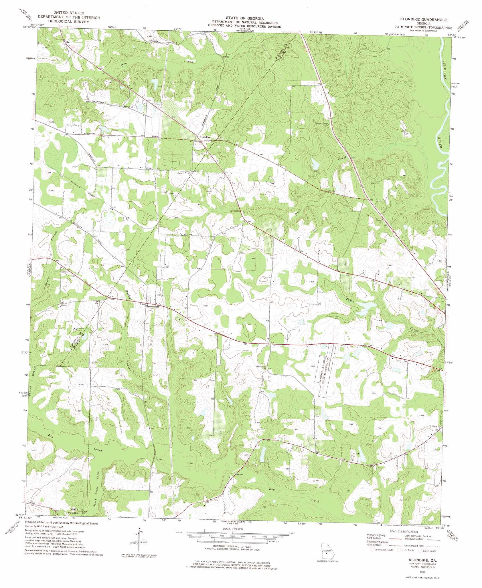
Klondike Topo Map Georgia
To zoom in, hover over the map of Klondike
USGS Topo Quad 32083c5 - 1:24,000 scale
| Topo Map Name: | Klondike |
| USGS Topo Quad ID: | 32083c5 |
| Print Size: | ca. 21 1/4" wide x 27" high |
| Southeast Coordinates: | 32.25° N latitude / 83.5° W longitude |
| Map Center Coordinates: | 32.3125° N latitude / 83.5625° W longitude |
| U.S. State: | GA |
| Filename: | o32083c5.jpg |
| Download Map JPG Image: | Klondike topo map 1:24,000 scale |
| Map Type: | Topographic |
| Topo Series: | 7.5´ |
| Map Scale: | 1:24,000 |
| Source of Map Images: | United States Geological Survey (USGS) |
| Alternate Map Versions: |
Klondike GA 1973, updated 1977 Download PDF Buy paper map Klondike GA 2011 Download PDF Buy paper map Klondike GA 2014 Download PDF Buy paper map |
1:24,000 Topo Quads surrounding Klondike
Fort Valley East |
Warner Robins Sw |
Warner Robins Se |
Tarversville |
Danville West |
Perry West |
Perry East |
Hayneville |
Westlake |
Cochran |
Henderson |
Unadilla |
Klondike |
Hawkinsville |
Empire |
Pinehurst |
Pineview Nw |
Finleyson West |
Finleyson East |
West Of Eastman |
Vienna |
Pineview Sw |
Pineview West |
Pineview East |
Abbeville North |
> Back to 32083a1 at 1:100,000 scale
> Back to 32082a1 at 1:250,000 scale
> Back to U.S. Topo Maps home
Klondike topo map: Gazetteer
Klondike: Dams
Anderson Lake Dam elevation 92m 301′Lawson Lake Dam elevation 79m 259′
Miller Pond Dam elevation 100m 328′
Nelson Lake Dam elevation 83m 272′
Seville Lake Dam elevation 83m 272′
Klondike: Mines
Chandler Mine elevation 86m 282′Klondike: Populated Places
Browndale elevation 109m 357′Klondike elevation 116m 380′
Klondike: Reservoirs
Anderson Lake elevation 92m 301′Lawson Lake elevation 79m 259′
Miller Pond elevation 100m 328′
Nelson Lake elevation 83m 272′
Seville Lake elevation 83m 272′
Klondike: Streams
Buck Creek elevation 63m 206′Rocky Branch elevation 74m 242′
Shiver Branch elevation 77m 252′
South Prong Creek elevation 75m 246′
Klondike digital topo map on disk
Buy this Klondike topo map showing relief, roads, GPS coordinates and other geographical features, as a high-resolution digital map file on DVD:
South Carolina, Western North Carolina & Northeastern Georgia
Buy digital topo maps: South Carolina, Western North Carolina & Northeastern Georgia