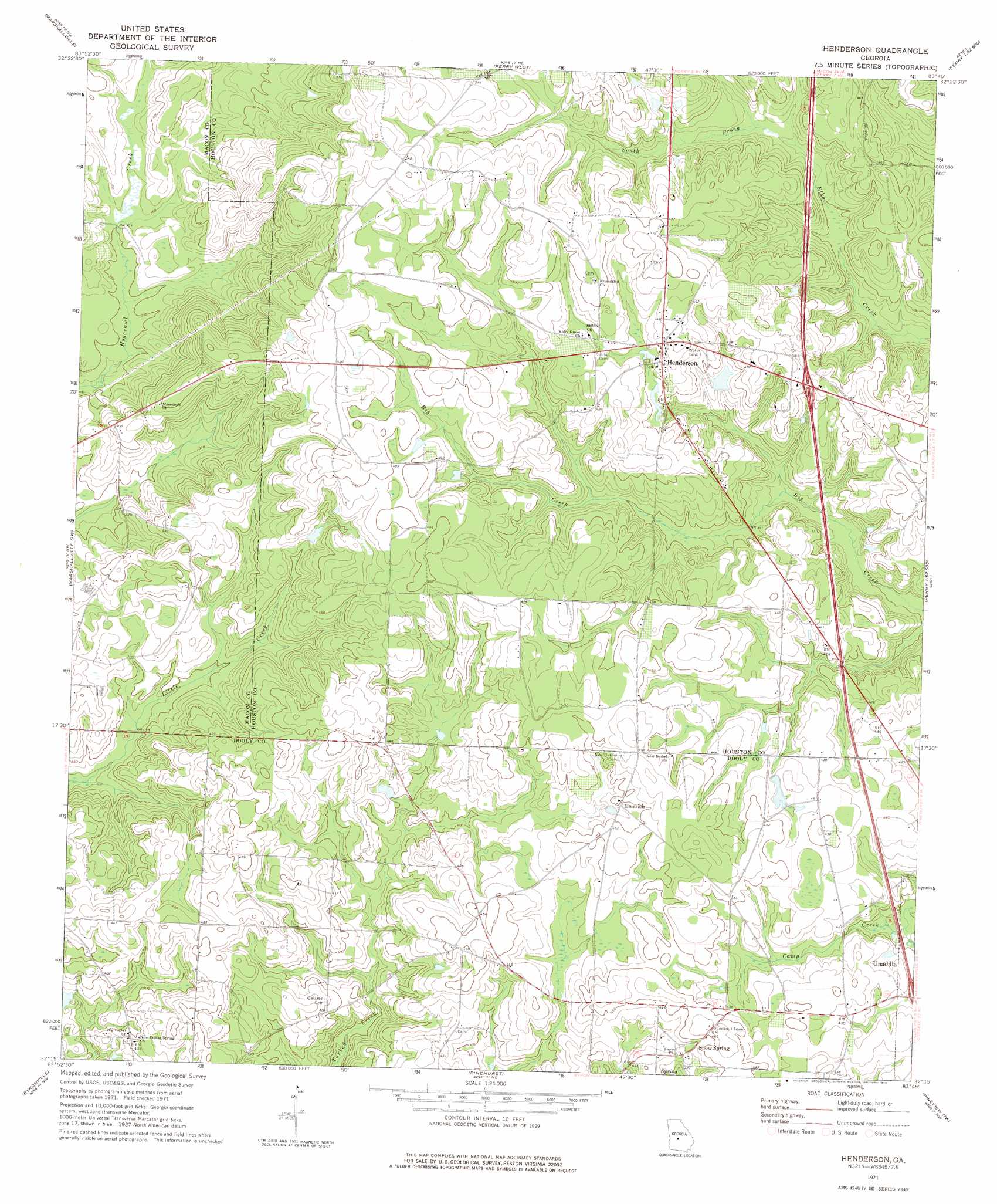
Henderson Topo Map Georgia
To zoom in, hover over the map of Henderson
USGS Topo Quad 32083c7 - 1:24,000 scale
| Topo Map Name: | Henderson |
| USGS Topo Quad ID: | 32083c7 |
| Print Size: | ca. 21 1/4" wide x 27" high |
| Southeast Coordinates: | 32.25° N latitude / 83.75° W longitude |
| Map Center Coordinates: | 32.3125° N latitude / 83.8125° W longitude |
| U.S. State: | GA |
| Filename: | o32083c7.jpg |
| Download Map JPG Image: | Henderson topo map 1:24,000 scale |
| Map Type: | Topographic |
| Topo Series: | 7.5´ |
| Map Scale: | 1:24,000 |
| Source of Map Images: | United States Geological Survey (USGS) |
| Alternate Map Versions: |
Henderson GA 1971, updated 1975 Download PDF Buy paper map Henderson GA 2011 Download PDF Buy paper map Henderson GA 2014 Download PDF Buy paper map |
1:24,000 Topo Quads surrounding Henderson
Reynolds |
Fort Valley West |
Fort Valley East |
Warner Robins Sw |
Warner Robins Se |
Garden Valley |
Marshallville |
Perry West |
Perry East |
Hayneville |
Montezuma |
Marshallville Sw |
Henderson |
Unadilla |
Klondike |
Pennington |
Byromville |
Pinehurst |
Pineview Nw |
Finleyson West |
Methvins |
Drayton |
Vienna |
Pineview Sw |
Pineview West |
> Back to 32083a1 at 1:100,000 scale
> Back to 32082a1 at 1:250,000 scale
> Back to U.S. Topo Maps home
Henderson topo map: Gazetteer
Henderson: Crossings
Exit 41 elevation 138m 452′Henderson: Dams
Kersey Dam elevation 126m 413′Kersey Lake Dam elevation 152m 498′
Thompson Dam elevation 114m 374′
Henderson: Populated Places
Emerich elevation 135m 442′Henderson elevation 144m 472′
Snow Spring elevation 134m 439′
Henderson: Reservoirs
Kersey Lake elevation 152m 498′Kersey Lake elevation 126m 413′
Thompson Lake elevation 114m 374′
Henderson digital topo map on disk
Buy this Henderson topo map showing relief, roads, GPS coordinates and other geographical features, as a high-resolution digital map file on DVD:
South Carolina, Western North Carolina & Northeastern Georgia
Buy digital topo maps: South Carolina, Western North Carolina & Northeastern Georgia