Fort Valley West Topo Map Georgia
To zoom in, hover over the map of Fort Valley West
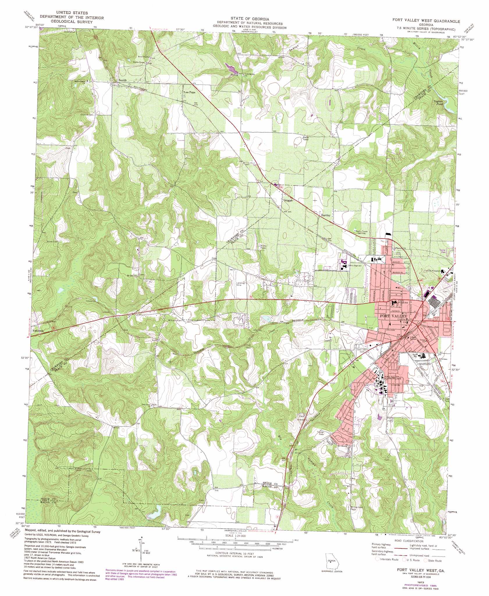
USGS Topo Quad 32083e8 - 1:24,000 scale
| Topo Map Name: | Fort Valley West |
| USGS Topo Quad ID: | 32083e8 |
| Print Size: | ca. 21 1/4" wide x 27" high |
| Southeast Coordinates: | 32.5° N latitude / 83.875° W longitude |
| Map Center Coordinates: | 32.5625° N latitude / 83.9375° W longitude |
| U.S. State: | GA |
| Filename: | o32083e8.jpg |
| Download Map JPG Image: | Fort Valley West topo map 1:24,000 scale |
| Map Type: | Topographic |
| Topo Series: | 7.5´ |
| Map Scale: | 1:24,000 |
| Source of Map Images: | United States Geological Survey (USGS) |
| Alternate Map Versions: |
Fort Valley West GA 1973, updated 1976 Download PDF Buy paper map Fort Valley West GA 1973, updated 1985 Download PDF Buy paper map Fort Valley West GA 2011 Download PDF Buy paper map Fort Valley West GA 2014 Download PDF Buy paper map |
1:24,000 Topo Quads surrounding Fort Valley West
Logtown |
Culloden |
Moran |
Lizella |
Macon West |
Fickling Mill |
Roberta |
Knoxville |
Byron |
Warner Robins Nw |
Butler East |
Reynolds |
Fort Valley West |
Fort Valley East |
Warner Robins Sw |
Ideal North |
Garden Valley |
Marshallville |
Perry West |
Perry East |
Ideal South |
Montezuma |
Marshallville Sw |
Henderson |
Unadilla |
> Back to 32083e1 at 1:100,000 scale
> Back to 32082a1 at 1:250,000 scale
> Back to U.S. Topo Maps home
Fort Valley West topo map: Gazetteer
Fort Valley West: Airports
Webb and Shepard Farm Airport elevation 169m 554′Fort Valley West: Dams
Hunnicutt Lake Dam elevation 122m 400′Pierceson Lake Dam elevation 159m 521′
Fort Valley West: Lakes
Taylors Pond elevation 121m 396′Fort Valley West: Populated Places
Alice Ingram Subdivision elevation 152m 498′Fort Valley elevation 159m 521′
Grogan elevation 168m 551′
Hartley elevation 170m 557′
Indian Oaks elevation 152m 498′
Lee Pope elevation 176m 577′
Peach Valley elevation 153m 501′
Ponderosa Lake elevation 153m 501′
Stallworth Trailer Park elevation 156m 511′
State College elevation 160m 524′
Valley Pines elevation 158m 518′
Washington Square elevation 154m 505′
Willow Lake elevation 152m 498′
Zenith elevation 178m 583′
Fort Valley West: Post Offices
Fort Valley Post Office elevation 159m 521′Fort Valley West: Reservoirs
Hunnicutt Lake elevation 122m 400′Pierceson Lake elevation 159m 521′
Fort Valley West: Streams
Indian Creek elevation 121m 396′Fort Valley West digital topo map on disk
Buy this Fort Valley West topo map showing relief, roads, GPS coordinates and other geographical features, as a high-resolution digital map file on DVD:
South Carolina, Western North Carolina & Northeastern Georgia
Buy digital topo maps: South Carolina, Western North Carolina & Northeastern Georgia