Nicklesville Topo Map Georgia
To zoom in, hover over the map of Nicklesville
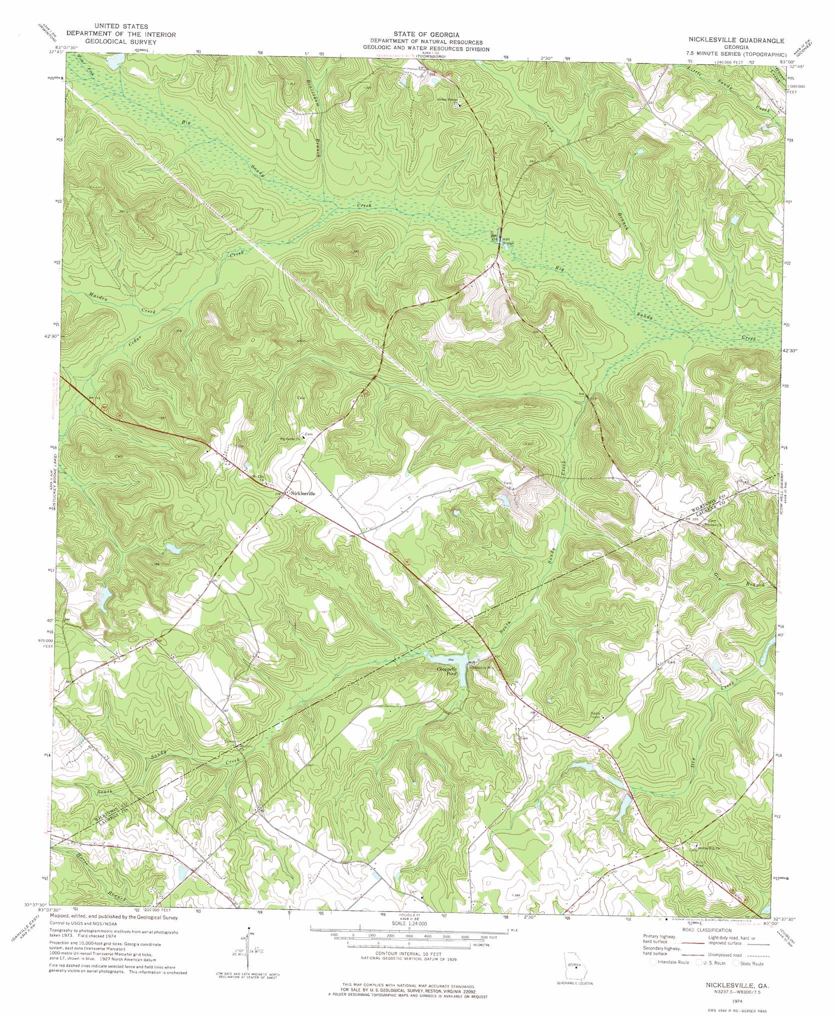
USGS Topo Quad 32083f1 - 1:24,000 scale
| Topo Map Name: | Nicklesville |
| USGS Topo Quad ID: | 32083f1 |
| Print Size: | ca. 21 1/4" wide x 27" high |
| Southeast Coordinates: | 32.625° N latitude / 83° W longitude |
| Map Center Coordinates: | 32.6875° N latitude / 83.0625° W longitude |
| U.S. State: | GA |
| Filename: | o32083f1.jpg |
| Download Map JPG Image: | Nicklesville topo map 1:24,000 scale |
| Map Type: | Topographic |
| Topo Series: | 7.5´ |
| Map Scale: | 1:24,000 |
| Source of Map Images: | United States Geological Survey (USGS) |
| Alternate Map Versions: |
Nicklesville GA 1974, updated 1976 Download PDF Buy paper map Nicklesville GA 2011 Download PDF Buy paper map Nicklesville GA 2014 Download PDF Buy paper map |
1:24,000 Topo Quads surrounding Nicklesville
Gordon |
Napier Pond |
Gumm Pond |
Tabernacle |
Sandersville |
Massey Hill |
Irwinton |
Toomsboro |
Oconee |
Irwins Crossroads |
Jeffersonville |
Stuckey Boone Lake |
Nicklesville |
Cow Hell Swamp |
Lovett |
Danville West |
Danville East |
Dudley |
Dublin |
East Dublin |
Cochran |
Chester |
Dexter |
Rentz |
Minter |
> Back to 32083e1 at 1:100,000 scale
> Back to 32082a1 at 1:250,000 scale
> Back to U.S. Topo Maps home
Nicklesville topo map: Gazetteer
Nicklesville: Bridges
Hall Bridge elevation 61m 200′Nicklesville: Dams
Chappells Pond Dam elevation 74m 242′Mills Lake Dam elevation 72m 236′
Taylors Pond Dam elevation 93m 305′
Townsend Lake Dam elevation 90m 295′
Nicklesville: Populated Places
Chappells Mill elevation 78m 255′Lindsey elevation 122m 400′
Nicklesville elevation 115m 377′
Spring Hill elevation 109m 357′
Nicklesville: Reservoirs
Chappells Pond elevation 74m 242′Mills Lake elevation 72m 236′
Taylors Pond elevation 93m 305′
Townsend Lake elevation 90m 295′
Nicklesville: Streams
Beaverdam Branch elevation 63m 206′Cedar Creek elevation 63m 206′
Horse Branch elevation 99m 324′
Long Branch elevation 59m 193′
Maiden Creek elevation 68m 223′
South Sandy Creek elevation 58m 190′
Water Fork elevation 66m 216′
Nicklesville digital topo map on disk
Buy this Nicklesville topo map showing relief, roads, GPS coordinates and other geographical features, as a high-resolution digital map file on DVD:
South Carolina, Western North Carolina & Northeastern Georgia
Buy digital topo maps: South Carolina, Western North Carolina & Northeastern Georgia