Smarr Topo Map Georgia
To zoom in, hover over the map of Smarr
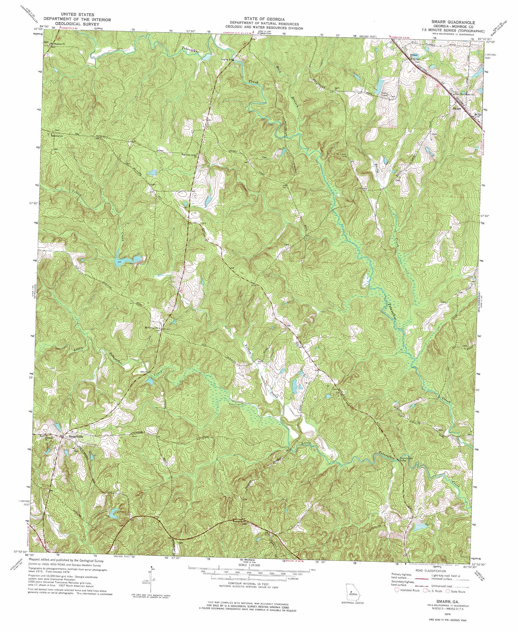
USGS Topo Quad 32083h8 - 1:24,000 scale
| Topo Map Name: | Smarr |
| USGS Topo Quad ID: | 32083h8 |
| Print Size: | ca. 21 1/4" wide x 27" high |
| Southeast Coordinates: | 32.875° N latitude / 83.875° W longitude |
| Map Center Coordinates: | 32.9375° N latitude / 83.9375° W longitude |
| U.S. State: | GA |
| Filename: | o32083h8.jpg |
| Download Map JPG Image: | Smarr topo map 1:24,000 scale |
| Map Type: | Topographic |
| Topo Series: | 7.5´ |
| Map Scale: | 1:24,000 |
| Source of Map Images: | United States Geological Survey (USGS) |
| Alternate Map Versions: |
Smarr GA 1974, updated 1976 Download PDF Buy paper map Smarr GA 2011 Download PDF Buy paper map Smarr GA 2014 Download PDF Buy paper map |
1:24,000 Topo Quads surrounding Smarr
Orchard Hill |
High Falls |
Indian Springs |
Berner |
Hillsboro |
Barnesville |
Johnstonville |
Forsyth |
East Juliette |
Dames Ferry |
Yatesville |
Strouds |
Smarr |
Bolingbroke |
Macon Nw |
Logtown |
Culloden |
Moran |
Lizella |
Macon West |
Fickling Mill |
Roberta |
Knoxville |
Byron |
Warner Robins Nw |
> Back to 32083e1 at 1:100,000 scale
> Back to 32082a1 at 1:250,000 scale
> Back to U.S. Topo Maps home
Smarr topo map: Gazetteer
Smarr: Bridges
Maynard Mill Bridge elevation 124m 406′Smarr: Dams
Abernathy Dam elevation 177m 580′Childs Lake Dam elevation 145m 475′
Hart Dam elevation 164m 538′
Maynard Lake Dam elevation 142m 465′
McCook Dam elevation 142m 465′
Smarr: Populated Places
Bamah (historical) elevation 184m 603′Russellville elevation 192m 629′
Smarr elevation 189m 620′
Spring Hill (historical) elevation 181m 593′
Smarr: Reservoirs
Abernathy Lake elevation 177m 580′Childs Lake elevation 145m 475′
Hart Lake elevation 164m 538′
Maynard Lake elevation 142m 465′
McCook Lake elevation 142m 465′
Smarr: Streams
Reedy Creek elevation 123m 403′Rock Branch elevation 133m 436′
Todd Creek elevation 145m 475′
Yellow Creek elevation 134m 439′
Smarr: Summits
Providence Hill elevation 195m 639′Smarr digital topo map on disk
Buy this Smarr topo map showing relief, roads, GPS coordinates and other geographical features, as a high-resolution digital map file on DVD:
South Carolina, Western North Carolina & Northeastern Georgia
Buy digital topo maps: South Carolina, Western North Carolina & Northeastern Georgia