Ideal North Topo Map Georgia
To zoom in, hover over the map of Ideal North
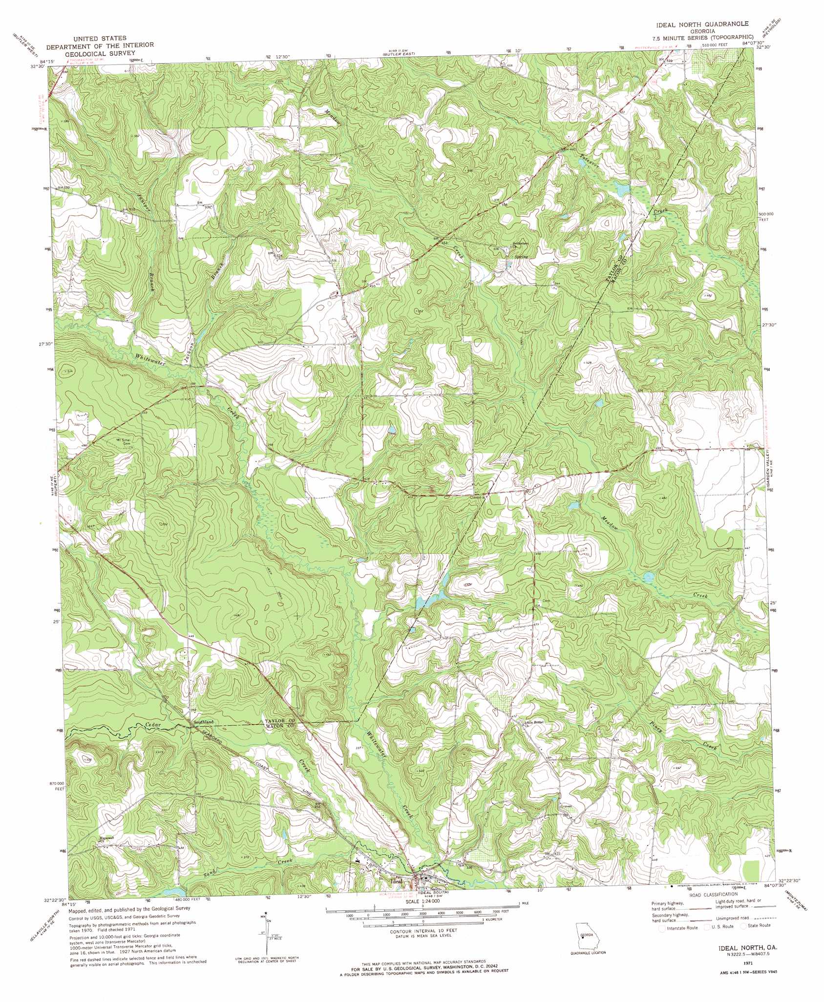
USGS Topo Quad 32084d2 - 1:24,000 scale
| Topo Map Name: | Ideal North |
| USGS Topo Quad ID: | 32084d2 |
| Print Size: | ca. 21 1/4" wide x 27" high |
| Southeast Coordinates: | 32.375° N latitude / 84.125° W longitude |
| Map Center Coordinates: | 32.4375° N latitude / 84.1875° W longitude |
| U.S. State: | GA |
| Filename: | o32084d2.jpg |
| Download Map JPG Image: | Ideal North topo map 1:24,000 scale |
| Map Type: | Topographic |
| Topo Series: | 7.5´ |
| Map Scale: | 1:24,000 |
| Source of Map Images: | United States Geological Survey (USGS) |
| Alternate Map Versions: |
Ideal North GA 1971, updated 1974 Download PDF Buy paper map Ideal North GA 2011 Download PDF Buy paper map Ideal North GA 2014 Download PDF Buy paper map |
1:24,000 Topo Quads surrounding Ideal North
Baldwinville |
Prattsburg |
Fickling Mill |
Roberta |
Knoxville |
Junction City |
Butler West |
Butler East |
Reynolds |
Fort Valley West |
Tazewell North |
Rupert |
Ideal North |
Garden Valley |
Marshallville |
Tazewell South |
Ellaville North |
Ideal South |
Montezuma |
Marshallville Sw |
Draneville |
Ellaville South |
Andersonville |
Pennington |
Byromville |
> Back to 32084a1 at 1:100,000 scale
> Back to 32084a1 at 1:250,000 scale
> Back to U.S. Topo Maps home
Ideal North topo map: Gazetteer
Ideal North: Dams
Brooks Mill Pond Dam elevation 110m 360′Ideal North: Populated Places
Southland elevation 107m 351′Ideal North: Reservoirs
Brooks Mill Pond elevation 110m 360′Ideal North: Streams
Cedar Creek elevation 101m 331′Jackson Branch elevation 108m 354′
Juniper Branch elevation 109m 357′
Sand Creek elevation 105m 344′
Ideal North digital topo map on disk
Buy this Ideal North topo map showing relief, roads, GPS coordinates and other geographical features, as a high-resolution digital map file on DVD:
Gulf Coast (LA, MS, AL, FL) & Southwestern Georgia
Buy digital topo maps: Gulf Coast (LA, MS, AL, FL) & Southwestern Georgia
 & Southwestern Georgia map DVD")