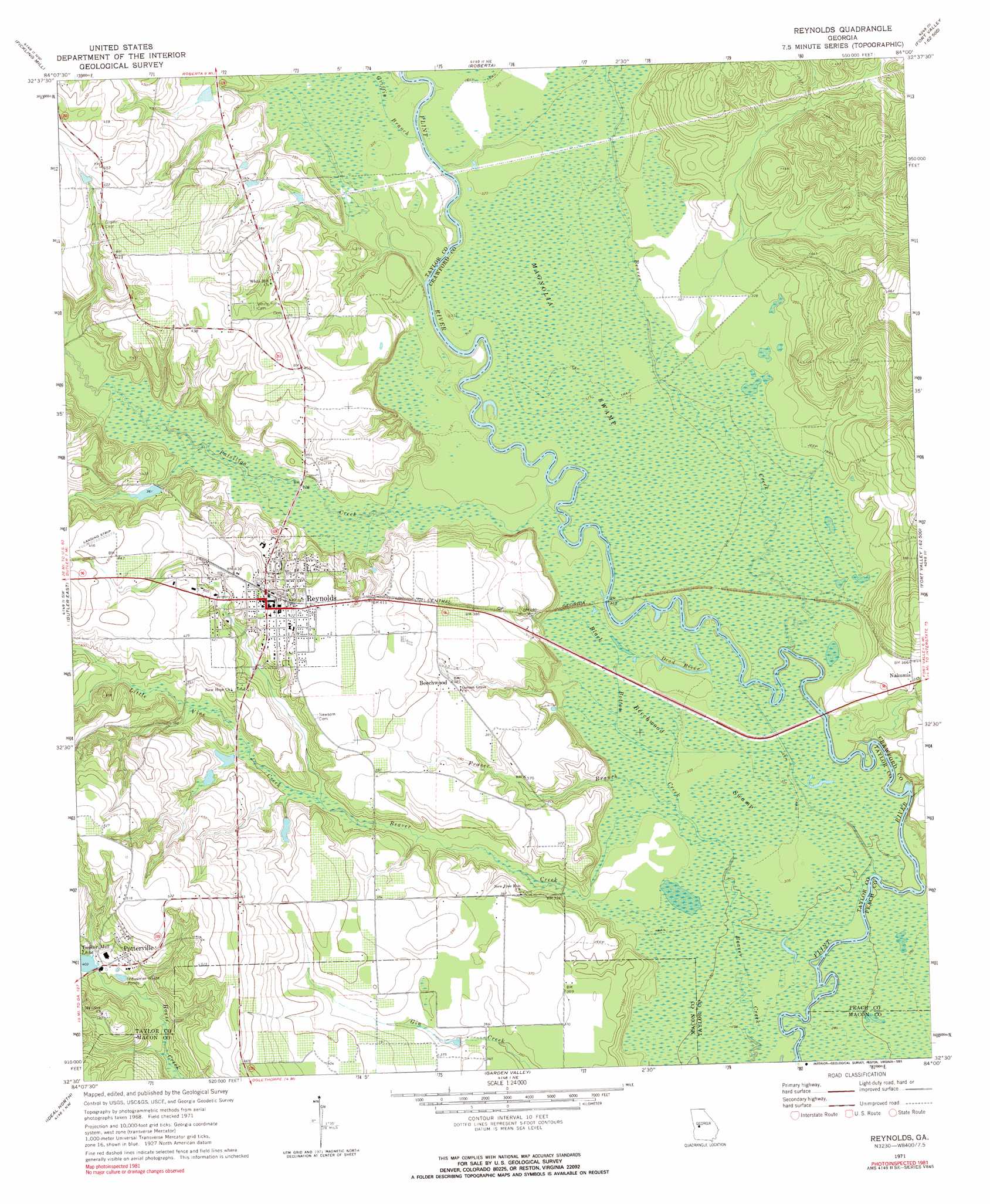
Reynolds Topo Map Georgia
To zoom in, hover over the map of Reynolds
USGS Topo Quad 32084e1 - 1:24,000 scale
| Topo Map Name: | Reynolds |
| USGS Topo Quad ID: | 32084e1 |
| Print Size: | ca. 21 1/4" wide x 27" high |
| Southeast Coordinates: | 32.5° N latitude / 84° W longitude |
| Map Center Coordinates: | 32.5625° N latitude / 84.0625° W longitude |
| U.S. State: | GA |
| Filename: | o32084e1.jpg |
| Download Map JPG Image: | Reynolds topo map 1:24,000 scale |
| Map Type: | Topographic |
| Topo Series: | 7.5´ |
| Map Scale: | 1:24,000 |
| Source of Map Images: | United States Geological Survey (USGS) |
| Alternate Map Versions: |
Reynolds GA 1971, updated 1973 Download PDF Buy paper map Reynolds GA 1971, updated 1991 Download PDF Buy paper map Reynolds GA 2011 Download PDF Buy paper map Reynolds GA 2014 Download PDF Buy paper map |
1:24,000 Topo Quads surrounding Reynolds
Lincoln Park |
Logtown |
Culloden |
Moran |
Lizella |
Prattsburg |
Fickling Mill |
Roberta |
Knoxville |
Byron |
Butler West |
Butler East |
Reynolds |
Fort Valley West |
Fort Valley East |
Rupert |
Ideal North |
Garden Valley |
Marshallville |
Perry West |
Ellaville North |
Ideal South |
Montezuma |
Marshallville Sw |
Henderson |
> Back to 32084e1 at 1:100,000 scale
> Back to 32084a1 at 1:250,000 scale
> Back to U.S. Topo Maps home
Reynolds topo map: Gazetteer
Reynolds: Dams
Brunson Lake Dam elevation 114m 374′Ricks Lake Dam elevation 112m 367′
Wainwright Lake Dam elevation 106m 347′
Whatley Lake Dam elevation 110m 360′
Reynolds: Guts
Dead River elevation 94m 308′Reynolds: Populated Places
Beechwood elevation 116m 380′Nakomis elevation 108m 354′
Potterville elevation 132m 433′
Reynolds elevation 131m 429′
Reynolds: Reservoirs
Brunson Lake elevation 114m 374′Ricks Lake elevation 112m 367′
Wainwright Lake elevation 106m 347′
Whatley Lake elevation 110m 360′
Reynolds: Streams
Beaver Creek elevation 91m 298′Black Bottom Creek elevation 92m 301′
Fraser Branch elevation 92m 301′
Griffin Branch elevation 97m 318′
Little Vine Creek elevation 104m 341′
Patsiliga Creek elevation 94m 308′
Reynolds: Swamps
Beechwood Swamp elevation 93m 305′Magnolia Swamp elevation 96m 314′
Reynolds digital topo map on disk
Buy this Reynolds topo map showing relief, roads, GPS coordinates and other geographical features, as a high-resolution digital map file on DVD:
Gulf Coast (LA, MS, AL, FL) & Southwestern Georgia
Buy digital topo maps: Gulf Coast (LA, MS, AL, FL) & Southwestern Georgia
 & Southwestern Georgia map DVD")