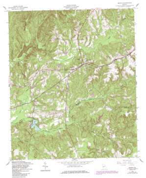
Geneva Topo Map Georgia
To zoom in, hover over the map of Geneva
USGS Topo Quad 32084e5 - 1:24,000 scale
| Topo Map Name: | Geneva |
| USGS Topo Quad ID: | 32084e5 |
| Print Size: | ca. 21 1/4" wide x 27" high |
| Southeast Coordinates: | 32.5° N latitude / 84.5° W longitude |
| Map Center Coordinates: | 32.5625° N latitude / 84.5625° W longitude |
| U.S. State: | GA |
| Filename: | o32084e5.jpg |
| Download Map JPG Image: | Geneva topo map 1:24,000 scale |
| Map Type: | Topographic |
| Topo Series: | 7.5´ |
| Map Scale: | 1:24,000 |
| Source of Map Images: | United States Geological Survey (USGS) |
| Alternate Map Versions: |
Geneva GA 1950, updated 1953 Download PDF Buy paper map Geneva GA 1955, updated 1959 Download PDF Buy paper map Geneva GA 1955, updated 1988 Download PDF Buy paper map Geneva GA 2011 Download PDF Buy paper map Geneva GA 2014 Download PDF Buy paper map |
1:24,000 Topo Quads surrounding Geneva
> Back to 32084e1 at 1:100,000 scale
> Back to 32084a1 at 1:250,000 scale
> Back to U.S. Topo Maps home
Geneva topo map: Gazetteer
Geneva: Dams
Badcock Lake Dam elevation 130m 426′Benson Lake Dam elevation 126m 413′
Hellens Lake Dam elevation 143m 469′
Juniper Lake Dam elevation 115m 377′
Klopp Lake Dam elevation 136m 446′
Meadows Lake Dam elevation 121m 396′
North Williams Lake Dam elevation 142m 465′
South Williams Lake Dam elevation 148m 485′
Geneva: Populated Places
Geneva elevation 174m 570′Juniper elevation 132m 433′
Lancaster (historical) elevation 176m 577′
Geneva: Reservoirs
Badcock Lake elevation 130m 426′Benson Lake elevation 126m 413′
Hellens Lake elevation 143m 469′
Juniper Lake elevation 115m 377′
Klopp Lake elevation 136m 446′
Meadows Lake elevation 121m 396′
North Williams Lake elevation 142m 465′
South Williams Lake elevation 148m 485′
Geneva: Streams
Black Creek elevation 118m 387′Blackman Branch elevation 125m 410′
Dry Creek elevation 129m 423′
Fort Perry Creek elevation 122m 400′
Jack Branch elevation 125m 410′
Juniper Creek elevation 114m 374′
Juniper Creek elevation 118m 387′
South Fork Upatoi Creek elevation 109m 357′
Geneva digital topo map on disk
Buy this Geneva topo map showing relief, roads, GPS coordinates and other geographical features, as a high-resolution digital map file on DVD:
Gulf Coast (LA, MS, AL, FL) & Southwestern Georgia
Buy digital topo maps: Gulf Coast (LA, MS, AL, FL) & Southwestern Georgia


