Fickling Mill Topo Map Georgia
To zoom in, hover over the map of Fickling Mill
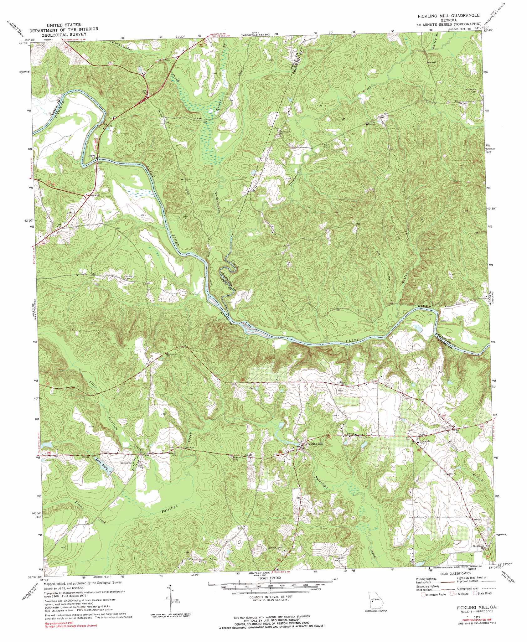
USGS Topo Quad 32084f2 - 1:24,000 scale
| Topo Map Name: | Fickling Mill |
| USGS Topo Quad ID: | 32084f2 |
| Print Size: | ca. 21 1/4" wide x 27" high |
| Southeast Coordinates: | 32.625° N latitude / 84.125° W longitude |
| Map Center Coordinates: | 32.6875° N latitude / 84.1875° W longitude |
| U.S. State: | GA |
| Filename: | o32084f2.jpg |
| Download Map JPG Image: | Fickling Mill topo map 1:24,000 scale |
| Map Type: | Topographic |
| Topo Series: | 7.5´ |
| Map Scale: | 1:24,000 |
| Source of Map Images: | United States Geological Survey (USGS) |
| Alternate Map Versions: |
Fickling Mill GA 1971, updated 1973 Download PDF Buy paper map Fickling Mill GA 1971, updated 1991 Download PDF Buy paper map Fickling Mill GA 2011 Download PDF Buy paper map Fickling Mill GA 2014 Download PDF Buy paper map |
1:24,000 Topo Quads surrounding Fickling Mill
Sunset Village |
Thomaston |
Yatesville |
Strouds |
Smarr |
Roland |
Lincoln Park |
Logtown |
Culloden |
Moran |
Baldwinville |
Prattsburg |
Fickling Mill |
Roberta |
Knoxville |
Junction City |
Butler West |
Butler East |
Reynolds |
Fort Valley West |
Tazewell North |
Rupert |
Ideal North |
Garden Valley |
Marshallville |
> Back to 32084e1 at 1:100,000 scale
> Back to 32084a1 at 1:250,000 scale
> Back to U.S. Topo Maps home
Fickling Mill topo map: Gazetteer
Fickling Mill: Crossings
Grays Ferry (historical) elevation 102m 334′Islands Ford elevation 100m 328′
Sulenojuhnene Ford elevation 100m 328′
Trices Ferry (historical) elevation 103m 337′
Fickling Mill: Dams
Lake Mary Dam elevation 138m 452′Fickling Mill: Islands
Harris Island elevation 105m 344′Reeves Island elevation 101m 331′
Fickling Mill: Populated Places
Fickling Mill elevation 116m 380′Fickling Mill: Rapids
Reeves Shoals elevation 100m 328′Fickling Mill: Reservoirs
Lake Mary elevation 138m 452′Fickling Mill: Streams
Auchumpkee Creek elevation 99m 324′Bailey Branch elevation 120m 393′
Little Patsiliga Creek elevation 125m 410′
Raines Branch elevation 114m 374′
Taylor Creek elevation 101m 331′
Timms Creek elevation 129m 423′
Ulcohatchee Creek elevation 107m 351′
Fickling Mill digital topo map on disk
Buy this Fickling Mill topo map showing relief, roads, GPS coordinates and other geographical features, as a high-resolution digital map file on DVD:
Gulf Coast (LA, MS, AL, FL) & Southwestern Georgia
Buy digital topo maps: Gulf Coast (LA, MS, AL, FL) & Southwestern Georgia
 & Southwestern Georgia map DVD")