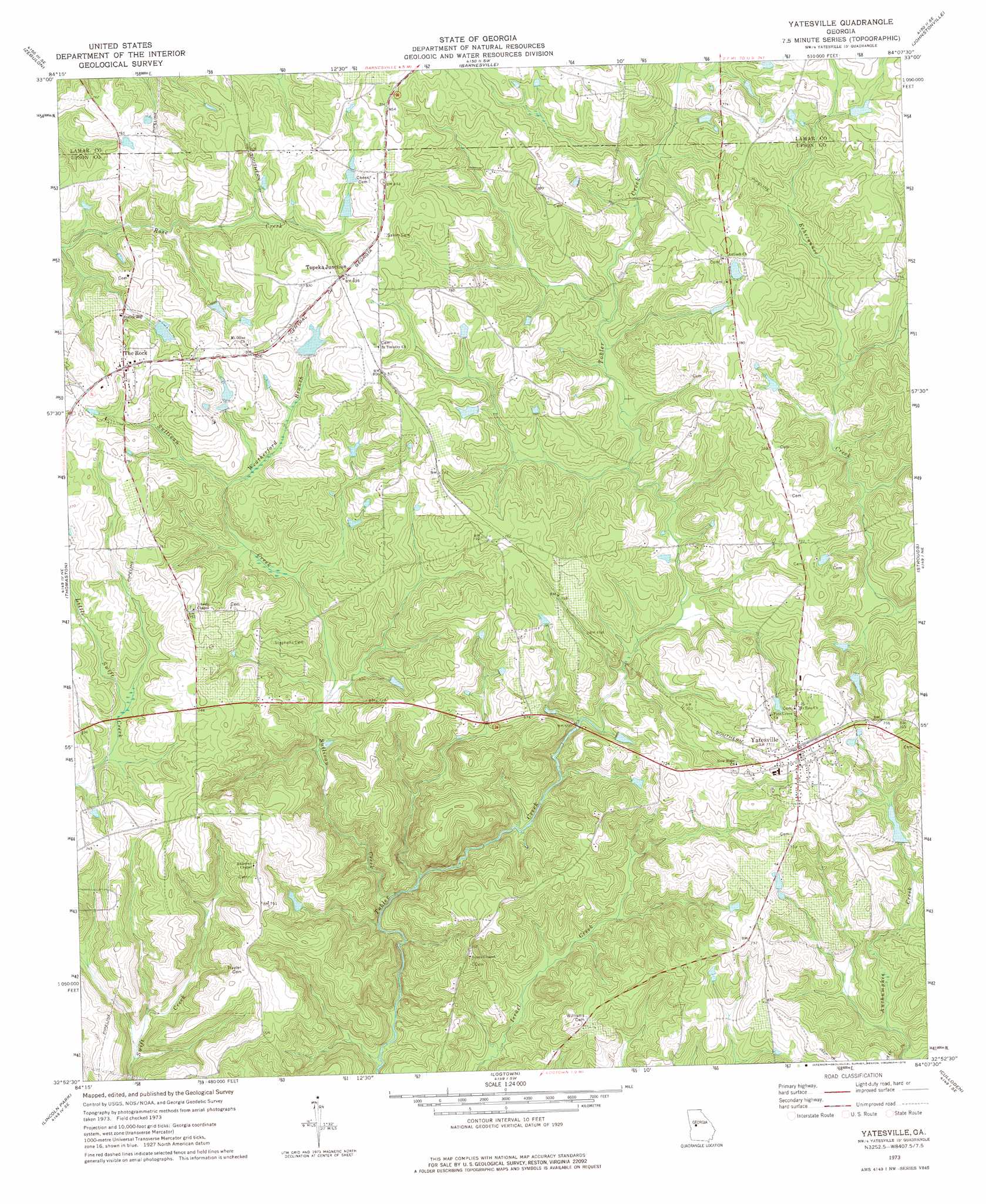
Yatesville Topo Map Georgia
To zoom in, hover over the map of Yatesville
USGS Topo Quad 32084h2 - 1:24,000 scale
| Topo Map Name: | Yatesville |
| USGS Topo Quad ID: | 32084h2 |
| Print Size: | ca. 21 1/4" wide x 27" high |
| Southeast Coordinates: | 32.875° N latitude / 84.125° W longitude |
| Map Center Coordinates: | 32.9375° N latitude / 84.1875° W longitude |
| U.S. State: | GA |
| Filename: | o32084h2.jpg |
| Download Map JPG Image: | Yatesville topo map 1:24,000 scale |
| Map Type: | Topographic |
| Topo Series: | 7.5´ |
| Map Scale: | 1:24,000 |
| Source of Map Images: | United States Geological Survey (USGS) |
| Alternate Map Versions: |
Yatesville GA 1973, updated 1976 Download PDF Buy paper map Yatesville GA 2011 Download PDF Buy paper map Yatesville GA 2014 Download PDF Buy paper map |
1:24,000 Topo Quads surrounding Yatesville
Hollonville |
Griffin South |
Orchard Hill |
High Falls |
Indian Springs |
Concord |
Zebulon |
Barnesville |
Johnstonville |
Forsyth |
Sunset Village |
Thomaston |
Yatesville |
Strouds |
Smarr |
Roland |
Lincoln Park |
Logtown |
Culloden |
Moran |
Baldwinville |
Prattsburg |
Fickling Mill |
Roberta |
Knoxville |
> Back to 32084e1 at 1:100,000 scale
> Back to 32084a1 at 1:250,000 scale
> Back to U.S. Topo Maps home
Yatesville topo map: Gazetteer
Yatesville: Airports
Thistle Field elevation 223m 731′Yatesville: Dams
Haygood Dam elevation 212m 695′McGehee Lake Dam elevation 239m 784′
Nash Dam elevation 233m 764′
Turner Dam elevation 192m 629′
White Dam elevation 229m 751′
Yatesville: Populated Places
Middlebrooks (historical) elevation 259m 849′Rest Haven elevation 236m 774′
The Rock elevation 251m 823′
Topeka Junction elevation 246m 807′
Yatesville elevation 233m 764′
Yatesville: Reservoirs
Haygood Lake elevation 212m 695′McGehee Lake elevation 239m 784′
Nash Lake elevation 233m 764′
Turner Lake elevation 192m 629′
White Lake elevation 229m 751′
Yatesville: Streams
Sullivan Creek elevation 171m 561′Weatherford Branch elevation 213m 698′
Yatesville digital topo map on disk
Buy this Yatesville topo map showing relief, roads, GPS coordinates and other geographical features, as a high-resolution digital map file on DVD:
Gulf Coast (LA, MS, AL, FL) & Southwestern Georgia
Buy digital topo maps: Gulf Coast (LA, MS, AL, FL) & Southwestern Georgia
 & Southwestern Georgia map DVD")