Comer Topo Map Alabama
To zoom in, hover over the map of Comer
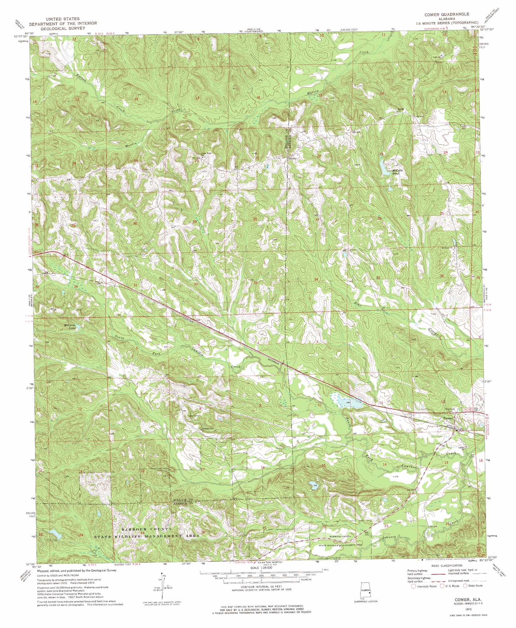
USGS Topo Quad 32085a4 - 1:24,000 scale
| Topo Map Name: | Comer |
| USGS Topo Quad ID: | 32085a4 |
| Print Size: | ca. 21 1/4" wide x 27" high |
| Southeast Coordinates: | 32° N latitude / 85.375° W longitude |
| Map Center Coordinates: | 32.0625° N latitude / 85.4375° W longitude |
| U.S. State: | AL |
| Filename: | o32085a4.jpg |
| Download Map JPG Image: | Comer topo map 1:24,000 scale |
| Map Type: | Topographic |
| Topo Series: | 7.5´ |
| Map Scale: | 1:24,000 |
| Source of Map Images: | United States Geological Survey (USGS) |
| Alternate Map Versions: |
Comer AL 1973, updated 1975 Download PDF Buy paper map Comer AL 2011 Download PDF Buy paper map Comer AL 2014 Download PDF Buy paper map |
1:24,000 Topo Quads surrounding Comer
Davisville |
Warriorstand |
Creek Stand |
Hatchechubbee |
Seale |
Union Springs |
Roba |
Hurtsboro |
Rutherford |
Pittsview |
Aberfoil |
Midway |
Comer |
Batesville |
Howe |
Perote |
Mount Andrew |
Clayton North |
White Oak |
Eufaula North |
Josie |
Louisville |
Clayton South |
Baker Hill |
Eufaula South |
> Back to 32085a1 at 1:100,000 scale
> Back to 32084a1 at 1:250,000 scale
> Back to U.S. Topo Maps home
Comer topo map: Gazetteer
Comer: Dams
Grants Duck Pond Dam elevation 98m 321′Mc Calls Lake Dam elevation 110m 360′
Wehle Lake Dam elevation 106m 347′
Comer: Parks
Barbour County State Wildlife Management Area elevation 108m 354′Comer: Populated Places
Comer elevation 87m 285′Comer: Reservoirs
Grants Duck Pond elevation 98m 321′McCains Lake elevation 119m 390′
McCalls Pond elevation 114m 374′
Wehle Lake elevation 106m 347′
Comer: Streams
Johnson Creek elevation 78m 255′Norton Creek elevation 107m 351′
Comer digital topo map on disk
Buy this Comer topo map showing relief, roads, GPS coordinates and other geographical features, as a high-resolution digital map file on DVD:
Gulf Coast (LA, MS, AL, FL) & Southwestern Georgia
Buy digital topo maps: Gulf Coast (LA, MS, AL, FL) & Southwestern Georgia
 & Southwestern Georgia map DVD")