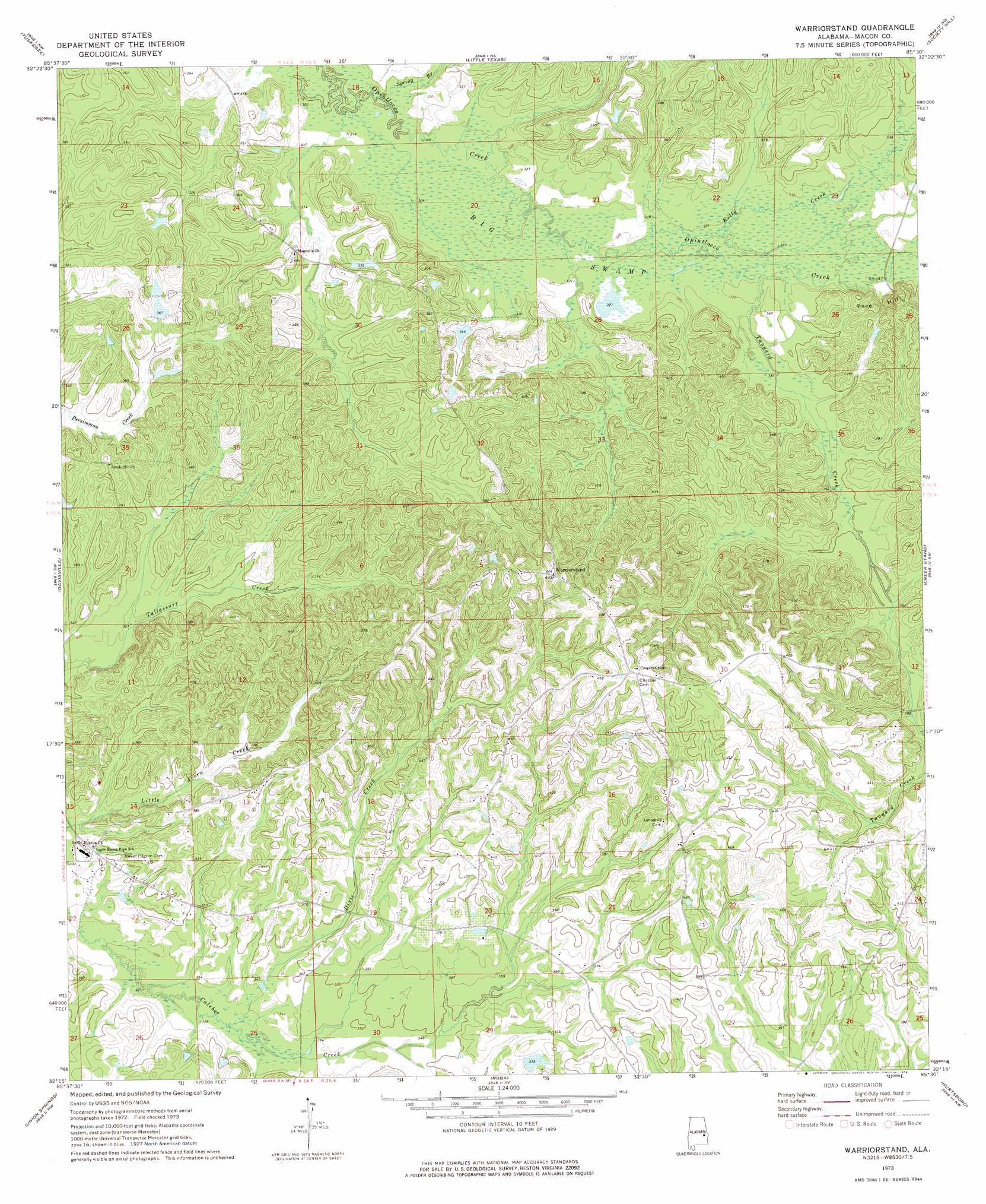
Warriorstand Topo Map Alabama
To zoom in, hover over the map of Warriorstand
USGS Topo Quad 32085c5 - 1:24,000 scale
| Topo Map Name: | Warriorstand |
| USGS Topo Quad ID: | 32085c5 |
| Print Size: | ca. 21 1/4" wide x 27" high |
| Southeast Coordinates: | 32.25° N latitude / 85.5° W longitude |
| Map Center Coordinates: | 32.3125° N latitude / 85.5625° W longitude |
| U.S. State: | AL |
| Filename: | o32085c5.jpg |
| Download Map JPG Image: | Warriorstand topo map 1:24,000 scale |
| Map Type: | Topographic |
| Topo Series: | 7.5´ |
| Map Scale: | 1:24,000 |
| Source of Map Images: | United States Geological Survey (USGS) |
| Alternate Map Versions: |
Warriorstand AL 1973, updated 1976 Download PDF Buy paper map Warriorstand AL 2011 Download PDF Buy paper map Warriorstand AL 2014 Download PDF Buy paper map |
1:24,000 Topo Quads surrounding Warriorstand
Carrville |
Notasulga |
Loachapoka |
Auburn |
Parkers Crossroads |
La Place |
Tuskegee |
Little Texas |
Society Hill |
Marvyn |
Hardaway |
Davisville |
Warriorstand |
Creek Stand |
Hatchechubbee |
Thompson |
Union Springs |
Roba |
Hurtsboro |
Rutherford |
Almeria |
Aberfoil |
Midway |
Comer |
Batesville |
> Back to 32085a1 at 1:100,000 scale
> Back to 32084a1 at 1:250,000 scale
> Back to U.S. Topo Maps home
Warriorstand topo map: Gazetteer
Warriorstand: Dams
H A Vaughan Junior Dam elevation 109m 357′Sanford Johnson Dam elevation 150m 492′
Warriorstand: Populated Places
Warriorstand elevation 149m 488′Warriorstand: Reservoirs
New Hog Wallow Lake elevation 109m 357′Sanford Johnson Lake elevation 150m 492′
Warriorstand: Streams
Dixie Creek elevation 100m 328′Kelly Creek elevation 97m 318′
Spring Branch elevation 91m 298′
Tanyard Creek elevation 99m 324′
Warriorstand: Swamps
Big Swamp elevation 100m 328′Warriorstand digital topo map on disk
Buy this Warriorstand topo map showing relief, roads, GPS coordinates and other geographical features, as a high-resolution digital map file on DVD:
Gulf Coast (LA, MS, AL, FL) & Southwestern Georgia
Buy digital topo maps: Gulf Coast (LA, MS, AL, FL) & Southwestern Georgia
 & Southwestern Georgia map DVD")