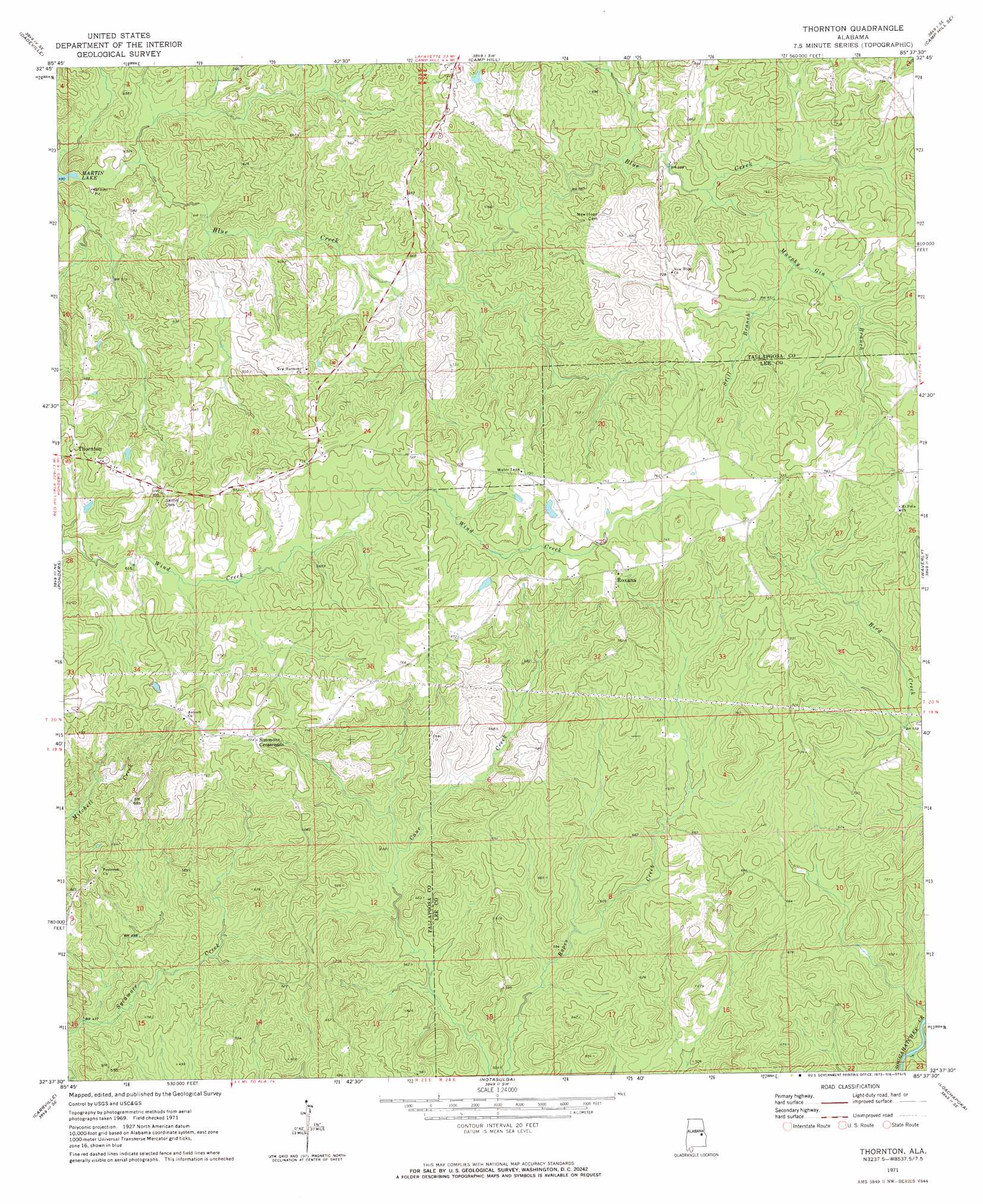
Thornton Topo Map Alabama
To zoom in, hover over the map of Thornton
USGS Topo Quad 32085f6 - 1:24,000 scale
| Topo Map Name: | Thornton |
| USGS Topo Quad ID: | 32085f6 |
| Print Size: | ca. 21 1/4" wide x 27" high |
| Southeast Coordinates: | 32.625° N latitude / 85.625° W longitude |
| Map Center Coordinates: | 32.6875° N latitude / 85.6875° W longitude |
| U.S. State: | AL |
| Filename: | o32085f6.jpg |
| Download Map JPG Image: | Thornton topo map 1:24,000 scale |
| Map Type: | Topographic |
| Topo Series: | 7.5´ |
| Map Scale: | 1:24,000 |
| Source of Map Images: | United States Geological Survey (USGS) |
| Alternate Map Versions: |
Thornton AL 1971, updated 1973 Download PDF Buy paper map Thornton AL 2011 Download PDF Buy paper map Thornton AL 2014 Download PDF Buy paper map |
1:24,000 Topo Quads surrounding Thornton
Alexander City |
Jacksons Gap |
Buttston |
Dudleyville |
Lafayette |
Our Town |
Dadeville |
Camp Hill |
Camp Hill Se |
Moorefield |
Red Hill |
Ponders |
Thornton |
Waverly |
Opelika West |
Tallassee |
Carrville |
Notasulga |
Loachapoka |
Auburn |
Shorter |
La Place |
Tuskegee |
Little Texas |
Society Hill |
> Back to 32085e1 at 1:100,000 scale
> Back to 32084a1 at 1:250,000 scale
> Back to U.S. Topo Maps home
Thornton topo map: Gazetteer
Thornton: Populated Places
Church Hill (historical) elevation 182m 597′Roxana elevation 225m 738′
Simmons Crossroads elevation 221m 725′
Smith Crossroads (historical) elevation 213m 698′
Thornton elevation 206m 675′
Thornton: Streams
Murphy Gin Branch elevation 178m 583′North Branch Blue Creek elevation 178m 583′
Still Branch elevation 194m 636′
Thornton digital topo map on disk
Buy this Thornton topo map showing relief, roads, GPS coordinates and other geographical features, as a high-resolution digital map file on DVD:
Gulf Coast (LA, MS, AL, FL) & Southwestern Georgia
Buy digital topo maps: Gulf Coast (LA, MS, AL, FL) & Southwestern Georgia
 & Southwestern Georgia map DVD")