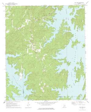
Our Town Topo Map Alabama
To zoom in, hover over the map of Our Town
USGS Topo Quad 32085g8 - 1:24,000 scale
| Topo Map Name: | Our Town |
| USGS Topo Quad ID: | 32085g8 |
| Print Size: | ca. 21 1/4" wide x 27" high |
| Southeast Coordinates: | 32.75° N latitude / 85.875° W longitude |
| Map Center Coordinates: | 32.8125° N latitude / 85.9375° W longitude |
| U.S. State: | AL |
| Filename: | o32085g8.jpg |
| Download Map JPG Image: | Our Town topo map 1:24,000 scale |
| Map Type: | Topographic |
| Topo Series: | 7.5´ |
| Map Scale: | 1:24,000 |
| Source of Map Images: | United States Geological Survey (USGS) |
| Alternate Map Versions: |
Our Town AL 1971, updated 1973 Download PDF Buy paper map Our Town AL 1971, updated 1977 Download PDF Buy paper map Our Town AL 2011 Download PDF Buy paper map Our Town AL 2014 Download PDF Buy paper map |
1:24,000 Topo Quads surrounding Our Town
> Back to 32085e1 at 1:100,000 scale
> Back to 32084a1 at 1:250,000 scale
> Back to U.S. Topo Maps home
Our Town topo map: Gazetteer
Our Town: Bridges
Robert Alston Russell Bridge elevation 149m 488′Our Town: Crossings
Robinson Ferry (historical) elevation 149m 488′Walker Ferry (historical) elevation 149m 488′
Our Town: Islands
Woods Island elevation 164m 538′Youngs Island elevation 158m 518′
Our Town: Parks
Wind Creek State Park elevation 188m 616′Our Town: Populated Places
Alkehatchee (historical) elevation 149m 488′Benson (historical) elevation 154m 505′
Bulgers elevation 176m 577′
Dyke (historical) elevation 180m 590′
Island Home (historical) elevation 159m 521′
Mount Zion elevation 194m 636′
Our Town elevation 201m 659′
Rover (historical) elevation 201m 659′
Russell Ferry Estates elevation 165m 541′
Wind Creek Farms elevation 159m 521′
Our Town: Streams
Elkahatchee Creek elevation 149m 488′Wind Creek elevation 149m 488′
Our Town digital topo map on disk
Buy this Our Town topo map showing relief, roads, GPS coordinates and other geographical features, as a high-resolution digital map file on DVD:
Gulf Coast (LA, MS, AL, FL) & Southwestern Georgia
Buy digital topo maps: Gulf Coast (LA, MS, AL, FL) & Southwestern Georgia


