Plantersville Topo Map Alabama
To zoom in, hover over the map of Plantersville
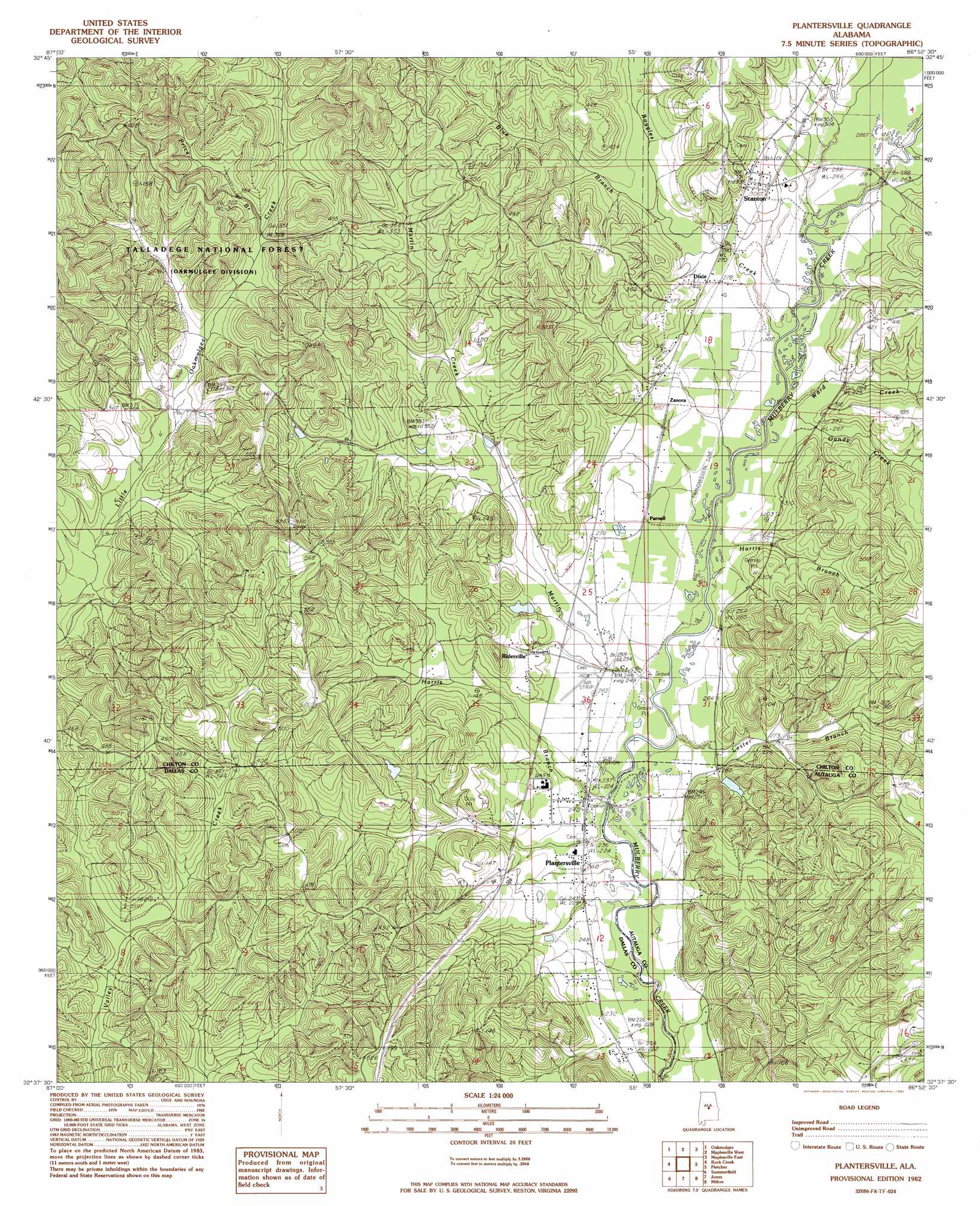
USGS Topo Quad 32086f8 - 1:24,000 scale
| Topo Map Name: | Plantersville |
| USGS Topo Quad ID: | 32086f8 |
| Print Size: | ca. 21 1/4" wide x 27" high |
| Southeast Coordinates: | 32.625° N latitude / 86.875° W longitude |
| Map Center Coordinates: | 32.6875° N latitude / 86.9375° W longitude |
| U.S. State: | AL |
| Filename: | o32086f8.jpg |
| Download Map JPG Image: | Plantersville topo map 1:24,000 scale |
| Map Type: | Topographic |
| Topo Series: | 7.5´ |
| Map Scale: | 1:24,000 |
| Source of Map Images: | United States Geological Survey (USGS) |
| Alternate Map Versions: |
Plantersville AL 1982, updated 1982 Download PDF Buy paper map Plantersville AL 2002, updated 2003 Download PDF Buy paper map Plantersville AL 2011 Download PDF Buy paper map Plantersville AL 2014 Download PDF Buy paper map |
| FStopo: | US Forest Service topo Plantersville is available: Download FStopo PDF Download FStopo TIF |
1:24,000 Topo Quads surrounding Plantersville
Centreville West |
Centreville East |
Randolph |
Jemison West |
Jemison East |
Harrisburg |
Oakmulgee |
Maplesville West |
Maplesville East |
Clanton West |
Sprott |
Buck Creek |
Plantersville |
Pletcher |
Billingsley |
Suttle |
Summerfield |
Jones |
Milton |
Vida |
Marion Junction |
Selma |
Burnsville |
Durant Bend |
Autaugaville |
> Back to 32086e1 at 1:100,000 scale
> Back to 32086a1 at 1:250,000 scale
> Back to U.S. Topo Maps home
Plantersville topo map: Gazetteer
Plantersville: Bridges
Corley Jones Bridge elevation 66m 216′Plantersville: Dams
Pickering Lake Dam elevation 97m 318′Plantersville: Parks
Martin Field elevation 93m 305′Plantersville: Populated Places
Dixie elevation 87m 285′Parnell elevation 81m 265′
Plantersville elevation 75m 246′
Riderville elevation 93m 305′
Stanton elevation 102m 334′
Plantersville: Reservoirs
Pickering Lake elevation 97m 318′Plantersville: Streams
Blue Branch elevation 93m 305′Boggles Creek elevation 78m 255′
Gandy Creek elevation 73m 239′
Harris Branch elevation 74m 242′
Harris Branch elevation 66m 216′
Lester Branch elevation 67m 219′
Martin Creek elevation 71m 232′
Price Branch elevation 101m 331′
Ward Creek elevation 78m 255′
Plantersville digital topo map on disk
Buy this Plantersville topo map showing relief, roads, GPS coordinates and other geographical features, as a high-resolution digital map file on DVD:
Gulf Coast (LA, MS, AL, FL) & Southwestern Georgia
Buy digital topo maps: Gulf Coast (LA, MS, AL, FL) & Southwestern Georgia
 & Southwestern Georgia map DVD")