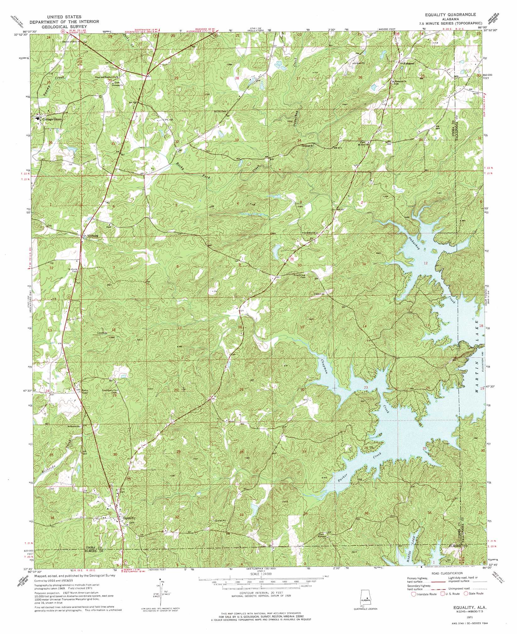
Equality Topo Map Alabama
To zoom in, hover over the map of Equality
USGS Topo Quad 32086g1 - 1:24,000 scale
| Topo Map Name: | Equality |
| USGS Topo Quad ID: | 32086g1 |
| Print Size: | ca. 21 1/4" wide x 27" high |
| Southeast Coordinates: | 32.75° N latitude / 86° W longitude |
| Map Center Coordinates: | 32.8125° N latitude / 86.0625° W longitude |
| U.S. State: | AL |
| Filename: | o32086g1.jpg |
| Download Map JPG Image: | Equality topo map 1:24,000 scale |
| Map Type: | Topographic |
| Topo Series: | 7.5´ |
| Map Scale: | 1:24,000 |
| Source of Map Images: | United States Geological Survey (USGS) |
| Alternate Map Versions: |
Equality AL 1971, updated 1973 Download PDF Buy paper map Equality AL 1971, updated 1977 Download PDF Buy paper map Equality AL 2011 Download PDF Buy paper map Equality AL 2014 Download PDF Buy paper map |
1:24,000 Topo Quads surrounding Equality
Weogufka |
Hollins |
Goodwater |
Hackneyville |
New Site |
Flag Mountain |
Rockford |
Kellyton |
Alexander City |
Jacksons Gap |
Richville |
Rockford Sw |
Equality |
Our Town |
Dadeville |
Holtville |
Dexter |
Eclectic |
Red Hill |
Ponders |
Elmore |
Wetumpka |
Claud |
Tallassee |
Carrville |
> Back to 32086e1 at 1:100,000 scale
> Back to 32086a1 at 1:250,000 scale
> Back to U.S. Topo Maps home
Equality topo map: Gazetteer
Equality: Bridges
Oakachoy Covered Bridge elevation 199m 652′Equality: Dams
Ewell C Forbes Dam elevation 179m 587′J M Granger Dam elevation 174m 570′
Equality: Populated Places
Cottage Grove elevation 219m 718′Equality elevation 224m 734′
Fishpond elevation 228m 748′
Nixburg elevation 221m 725′
Equality: Post Offices
Equality Post Office elevation 225m 738′Equality: Reservoirs
Newberrys Pond elevation 195m 639′Parrish Pond elevation 201m 659′
Equality: Streams
Chapman Creek elevation 152m 498′Oakachoy Creek elevation 149m 488′
Parker Creek elevation 149m 488′
Rocky Ford Creek elevation 161m 528′
Equality digital topo map on disk
Buy this Equality topo map showing relief, roads, GPS coordinates and other geographical features, as a high-resolution digital map file on DVD:
Gulf Coast (LA, MS, AL, FL) & Southwestern Georgia
Buy digital topo maps: Gulf Coast (LA, MS, AL, FL) & Southwestern Georgia
 & Southwestern Georgia map DVD")