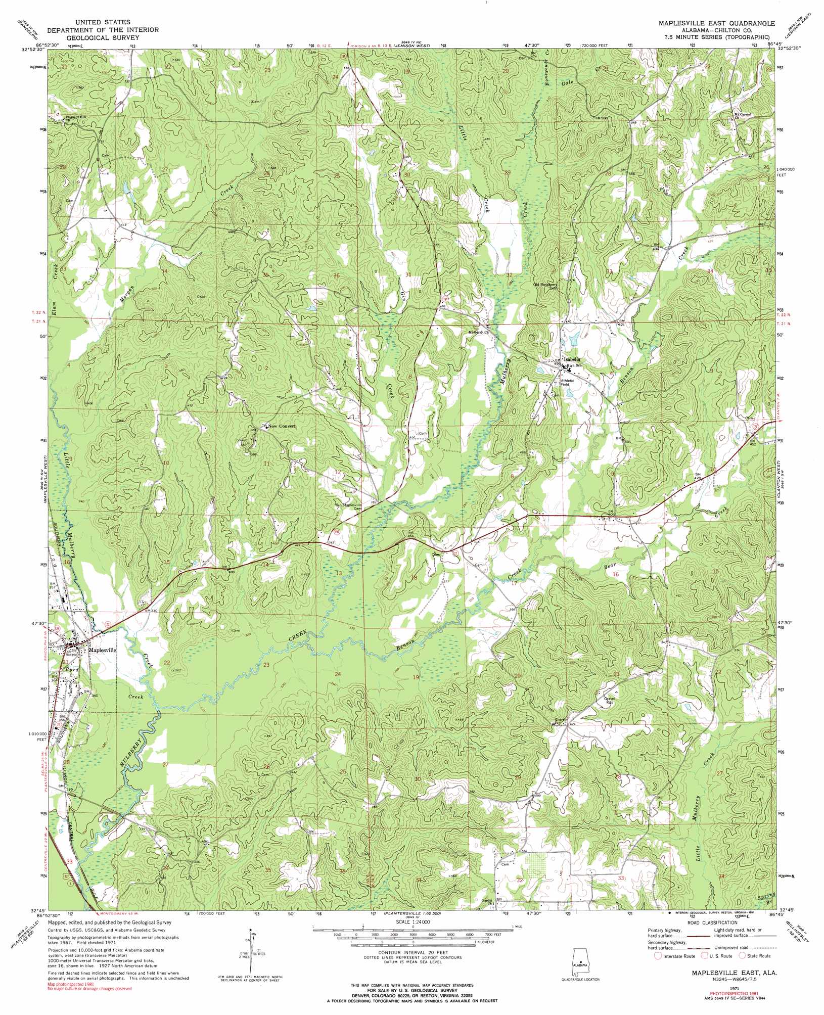
Maplesville East Topo Map Alabama
To zoom in, hover over the map of Maplesville East
USGS Topo Quad 32086g7 - 1:24,000 scale
| Topo Map Name: | Maplesville East |
| USGS Topo Quad ID: | 32086g7 |
| Print Size: | ca. 21 1/4" wide x 27" high |
| Southeast Coordinates: | 32.75° N latitude / 86.75° W longitude |
| Map Center Coordinates: | 32.8125° N latitude / 86.8125° W longitude |
| U.S. State: | AL |
| Filename: | o32086g7.jpg |
| Download Map JPG Image: | Maplesville East topo map 1:24,000 scale |
| Map Type: | Topographic |
| Topo Series: | 7.5´ |
| Map Scale: | 1:24,000 |
| Source of Map Images: | United States Geological Survey (USGS) |
| Alternate Map Versions: |
Maplesville East AL 1971, updated 1974 Download PDF Buy paper map Maplesville East AL 1971, updated 1991 Download PDF Buy paper map Maplesville East AL 2011 Download PDF Buy paper map Maplesville East AL 2014 Download PDF Buy paper map |
1:24,000 Topo Quads surrounding Maplesville East
West Blocton East |
Aldrich |
Montevallo |
Ozan |
Shelby |
Centreville East |
Randolph |
Jemison West |
Jemison East |
Lay Dam |
Oakmulgee |
Maplesville West |
Maplesville East |
Clanton West |
Clanton East |
Buck Creek |
Plantersville |
Pletcher |
Billingsley |
White City |
Summerfield |
Jones |
Milton |
Vida |
Old Kingston |
> Back to 32086e1 at 1:100,000 scale
> Back to 32086a1 at 1:250,000 scale
> Back to U.S. Topo Maps home
Maplesville East topo map: Gazetteer
Maplesville East: Dams
Calfee Lake Dam elevation 140m 459′Maplesville East: Mines
Judge Terrys Goldmine (historical) elevation 185m 606′Maplesville East: Populated Places
Isabella elevation 139m 456′Maplesville elevation 107m 351′
New Convert elevation 147m 482′
Maplesville East: Post Offices
Highland Post Office (historical) elevation 143m 469′Maplesville Post Office elevation 106m 347′
Shelbyville Post Office (historical) elevation 125m 410′
Maplesville East: Reservoirs
Calfee Lake elevation 140m 459′Maplesville East: Streams
Bear Creek elevation 110m 360′Benson Creek elevation 98m 321′
Byrd Creek elevation 93m 305′
Elam Creek elevation 105m 344′
Gale Creek elevation 125m 410′
Gin Creek elevation 103m 337′
Honeycutt Creek elevation 125m 410′
Little Creek elevation 113m 370′
Little Mulberry Creek elevation 92m 301′
Morgan Creek elevation 105m 344′
Sandy Branch elevation 127m 416′
Maplesville East digital topo map on disk
Buy this Maplesville East topo map showing relief, roads, GPS coordinates and other geographical features, as a high-resolution digital map file on DVD:
Gulf Coast (LA, MS, AL, FL) & Southwestern Georgia
Buy digital topo maps: Gulf Coast (LA, MS, AL, FL) & Southwestern Georgia
 & Southwestern Georgia map DVD")