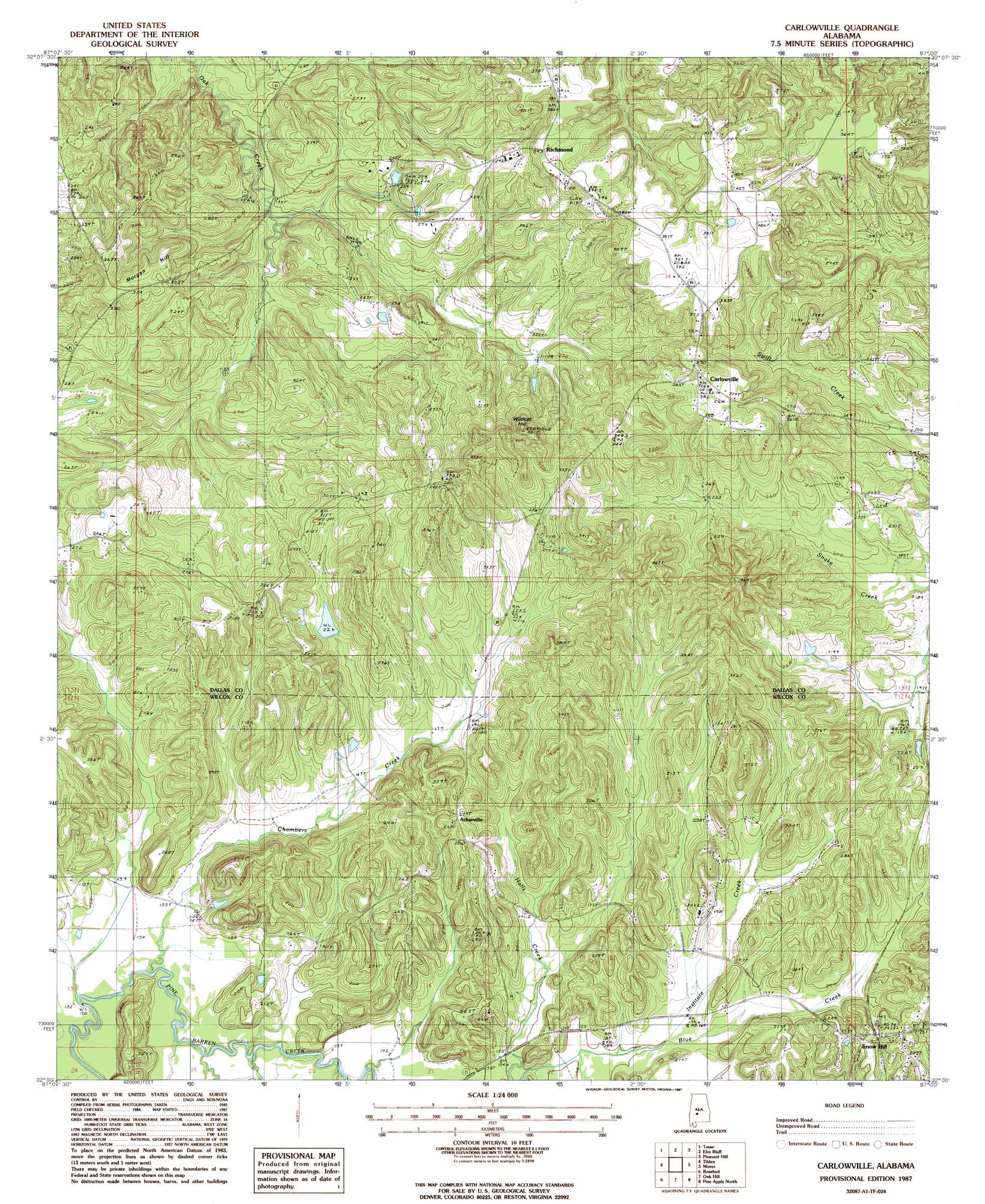
Carlowville Topo Map Alabama
To zoom in, hover over the map of Carlowville
USGS Topo Quad 32087a1 - 1:24,000 scale
| Topo Map Name: | Carlowville |
| USGS Topo Quad ID: | 32087a1 |
| Print Size: | ca. 21 1/4" wide x 27" high |
| Southeast Coordinates: | 32° N latitude / 87° W longitude |
| Map Center Coordinates: | 32.0625° N latitude / 87.0625° W longitude |
| U.S. State: | AL |
| Filename: | o32087a1.jpg |
| Download Map JPG Image: | Carlowville topo map 1:24,000 scale |
| Map Type: | Topographic |
| Topo Series: | 7.5´ |
| Map Scale: | 1:24,000 |
| Source of Map Images: | United States Geological Survey (USGS) |
| Alternate Map Versions: |
Carlowville AL 1987, updated 1987 Download PDF Buy paper map Carlowville AL 2011 Download PDF Buy paper map Carlowville AL 2014 Download PDF Buy paper map |
1:24,000 Topo Quads surrounding Carlowville
Safford |
Orrville |
Blackwell Bend |
Sardis |
Benton |
Crumptonia |
Tasso |
Elm Bluff |
Pleasant Hill |
Collirene |
Camden North |
Tilden |
Carlowville |
Minter |
Braggs |
Camden South |
Rosebud |
Oak Hill |
Pine Apple North |
Ridgeville |
Vredenburgh |
Nadawah |
Mcwilliams |
Pine Apple South |
Forest Home |
> Back to 32087a1 at 1:100,000 scale
> Back to 32086a1 at 1:250,000 scale
> Back to U.S. Topo Maps home
Carlowville topo map: Gazetteer
Carlowville: Airports
Boy's Ranch Airport elevation 90m 295′Carlowville: Parks
Carlowville Historic District elevation 110m 360′Carlowville: Populated Places
Ackerville elevation 87m 285′Carlowville elevation 110m 360′
Richmond elevation 119m 390′
Snow Hill elevation 69m 226′
Carlowville: Streams
Chambers Creek elevation 38m 124′Institute Creek elevation 46m 150′
Prairie Creek elevation 40m 131′
Carlowville: Summits
Morgan Hill elevation 95m 311′Wildcat Hill elevation 143m 469′
Carlowville digital topo map on disk
Buy this Carlowville topo map showing relief, roads, GPS coordinates and other geographical features, as a high-resolution digital map file on DVD:
Gulf Coast (LA, MS, AL, FL) & Southwestern Georgia
Buy digital topo maps: Gulf Coast (LA, MS, AL, FL) & Southwestern Georgia
 & Southwestern Georgia map DVD")