Catherine Topo Map Alabama
To zoom in, hover over the map of Catherine
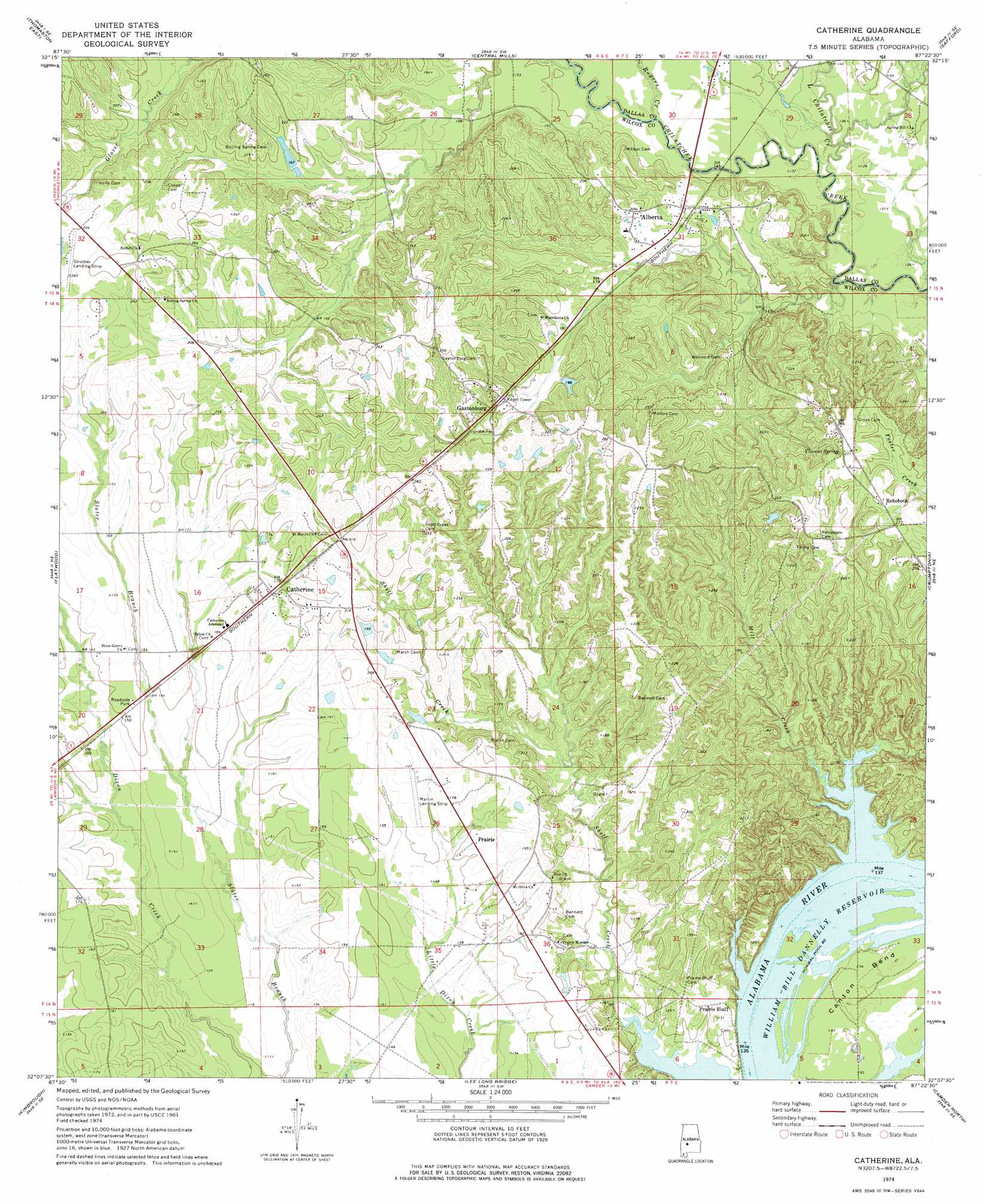
USGS Topo Quad 32087b4 - 1:24,000 scale
| Topo Map Name: | Catherine |
| USGS Topo Quad ID: | 32087b4 |
| Print Size: | ca. 21 1/4" wide x 27" high |
| Southeast Coordinates: | 32.125° N latitude / 87.375° W longitude |
| Map Center Coordinates: | 32.1875° N latitude / 87.4375° W longitude |
| U.S. State: | AL |
| Filename: | o32087b4.jpg |
| Download Map JPG Image: | Catherine topo map 1:24,000 scale |
| Map Type: | Topographic |
| Topo Series: | 7.5´ |
| Map Scale: | 1:24,000 |
| Source of Map Images: | United States Geological Survey (USGS) |
| Alternate Map Versions: |
Catherine AL 1974, updated 1977 Download PDF Buy paper map Catherine AL 2011 Download PDF Buy paper map Catherine AL 2014 Download PDF Buy paper map |
1:24,000 Topo Quads surrounding Catherine
Gallion |
Uniontown West |
Uniontown East |
Browns |
Marion Junction |
Thomaston West |
Thomaston East |
Central Mills |
Safford |
Orrville |
Magnolia |
Flatwood |
Catherine |
Crumptonia |
Tasso |
Surginer |
Kimbrough |
Lee Long Bridge |
Camden North |
Tilden |
Thomasville |
Pine Hill |
Coy |
Camden South |
Rosebud |
> Back to 32087a1 at 1:100,000 scale
> Back to 32086a1 at 1:250,000 scale
> Back to U.S. Topo Maps home
Catherine topo map: Gazetteer
Catherine: Airports
Martin Field elevation 48m 157′Catherine: Bars
Hobbs Bar (historical) elevation 24m 78′Nixon and McGuire Bar (historical) elevation 24m 78′
Catherine: Dams
Joe Harrison Dam elevation 62m 203′Catherine: Populated Places
Alberta elevation 54m 177′Bethel elevation 39m 127′
Boiling Springs elevation 31m 101′
Catherine elevation 59m 193′
Donald elevation 46m 150′
Gastonburg elevation 67m 219′
Prairie elevation 49m 160′
Prairie Bluff elevation 43m 141′
Rehoboth elevation 83m 272′
Catherine: Post Offices
Alberta Post Office elevation 52m 170′Catherine Post Office elevation 59m 193′
Catherine: Reservoirs
Joe Harrison Lake elevation 62m 203′Catherine: Springs
Vincent Spring elevation 83m 272′Catherine: Streams
Little Chilatchee Creek elevation 34m 111′Mill Creek elevation 24m 78′
Rogers Creek elevation 38m 124′
Catherine digital topo map on disk
Buy this Catherine topo map showing relief, roads, GPS coordinates and other geographical features, as a high-resolution digital map file on DVD:
Gulf Coast (LA, MS, AL, FL) & Southwestern Georgia
Buy digital topo maps: Gulf Coast (LA, MS, AL, FL) & Southwestern Georgia
 & Southwestern Georgia map DVD")