Central Mills Topo Map Alabama
To zoom in, hover over the map of Central Mills
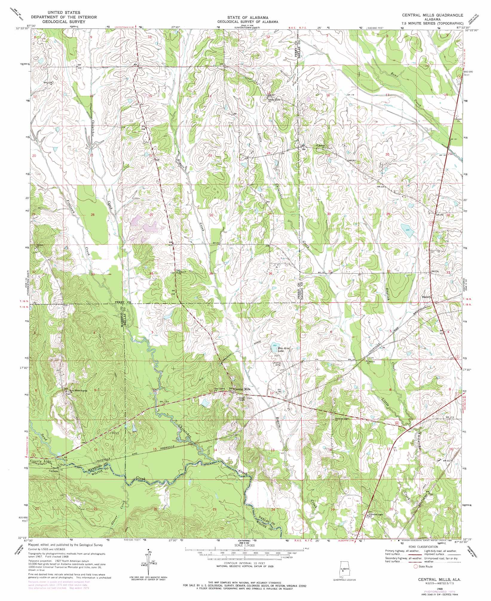
USGS Topo Quad 32087c4 - 1:24,000 scale
| Topo Map Name: | Central Mills |
| USGS Topo Quad ID: | 32087c4 |
| Print Size: | ca. 21 1/4" wide x 27" high |
| Southeast Coordinates: | 32.25° N latitude / 87.375° W longitude |
| Map Center Coordinates: | 32.3125° N latitude / 87.4375° W longitude |
| U.S. State: | AL |
| Filename: | o32087c4.jpg |
| Download Map JPG Image: | Central Mills topo map 1:24,000 scale |
| Map Type: | Topographic |
| Topo Series: | 7.5´ |
| Map Scale: | 1:24,000 |
| Source of Map Images: | United States Geological Survey (USGS) |
| Alternate Map Versions: |
Central Mills AL 1968, updated 1971 Download PDF Buy paper map Central Mills AL 1968, updated 1984 Download PDF Buy paper map Central Mills AL 2011 Download PDF Buy paper map Central Mills AL 2014 Download PDF Buy paper map |
1:24,000 Topo Quads surrounding Central Mills
Casemore |
Newbern |
Scott Station |
Marion South |
Suttle |
Gallion |
Uniontown West |
Uniontown East |
Browns |
Marion Junction |
Thomaston West |
Thomaston East |
Central Mills |
Safford |
Orrville |
Magnolia |
Flatwood |
Catherine |
Crumptonia |
Tasso |
Surginer |
Kimbrough |
Lee Long Bridge |
Camden North |
Tilden |
> Back to 32087a1 at 1:100,000 scale
> Back to 32086a1 at 1:250,000 scale
> Back to U.S. Topo Maps home
Central Mills topo map: Gazetteer
Central Mills: Areas
Black Belt elevation 66m 216′Central Mills: Dams
C Shuptrine Dam elevation 64m 209′Miller Brothers Dam Number One elevation 59m 193′
Miller Brothers Dam Number Three elevation 61m 200′
Miller Brothers Dam Number Two elevation 61m 200′
Sand Creek Dam Number One elevation 61m 200′
Triangle 6 Ranch Dam elevation 65m 213′
Central Mills: Populated Places
Blalock elevation 69m 226′Carleys elevation 53m 173′
Central Mills elevation 75m 246′
Central Mills: Reservoirs
Bon Aire Lake elevation 62m 203′Miller Brothers Lake Number One elevation 59m 193′
Miller Brothers Lake Number Three elevation 61m 200′
Miller Brothers Lake Number Two elevation 61m 200′
Sand Creek Lake Number One elevation 61m 200′
Triangle 6 Ranch Lake elevation 65m 213′
Central Mills: Streams
County Line Creek elevation 49m 160′English Creek elevation 46m 150′
Freetown Creek elevation 49m 160′
Glover Creek elevation 47m 154′
Sand Creek elevation 42m 137′
Central Mills digital topo map on disk
Buy this Central Mills topo map showing relief, roads, GPS coordinates and other geographical features, as a high-resolution digital map file on DVD:
Gulf Coast (LA, MS, AL, FL) & Southwestern Georgia
Buy digital topo maps: Gulf Coast (LA, MS, AL, FL) & Southwestern Georgia
 & Southwestern Georgia map DVD")