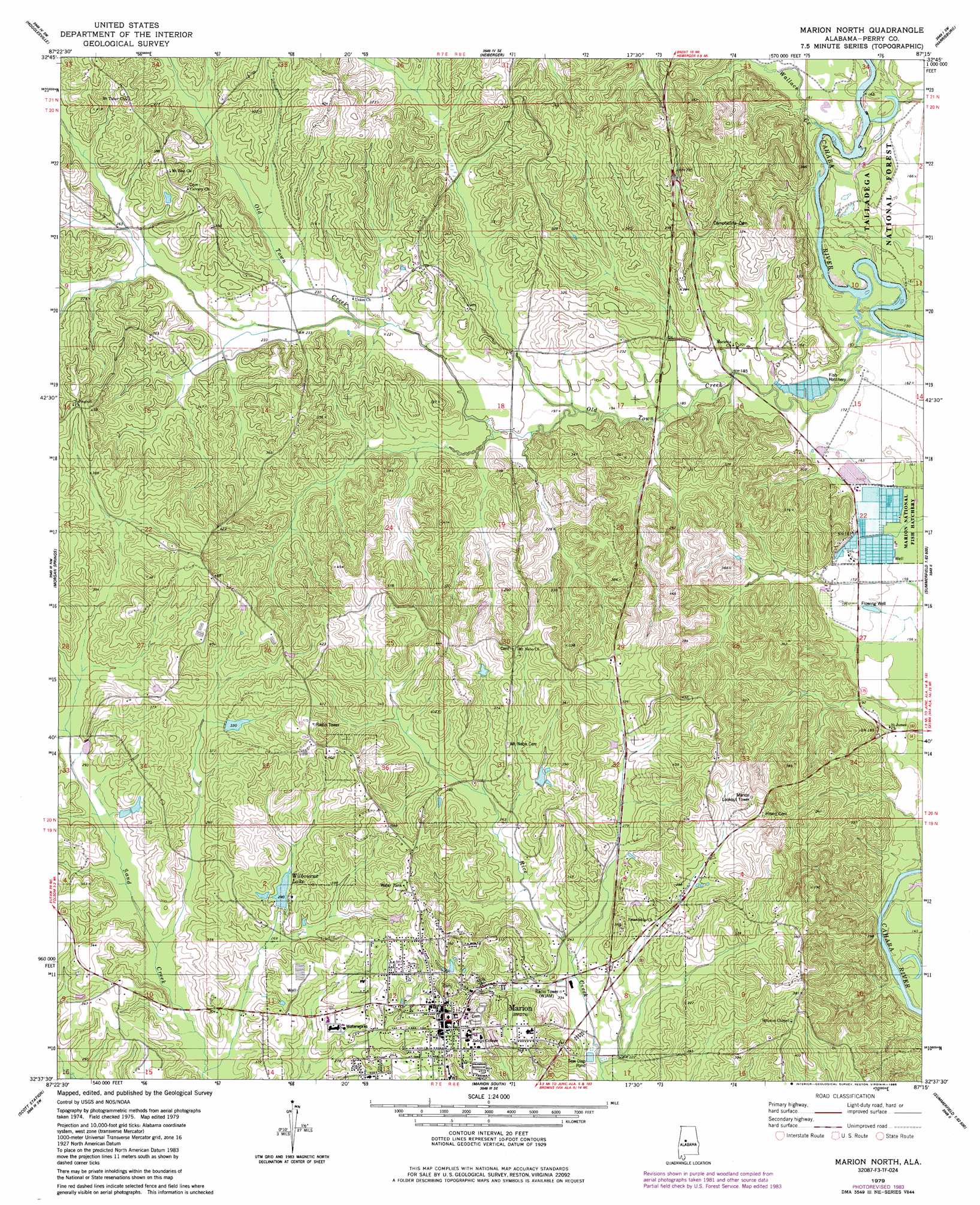
Marion North Topo Map Alabama
To zoom in, hover over the map of Marion North
USGS Topo Quad 32087f3 - 1:24,000 scale
| Topo Map Name: | Marion North |
| USGS Topo Quad ID: | 32087f3 |
| Print Size: | ca. 21 1/4" wide x 27" high |
| Southeast Coordinates: | 32.625° N latitude / 87.25° W longitude |
| Map Center Coordinates: | 32.6875° N latitude / 87.3125° W longitude |
| U.S. State: | AL |
| Filename: | o32087f3.jpg |
| Download Map JPG Image: | Marion North topo map 1:24,000 scale |
| Map Type: | Topographic |
| Topo Series: | 7.5´ |
| Map Scale: | 1:24,000 |
| Source of Map Images: | United States Geological Survey (USGS) |
| Alternate Map Versions: |
Marion North AL 1979, updated 1980 Download PDF Buy paper map Marion North AL 1979, updated 1986 Download PDF Buy paper map Marion North AL 2002, updated 2004 Download PDF Buy paper map Marion North AL 2011 Download PDF Buy paper map Marion North AL 2014 Download PDF Buy paper map |
| FStopo: | US Forest Service topo Marion North is available: Download FStopo PDF Download FStopo TIF |
1:24,000 Topo Quads surrounding Marion North
Moundville East |
Payne Lake |
Pondville |
Centreville West |
Centreville East |
Ingram |
Hogglesville |
Heiberger |
Harrisburg |
Oakmulgee |
Greensboro |
Morgan Springs |
Marion North |
Sprott |
Buck Creek |
Newbern |
Scott Station |
Marion South |
Suttle |
Summerfield |
Uniontown West |
Uniontown East |
Browns |
Marion Junction |
Selma |
> Back to 32087e1 at 1:100,000 scale
> Back to 32086a1 at 1:250,000 scale
> Back to U.S. Topo Maps home
Marion North topo map: Gazetteer
Marion North: Dams
Emily Foster Lake Dam elevation 94m 308′Marion Fish Hatchery Dam Number One elevation 48m 157′
Marion Fish Hatchery Number Two Dam elevation 48m 157′
Rice Dam elevation 119m 390′
Willie Wilbourne Dam elevation 92m 301′
Marion North: Parks
Perry Lake Recreation Area elevation 50m 164′Marion North: Populated Places
Curbville elevation 126m 413′Marion elevation 114m 374′
Marion North: Post Offices
Marion Post Office elevation 116m 380′Marion North: Reservoirs
Emily Foster Lake elevation 94m 308′Marion Fish Hatchery Number One elevation 48m 157′
Marion Fish Hatchery Number Two P elevation 48m 157′
Rice Lake elevation 119m 390′
Wilbourne Lake elevation 88m 288′
Marion North: Streams
Old Town Creek elevation 46m 150′Wallace Creek elevation 45m 147′
Marion North digital topo map on disk
Buy this Marion North topo map showing relief, roads, GPS coordinates and other geographical features, as a high-resolution digital map file on DVD:
Gulf Coast (LA, MS, AL, FL) & Southwestern Georgia
Buy digital topo maps: Gulf Coast (LA, MS, AL, FL) & Southwestern Georgia
 & Southwestern Georgia map DVD")