Morgan Springs Topo Map Alabama
To zoom in, hover over the map of Morgan Springs
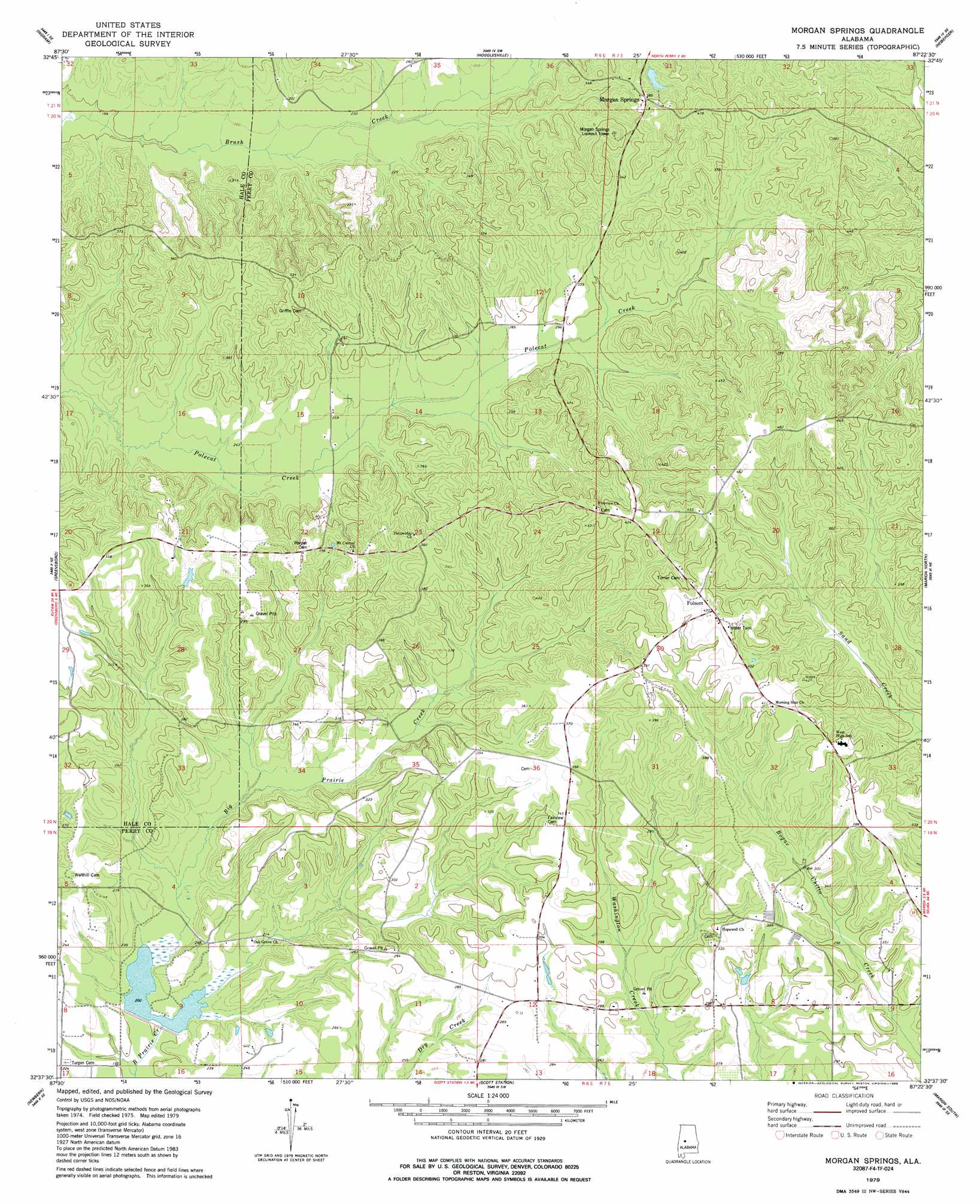
USGS Topo Quad 32087f4 - 1:24,000 scale
| Topo Map Name: | Morgan Springs |
| USGS Topo Quad ID: | 32087f4 |
| Print Size: | ca. 21 1/4" wide x 27" high |
| Southeast Coordinates: | 32.625° N latitude / 87.375° W longitude |
| Map Center Coordinates: | 32.6875° N latitude / 87.4375° W longitude |
| U.S. State: | AL |
| Filename: | o32087f4.jpg |
| Download Map JPG Image: | Morgan Springs topo map 1:24,000 scale |
| Map Type: | Topographic |
| Topo Series: | 7.5´ |
| Map Scale: | 1:24,000 |
| Source of Map Images: | United States Geological Survey (USGS) |
| Alternate Map Versions: |
Morgan Springs AL 1979, updated 1986 Download PDF Buy paper map Morgan Springs AL 2011 Download PDF Buy paper map Morgan Springs AL 2014 Download PDF Buy paper map |
1:24,000 Topo Quads surrounding Morgan Springs
Moundville West |
Moundville East |
Payne Lake |
Pondville |
Centreville West |
Sawyerville |
Ingram |
Hogglesville |
Heiberger |
Harrisburg |
Melton |
Greensboro |
Morgan Springs |
Marion North |
Sprott |
Casemore |
Newbern |
Scott Station |
Marion South |
Suttle |
Gallion |
Uniontown West |
Uniontown East |
Browns |
Marion Junction |
> Back to 32087e1 at 1:100,000 scale
> Back to 32086a1 at 1:250,000 scale
> Back to U.S. Topo Maps home
Morgan Springs topo map: Gazetteer
Morgan Springs: Dams
MacMillian Bloedell Lake Dam elevation 86m 282′Morgan Springs: Populated Places
Folsom elevation 131m 429′Morgan Springs elevation 117m 383′
Morgan Springs: Post Offices
Morgan Springs Post Office (historical) elevation 121m 396′Morgan Springs: Reservoirs
MacMillian Bloedell Lake elevation 86m 282′Watershed Structure Number Twelve elevation 60m 196′
Morgan Springs digital topo map on disk
Buy this Morgan Springs topo map showing relief, roads, GPS coordinates and other geographical features, as a high-resolution digital map file on DVD:
Gulf Coast (LA, MS, AL, FL) & Southwestern Georgia
Buy digital topo maps: Gulf Coast (LA, MS, AL, FL) & Southwestern Georgia
 & Southwestern Georgia map DVD")