Hogglesville Topo Map Alabama
To zoom in, hover over the map of Hogglesville
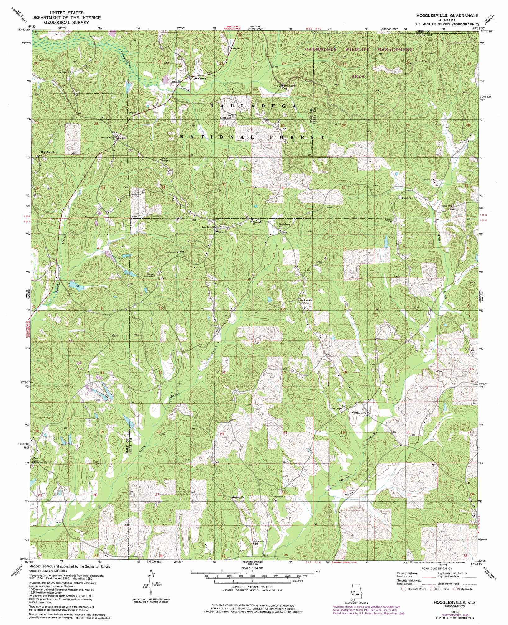
USGS Topo Quad 32087g4 - 1:24,000 scale
| Topo Map Name: | Hogglesville |
| USGS Topo Quad ID: | 32087g4 |
| Print Size: | ca. 21 1/4" wide x 27" high |
| Southeast Coordinates: | 32.75° N latitude / 87.375° W longitude |
| Map Center Coordinates: | 32.8125° N latitude / 87.4375° W longitude |
| U.S. State: | AL |
| Filename: | o32087g4.jpg |
| Download Map JPG Image: | Hogglesville topo map 1:24,000 scale |
| Map Type: | Topographic |
| Topo Series: | 7.5´ |
| Map Scale: | 1:24,000 |
| Source of Map Images: | United States Geological Survey (USGS) |
| Alternate Map Versions: |
Hogglesville AL 1980, updated 1980 Download PDF Buy paper map Hogglesville AL 1980, updated 1985 Download PDF Buy paper map Hogglesville AL 2002, updated 2003 Download PDF Buy paper map Hogglesville AL 2011 Download PDF Buy paper map Hogglesville AL 2014 Download PDF Buy paper map |
| FStopo: | US Forest Service topo Hogglesville is available: Download FStopo PDF Download FStopo TIF |
1:24,000 Topo Quads surrounding Hogglesville
Fosters |
Englewood |
Duncanville |
Pearson |
West Blocton West |
Moundville West |
Moundville East |
Payne Lake |
Pondville |
Centreville West |
Sawyerville |
Ingram |
Hogglesville |
Heiberger |
Harrisburg |
Melton |
Greensboro |
Morgan Springs |
Marion North |
Sprott |
Casemore |
Newbern |
Scott Station |
Marion South |
Suttle |
> Back to 32087e1 at 1:100,000 scale
> Back to 32086a1 at 1:250,000 scale
> Back to U.S. Topo Maps home
Hogglesville topo map: Gazetteer
Hogglesville: Dams
J B Thomas Dam elevation 89m 291′Joe Glover Dam elevation 76m 249′
Mike Wurm Dam elevation 111m 364′
Hogglesville: Populated Places
Brush Creek elevation 94m 308′Hogglesville elevation 100m 328′
North Perry elevation 91m 298′
Wateroak elevation 84m 275′
Hogglesville: Reservoirs
J B Thomas Lake elevation 89m 291′Joe Glover Lake elevation 76m 249′
Thomas Lake elevation 111m 364′
Hogglesville digital topo map on disk
Buy this Hogglesville topo map showing relief, roads, GPS coordinates and other geographical features, as a high-resolution digital map file on DVD:
Gulf Coast (LA, MS, AL, FL) & Southwestern Georgia
Buy digital topo maps: Gulf Coast (LA, MS, AL, FL) & Southwestern Georgia
 & Southwestern Georgia map DVD")