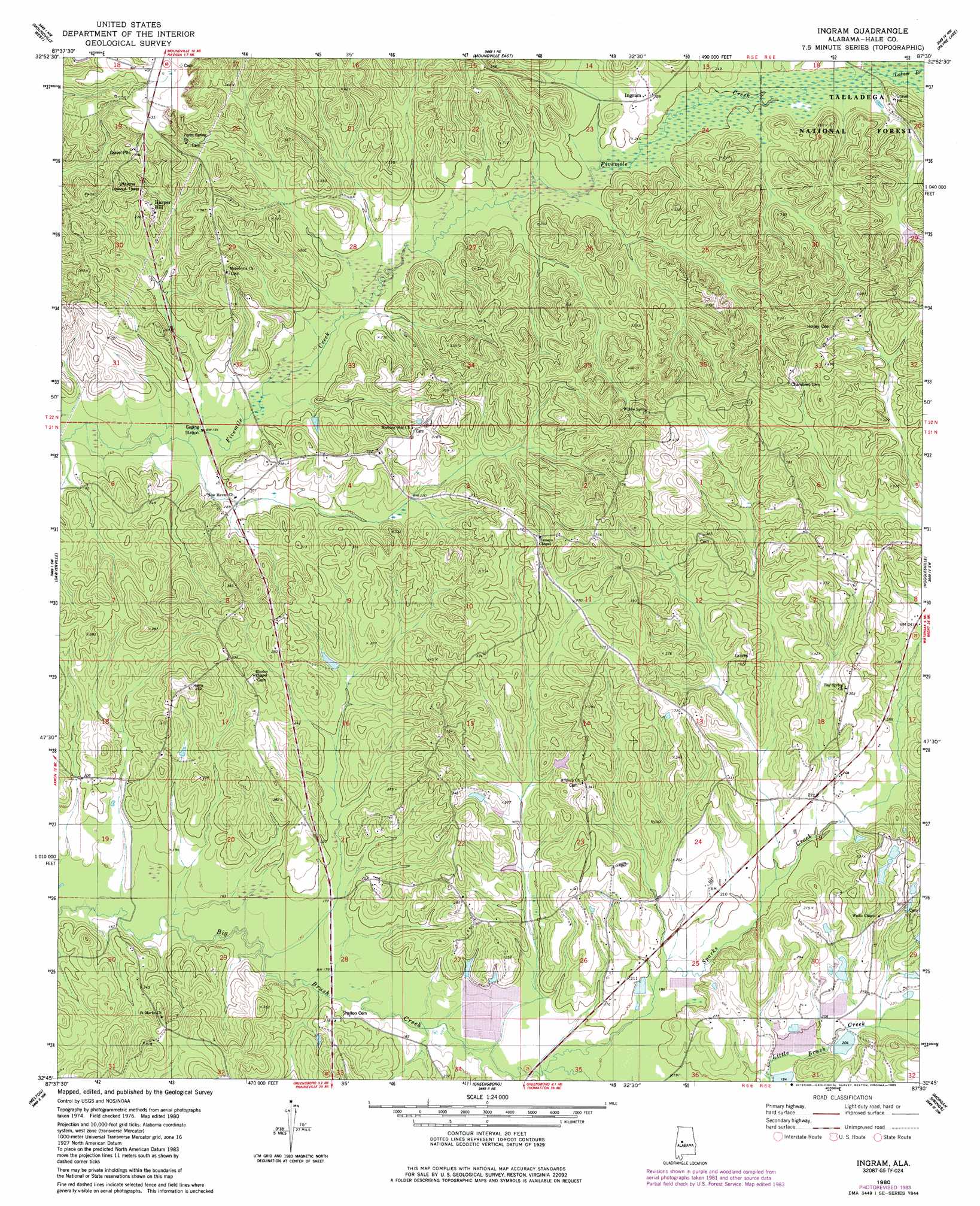
Ingram Topo Map Alabama
To zoom in, hover over the map of Ingram
USGS Topo Quad 32087g5 - 1:24,000 scale
| Topo Map Name: | Ingram |
| USGS Topo Quad ID: | 32087g5 |
| Print Size: | ca. 21 1/4" wide x 27" high |
| Southeast Coordinates: | 32.75° N latitude / 87.5° W longitude |
| Map Center Coordinates: | 32.8125° N latitude / 87.5625° W longitude |
| U.S. State: | AL |
| Filename: | o32087g5.jpg |
| Download Map JPG Image: | Ingram topo map 1:24,000 scale |
| Map Type: | Topographic |
| Topo Series: | 7.5´ |
| Map Scale: | 1:24,000 |
| Source of Map Images: | United States Geological Survey (USGS) |
| Alternate Map Versions: |
Ingram AL 1980, updated 1980 Download PDF Buy paper map Ingram AL 1980, updated 1985 Download PDF Buy paper map Ingram AL 2002, updated 2003 Download PDF Buy paper map Ingram AL 2011 Download PDF Buy paper map Ingram AL 2014 Download PDF Buy paper map |
| FStopo: | US Forest Service topo Ingram is available: Download FStopo PDF Download FStopo TIF |
1:24,000 Topo Quads surrounding Ingram
Ralph |
Fosters |
Englewood |
Duncanville |
Pearson |
Knoxville |
Moundville West |
Moundville East |
Payne Lake |
Pondville |
Warrior Dam |
Sawyerville |
Ingram |
Hogglesville |
Heiberger |
Mason Bend |
Melton |
Greensboro |
Morgan Springs |
Marion North |
Demopolis |
Casemore |
Newbern |
Scott Station |
Marion South |
> Back to 32087e1 at 1:100,000 scale
> Back to 32086a1 at 1:250,000 scale
> Back to U.S. Topo Maps home
Ingram topo map: Gazetteer
Ingram: Dams
Lenson Montgomery Dam Number 1 elevation 70m 229′Lenson Montgomery Dam Number 2 elevation 64m 209′
Murphy Averette Dam elevation 63m 206′
Ingram: Populated Places
Dominick elevation 103m 337′Harper Hill elevation 103m 337′
Ingram elevation 67m 219′
Ingram: Reservoirs
Lenson Montgomery Lake Number 1 elevation 70m 229′Lenson Montgomery Lake Number 2 elevation 64m 209′
Murphy Averette Lake elevation 63m 206′
Ingram: Streams
Harry Branch elevation 49m 160′Latner Branch elevation 64m 209′
Polecat Creek elevation 55m 180′
Sparks Creek elevation 55m 180′
Ingram digital topo map on disk
Buy this Ingram topo map showing relief, roads, GPS coordinates and other geographical features, as a high-resolution digital map file on DVD:
Gulf Coast (LA, MS, AL, FL) & Southwestern Georgia
Buy digital topo maps: Gulf Coast (LA, MS, AL, FL) & Southwestern Georgia
 & Southwestern Georgia map DVD")