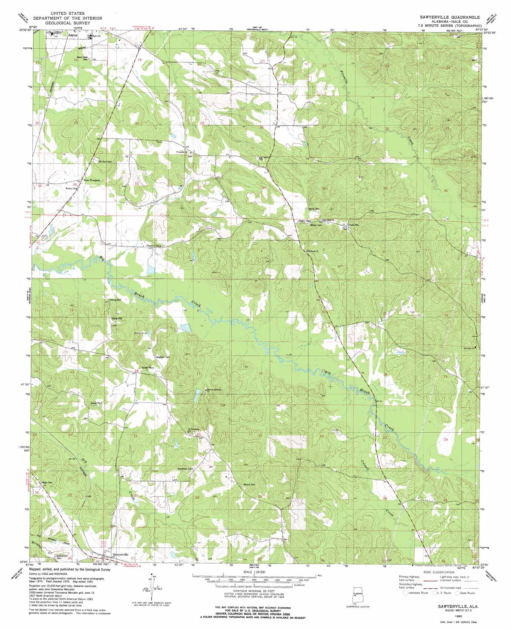
Sawyerville Topo Map Alabama
To zoom in, hover over the map of Sawyerville
USGS Topo Quad 32087g6 - 1:24,000 scale
| Topo Map Name: | Sawyerville |
| USGS Topo Quad ID: | 32087g6 |
| Print Size: | ca. 21 1/4" wide x 27" high |
| Southeast Coordinates: | 32.75° N latitude / 87.625° W longitude |
| Map Center Coordinates: | 32.8125° N latitude / 87.6875° W longitude |
| U.S. State: | AL |
| Filename: | o32087g6.jpg |
| Download Map JPG Image: | Sawyerville topo map 1:24,000 scale |
| Map Type: | Topographic |
| Topo Series: | 7.5´ |
| Map Scale: | 1:24,000 |
| Source of Map Images: | United States Geological Survey (USGS) |
| Alternate Map Versions: |
Sawyerville AL 1980, updated 1980 Download PDF Buy paper map Sawyerville AL 2011 Download PDF Buy paper map Sawyerville AL 2014 Download PDF Buy paper map |
1:24,000 Topo Quads surrounding Sawyerville
Mantua |
Ralph |
Fosters |
Englewood |
Duncanville |
Union |
Knoxville |
Moundville West |
Moundville East |
Payne Lake |
Eutaw |
Warrior Dam |
Sawyerville |
Ingram |
Hogglesville |
Forkland |
Mason Bend |
Melton |
Greensboro |
Morgan Springs |
Mcdowell |
Demopolis |
Casemore |
Newbern |
Scott Station |
> Back to 32087e1 at 1:100,000 scale
> Back to 32086a1 at 1:250,000 scale
> Back to U.S. Topo Maps home
Sawyerville topo map: Gazetteer
Sawyerville: Parks
Rams Field elevation 51m 167′Sawyerville: Populated Places
New Prospect elevation 45m 147′Sawyerville elevation 69m 226′
Sawyerville: Post Offices
Sawyerville Post Office elevation 68m 223′Sawyerville: Springs
Chalaybeate Spring elevation 60m 196′Sawyerville: Streams
Colwell Creek elevation 43m 141′McCrarys Branch elevation 44m 144′
Sawyerville digital topo map on disk
Buy this Sawyerville topo map showing relief, roads, GPS coordinates and other geographical features, as a high-resolution digital map file on DVD:
Gulf Coast (LA, MS, AL, FL) & Southwestern Georgia
Buy digital topo maps: Gulf Coast (LA, MS, AL, FL) & Southwestern Georgia
 & Southwestern Georgia map DVD")