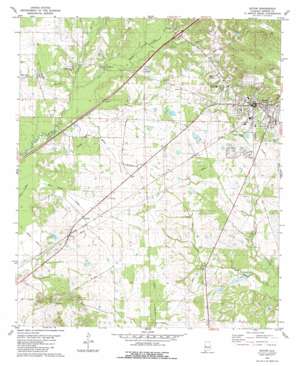
Eutaw Topo Map Alabama
To zoom in, hover over the map of Eutaw
USGS Topo Quad 32087g8 - 1:24,000 scale
| Topo Map Name: | Eutaw |
| USGS Topo Quad ID: | 32087g8 |
| Print Size: | ca. 21 1/4" wide x 27" high |
| Southeast Coordinates: | 32.75° N latitude / 87.875° W longitude |
| Map Center Coordinates: | 32.8125° N latitude / 87.9375° W longitude |
| U.S. State: | AL |
| Filename: | o32087g8.jpg |
| Download Map JPG Image: | Eutaw topo map 1:24,000 scale |
| Map Type: | Topographic |
| Topo Series: | 7.5´ |
| Map Scale: | 1:24,000 |
| Source of Map Images: | United States Geological Survey (USGS) |
| Alternate Map Versions: |
Eutaw AL 1980, updated 1980 Download PDF Buy paper map Eutaw AL 1980, updated 1980 Download PDF Buy paper map Eutaw AL 2011 Download PDF Buy paper map Eutaw AL 2014 Download PDF Buy paper map |
1:24,000 Topo Quads surrounding Eutaw
> Back to 32087e1 at 1:100,000 scale
> Back to 32086a1 at 1:250,000 scale
> Back to U.S. Topo Maps home
Eutaw topo map: Gazetteer
Eutaw: Areas
Daniels Prairie elevation 60m 196′The Prairie elevation 35m 114′
Eutaw: Crossings
Exit 40 elevation 52m 170′Eutaw: Dams
Doctor Hollingsworth Dam elevation 46m 150′L C Hardy Dams elevation 34m 111′
R R Banks Lake Dam elevation 51m 167′
W A Taylor Camp Dam elevation 32m 104′
W R Odum Dam elevation 56m 183′
Eutaw: Parks
Greene County Courthouse Square Historic District elevation 66m 216′Eutaw: Populated Places
Allison elevation 58m 190′Eutaw elevation 66m 216′
Eutaw: Post Offices
Mesopotamia Post Office (historical) elevation 71m 232′Eutaw: Reservoirs
Banks Lake elevation 51m 167′Doc Hollingsworth Lake elevation 46m 150′
Hardy Lake Number 1 elevation 34m 111′
Odum Lake Number 1 elevation 56m 183′
Taylor Lake elevation 32m 104′
Eutaw: Streams
Bean Stack Creek elevation 37m 121′Bovell Branch elevation 39m 127′
Clanton Branch elevation 46m 150′
Culpeper Creek elevation 27m 88′
Dance Branch elevation 33m 108′
Danoe Branch elevation 36m 118′
Miller Branch elevation 37m 121′
Moore Branch elevation 43m 141′
Pippen Creek elevation 40m 131′
Eutaw: Summits
Hays Mount elevation 88m 288′Eutaw: Wells
Jordan Artesian Well elevation 55m 180′Eutaw digital topo map on disk
Buy this Eutaw topo map showing relief, roads, GPS coordinates and other geographical features, as a high-resolution digital map file on DVD:
Gulf Coast (LA, MS, AL, FL) & Southwestern Georgia
Buy digital topo maps: Gulf Coast (LA, MS, AL, FL) & Southwestern Georgia


