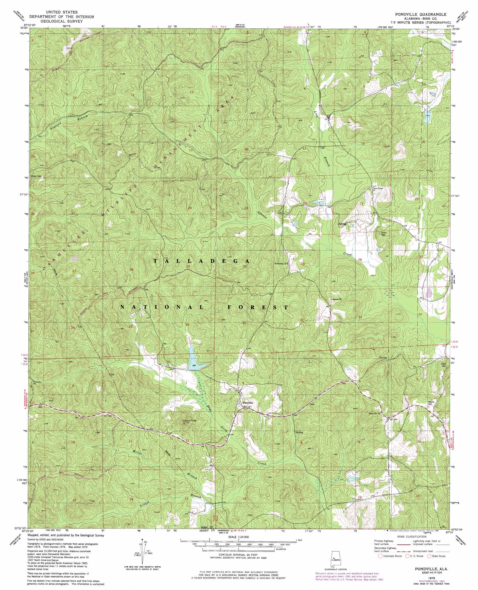
Pondville Topo Map Alabama
To zoom in, hover over the map of Pondville
USGS Topo Quad 32087h3 - 1:24,000 scale
| Topo Map Name: | Pondville |
| USGS Topo Quad ID: | 32087h3 |
| Print Size: | ca. 21 1/4" wide x 27" high |
| Southeast Coordinates: | 32.875° N latitude / 87.25° W longitude |
| Map Center Coordinates: | 32.9375° N latitude / 87.3125° W longitude |
| U.S. State: | AL |
| Filename: | o32087h3.jpg |
| Download Map JPG Image: | Pondville topo map 1:24,000 scale |
| Map Type: | Topographic |
| Topo Series: | 7.5´ |
| Map Scale: | 1:24,000 |
| Source of Map Images: | United States Geological Survey (USGS) |
| Alternate Map Versions: |
Pondville AL 1979, updated 1980 Download PDF Buy paper map Pondville AL 1979, updated 1985 Download PDF Buy paper map Pondville AL 2002, updated 2003 Download PDF Buy paper map Pondville AL 2011 Download PDF Buy paper map Pondville AL 2014 Download PDF Buy paper map |
| FStopo: | US Forest Service topo Pondville is available: Download FStopo PDF Download FStopo TIF |
1:24,000 Topo Quads surrounding Pondville
Tuscaloosa |
Cottondale |
Coaling |
Woodstock |
Halfmile Shoals |
Englewood |
Duncanville |
Pearson |
West Blocton West |
West Blocton East |
Moundville East |
Payne Lake |
Pondville |
Centreville West |
Centreville East |
Ingram |
Hogglesville |
Heiberger |
Harrisburg |
Oakmulgee |
Greensboro |
Morgan Springs |
Marion North |
Sprott |
Buck Creek |
> Back to 32087e1 at 1:100,000 scale
> Back to 32086a1 at 1:250,000 scale
> Back to U.S. Topo Maps home
Pondville topo map: Gazetteer
Pondville: Dams
Caddis Lake Dam elevation 88m 288′Kornegay Lake Dam elevation 117m 383′
Pondville: Populated Places
Pondville elevation 117m 383′Pondville: Reservoirs
Kornegay Lake elevation 117m 383′Lake Ponderosa elevation 87m 285′
Pondville: Streams
Lick Branch elevation 76m 249′Miller Branch elevation 76m 249′
Yeager Branch elevation 72m 236′
Pondville digital topo map on disk
Buy this Pondville topo map showing relief, roads, GPS coordinates and other geographical features, as a high-resolution digital map file on DVD:
Gulf Coast (LA, MS, AL, FL) & Southwestern Georgia
Buy digital topo maps: Gulf Coast (LA, MS, AL, FL) & Southwestern Georgia
 & Southwestern Georgia map DVD")