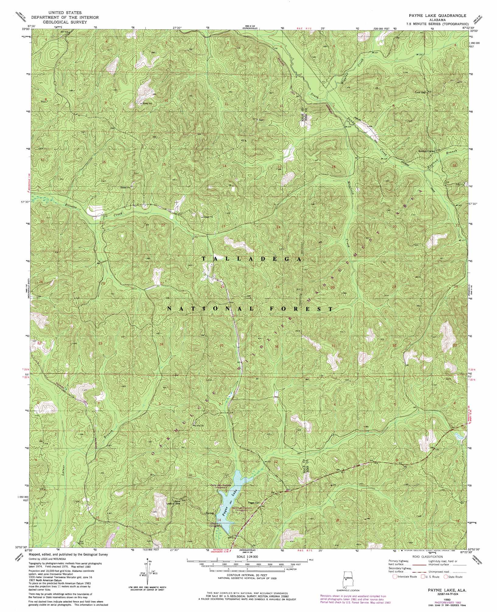
Payne Lake Topo Map Alabama
To zoom in, hover over the map of Payne Lake
USGS Topo Quad 32087h4 - 1:24,000 scale
| Topo Map Name: | Payne Lake |
| USGS Topo Quad ID: | 32087h4 |
| Print Size: | ca. 21 1/4" wide x 27" high |
| Southeast Coordinates: | 32.875° N latitude / 87.375° W longitude |
| Map Center Coordinates: | 32.9375° N latitude / 87.4375° W longitude |
| U.S. State: | AL |
| Filename: | o32087h4.jpg |
| Download Map JPG Image: | Payne Lake topo map 1:24,000 scale |
| Map Type: | Topographic |
| Topo Series: | 7.5´ |
| Map Scale: | 1:24,000 |
| Source of Map Images: | United States Geological Survey (USGS) |
| Alternate Map Versions: |
Payne Lake AL 1980, updated 1980 Download PDF Buy paper map Payne Lake AL 1980, updated 1985 Download PDF Buy paper map Payne Lake AL 2002, updated 2003 Download PDF Buy paper map Payne Lake AL 2011 Download PDF Buy paper map Payne Lake AL 2014 Download PDF Buy paper map |
| FStopo: | US Forest Service topo Payne Lake is available: Download FStopo PDF Download FStopo TIF |
1:24,000 Topo Quads surrounding Payne Lake
Coker |
Tuscaloosa |
Cottondale |
Coaling |
Woodstock |
Fosters |
Englewood |
Duncanville |
Pearson |
West Blocton West |
Moundville West |
Moundville East |
Payne Lake |
Pondville |
Centreville West |
Sawyerville |
Ingram |
Hogglesville |
Heiberger |
Harrisburg |
Melton |
Greensboro |
Morgan Springs |
Marion North |
Sprott |
> Back to 32087e1 at 1:100,000 scale
> Back to 32086a1 at 1:250,000 scale
> Back to U.S. Topo Maps home
Payne Lake topo map: Gazetteer
Payne Lake: Dams
Payne Lake Dam elevation 79m 259′Payne Lake: Parks
Oakmulgee Wildlife Management Area elevation 120m 393′Reed Brake Research Natural Area elevation 115m 377′
Payne Lake: Populated Places
Mertz elevation 121m 396′Payne Lake: Reservoirs
Payne Lake elevation 79m 259′Payne Lake: Streams
Ragland Branch elevation 74m 242′Troublesome Branch elevation 68m 223′
Wiggins Creek elevation 67m 219′
Payne Lake: Trails
Payne Lake Nature Trail elevation 80m 262′Payne Lake digital topo map on disk
Buy this Payne Lake topo map showing relief, roads, GPS coordinates and other geographical features, as a high-resolution digital map file on DVD:
Gulf Coast (LA, MS, AL, FL) & Southwestern Georgia
Buy digital topo maps: Gulf Coast (LA, MS, AL, FL) & Southwestern Georgia
 & Southwestern Georgia map DVD")