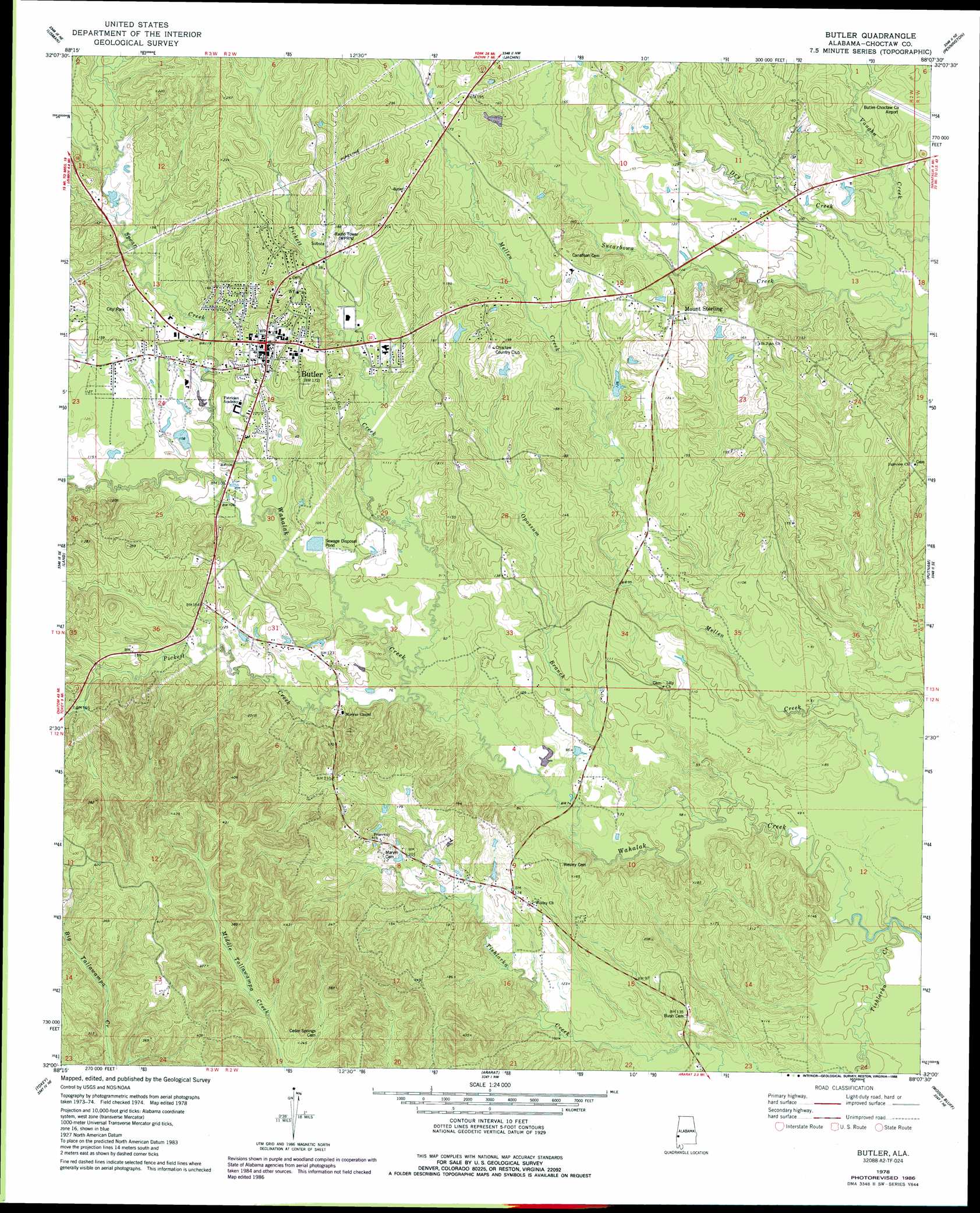
Butler Topo Map Alabama
To zoom in, hover over the map of Butler
USGS Topo Quad 32088a2 - 1:24,000 scale
| Topo Map Name: | Butler |
| USGS Topo Quad ID: | 32088a2 |
| Print Size: | ca. 21 1/4" wide x 27" high |
| Southeast Coordinates: | 32° N latitude / 88.125° W longitude |
| Map Center Coordinates: | 32.0625° N latitude / 88.1875° W longitude |
| U.S. State: | AL |
| Filename: | o32088a2.jpg |
| Download Map JPG Image: | Butler topo map 1:24,000 scale |
| Map Type: | Topographic |
| Topo Series: | 7.5´ |
| Map Scale: | 1:24,000 |
| Source of Map Images: | United States Geological Survey (USGS) |
| Alternate Map Versions: |
Butler AL 1978, updated 1986 Download PDF Buy paper map Butler AL 2011 Download PDF Buy paper map Butler AL 2014 Download PDF Buy paper map |
1:24,000 Topo Quads surrounding Butler
Whynot |
Ward |
Gaston |
Whitfield |
Myrtlewood North |
Yantley |
Lisman |
Jachin |
Pennington |
Myrtlewood South |
Hinton |
Land |
Butler |
Putnam |
Nanafalia |
Melvin |
Toxey |
Ararat |
Woods Bluff |
Morvin |
Isney |
Silas |
Coffeeville Lock And Dam |
Coffeeville |
Mcentyre |
> Back to 32088a1 at 1:100,000 scale
> Back to 32088a1 at 1:250,000 scale
> Back to U.S. Topo Maps home
Butler topo map: Gazetteer
Butler: Airports
Butler-Choctaw County Airport elevation 37m 121′Butler: Dams
City of Butler Sewage Lagoon Dam elevation 27m 88′Butler: Populated Places
Butler elevation 54m 177′Green Acres elevation 48m 157′
Morgan Chapel elevation 44m 144′
Mount Sterling elevation 50m 164′
Butler: Post Offices
Butler Post Office elevation 53m 173′Butler: Reservoirs
City of Butler Sewage Lagoon elevation 27m 88′Butler: Streams
Dry Creek elevation 22m 72′Opossum Branch elevation 15m 49′
Pickett Creek elevation 24m 78′
Pickett Creek elevation 22m 72′
Spear Creek elevation 27m 88′
Tishlarka Creek elevation 16m 52′
Butler digital topo map on disk
Buy this Butler topo map showing relief, roads, GPS coordinates and other geographical features, as a high-resolution digital map file on DVD:
Gulf Coast (LA, MS, AL, FL) & Southwestern Georgia
Buy digital topo maps: Gulf Coast (LA, MS, AL, FL) & Southwestern Georgia
 & Southwestern Georgia map DVD")