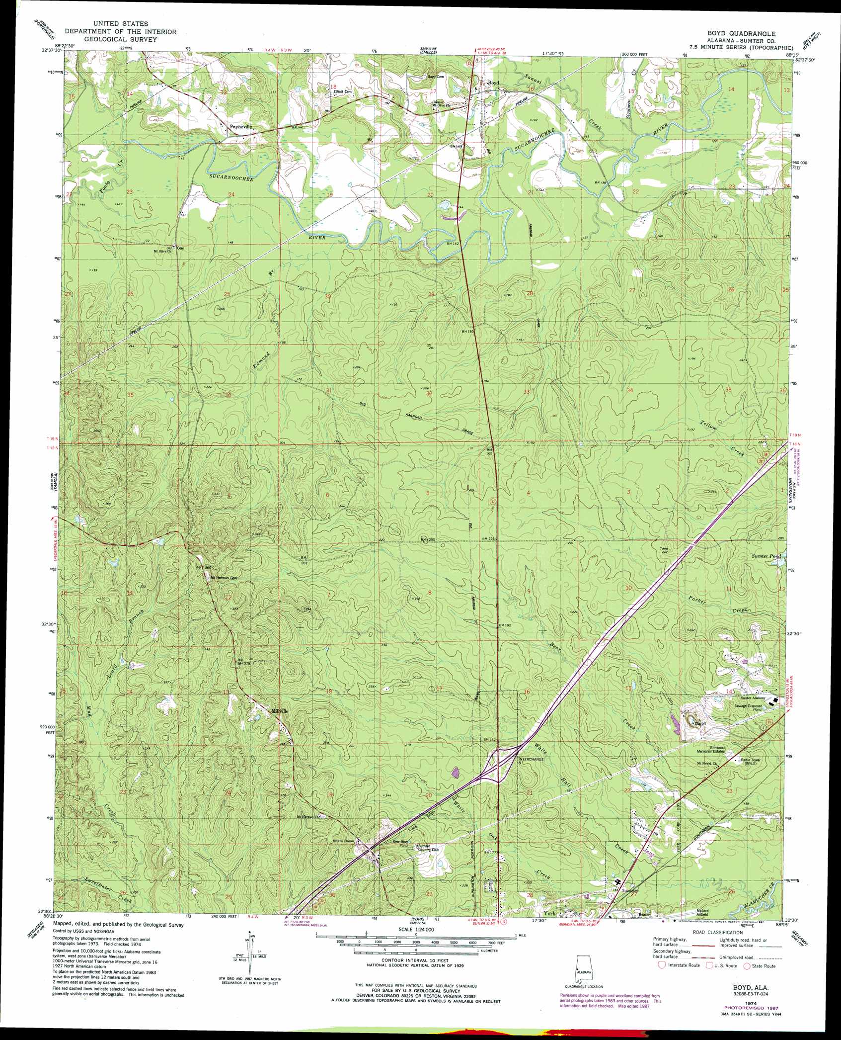
Boyd Topo Map Alabama
To zoom in, hover over the map of Boyd
USGS Topo Quad 32088e3 - 1:24,000 scale
| Topo Map Name: | Boyd |
| USGS Topo Quad ID: | 32088e3 |
| Print Size: | ca. 21 1/4" wide x 27" high |
| Southeast Coordinates: | 32.5° N latitude / 88.25° W longitude |
| Map Center Coordinates: | 32.5625° N latitude / 88.3125° W longitude |
| U.S. State: | AL |
| Filename: | o32088e3.jpg |
| Download Map JPG Image: | Boyd topo map 1:24,000 scale |
| Map Type: | Topographic |
| Topo Series: | 7.5´ |
| Map Scale: | 1:24,000 |
| Source of Map Images: | United States Geological Survey (USGS) |
| Alternate Map Versions: |
Boyd AL 1974, updated 1978 Download PDF Buy paper map Boyd AL 1974, updated 1987 Download PDF Buy paper map Boyd AL 2011 Download PDF Buy paper map Boyd AL 2014 Download PDF Buy paper map |
1:24,000 Topo Quads surrounding Boyd
Townsend |
Scooba |
Geiger |
Gainesville |
Boligee |
Oak Grove |
Porterville |
Emelle |
Epes West |
Epes East |
Lauderdale |
Tamola |
Boyd |
Livingston |
Brewersville |
Toomsuba |
Kewanee |
York |
Bellamy |
Coatopa |
Vimville |
Whynot |
Ward |
Gaston |
Whitfield |
> Back to 32088e1 at 1:100,000 scale
> Back to 32088a1 at 1:250,000 scale
> Back to U.S. Topo Maps home
Boyd topo map: Gazetteer
Boyd: Crossings
Interchange 8 elevation 64m 209′Boyd: Lakes
Sumter Pond elevation 60m 196′Boyd: Populated Places
Boyd elevation 50m 164′Millville elevation 107m 351′
Payneville elevation 58m 190′
Boyd: Streams
Atanchiluka Creek elevation 37m 121′Barebone Creek elevation 37m 121′
Edmond Branch elevation 43m 141′
Leard Branch elevation 69m 226′
Mud Creek elevation 56m 183′
Ponta Creek elevation 43m 141′
Sambo Creek elevation 37m 121′
Sanusi Creek elevation 37m 121′
Sicolocco Creek elevation 37m 121′
Teoc Creek elevation 40m 131′
Tubby Creek elevation 43m 141′
White Hall Creek elevation 36m 118′
White Oak Creek elevation 43m 141′
Boyd digital topo map on disk
Buy this Boyd topo map showing relief, roads, GPS coordinates and other geographical features, as a high-resolution digital map file on DVD:
Gulf Coast (LA, MS, AL, FL) & Southwestern Georgia
Buy digital topo maps: Gulf Coast (LA, MS, AL, FL) & Southwestern Georgia
 & Southwestern Georgia map DVD")